Howard Lake Topo Map Minnesota
To zoom in, hover over the map of Howard Lake
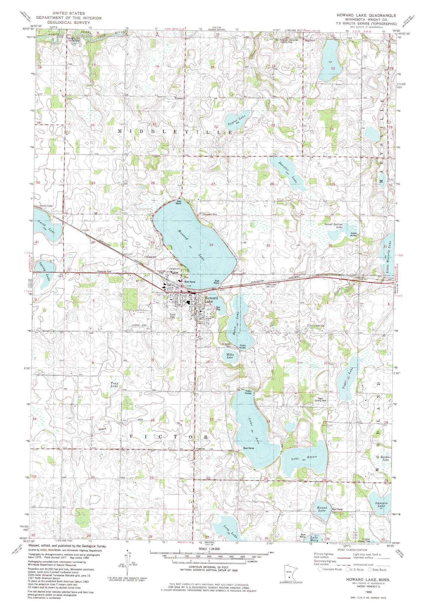
USGS Topo Quad 45094a1 - 1:24,000 scale
| Topo Map Name: | Howard Lake |
| USGS Topo Quad ID: | 45094a1 |
| Print Size: | ca. 21 1/4" wide x 27" high |
| Southeast Coordinates: | 45° N latitude / 94° W longitude |
| Map Center Coordinates: | 45.0625° N latitude / 94.0625° W longitude |
| U.S. State: | MN |
| Filename: | o45094a1.jpg |
| Download Map JPG Image: | Howard Lake topo map 1:24,000 scale |
| Map Type: | Topographic |
| Topo Series: | 7.5´ |
| Map Scale: | 1:24,000 |
| Source of Map Images: | United States Geological Survey (USGS) |
| Alternate Map Versions: |
Howard Lake MN 1982, updated 1982 Download PDF Buy paper map Howard Lake MN 2010 Download PDF Buy paper map Howard Lake MN 2013 Download PDF Buy paper map Howard Lake MN 2016 Download PDF Buy paper map |
1:24,000 Topo Quads surrounding Howard Lake
Kimball |
South Haven |
Annandale |
Silver Creek |
Monticello |
Kingston |
French Lake |
Albion Center |
Buffalo West |
Buffalo East |
Dassel |
Cokato |
Howard Lake |
Waverly |
Delano |
Hutchinson East |
Silver Lake |
Winsted |
Mayer |
Watertown |
Biscay |
Glenco |
Plato |
Norwood |
Waconia |
> Back to 45094a1 at 1:100,000 scale
> Back to 45094a1 at 1:250,000 scale
> Back to U.S. Topo Maps home
Howard Lake topo map: Gazetteer
Howard Lake: Canals
County Ditch Number Ten elevation 304m 997′Howard Lake: Lakes
Doerfler Lake elevation 305m 1000′Dutch Lake elevation 303m 994′
Howard Lake elevation 304m 997′
Lake Ann elevation 300m 984′
Lake Emma elevation 300m 984′
Lauzers Lake elevation 302m 990′
Long Lake elevation 301m 987′
Mallard Pass Lake elevation 303m 994′
Mallard Pass Lake elevation 303m 994′
Milky Lake elevation 303m 994′
Round Lake elevation 303m 994′
School Section Lake elevation 299m 980′
Spring Lake elevation 315m 1033′
Taylor Lake elevation 295m 967′
Yager Lake elevation 302m 990′
Howard Lake: Parks
Albrights Mill County Park elevation 294m 964′Billy Anderson Memorial County Park elevation 299m 980′
Dustin Massacre Historical Marker elevation 315m 1033′
Dustin Memorial Wayside Park elevation 315m 1033′
Yager County Park elevation 301m 987′
Howard Lake: Populated Places
Highland elevation 303m 994′Howard Lake elevation 311m 1020′
Howard Lake Mobile Home Park elevation 315m 1033′
Smith Lake elevation 320m 1049′
Howard Lake: Post Offices
Howard Lake Post Office elevation 312m 1023′Smith Lake Post Office (historical) elevation 320m 1049′
Howard Lake: Swamps
Ruckles Lake elevation 303m 994′Tuey Lake elevation 303m 994′
Howard Lake digital topo map on disk
Buy this Howard Lake topo map showing relief, roads, GPS coordinates and other geographical features, as a high-resolution digital map file on DVD: