Kingston Topo Map Minnesota
To zoom in, hover over the map of Kingston
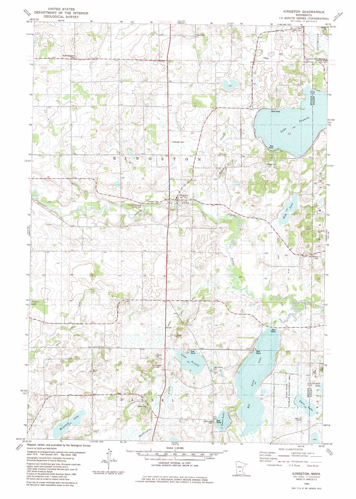
USGS Topo Quad 45094b3 - 1:24,000 scale
| Topo Map Name: | Kingston |
| USGS Topo Quad ID: | 45094b3 |
| Print Size: | ca. 21 1/4" wide x 27" high |
| Southeast Coordinates: | 45.125° N latitude / 94.25° W longitude |
| Map Center Coordinates: | 45.1875° N latitude / 94.3125° W longitude |
| U.S. State: | MN |
| Filename: | o45094b3.jpg |
| Download Map JPG Image: | Kingston topo map 1:24,000 scale |
| Map Type: | Topographic |
| Topo Series: | 7.5´ |
| Map Scale: | 1:24,000 |
| Source of Map Images: | United States Geological Survey (USGS) |
| Alternate Map Versions: |
Kingston MN 1982, updated 1982 Download PDF Buy paper map Kingston MN 2010 Download PDF Buy paper map Kingston MN 2013 Download PDF Buy paper map Kingston MN 2016 Download PDF Buy paper map |
1:24,000 Topo Quads surrounding Kingston
Richmond |
Cold Spring |
Rockville |
Saint Augusta |
Clearwater |
Eden Valley |
Watkins |
Kimball |
South Haven |
Annandale |
Litchfield North |
Forest City |
Kingston |
French Lake |
Albion Center |
Litchfield South |
Darwin |
Dassel |
Cokato |
Howard Lake |
Cedar Mills |
Hutchinson West |
Hutchinson East |
Silver Lake |
Winsted |
> Back to 45094a1 at 1:100,000 scale
> Back to 45094a1 at 1:250,000 scale
> Back to U.S. Topo Maps home
Kingston topo map: Gazetteer
Kingston: Canals
County Ditch Number Nine elevation 310m 1017′County Ditch Number Twentyfive elevation 308m 1010′
Judicial Ditch Number Two elevation 319m 1046′
Kingston: Lakes
Big Swan Lake elevation 306m 1003′Lake Arvilla elevation 307m 1007′
Lake Francis elevation 320m 1049′
Little Swan Lake elevation 310m 1017′
Maynard Lake elevation 321m 1053′
Mud Lake elevation 307m 1007′
Swan Lake elevation 306m 1003′
Kingston: Parks
Finnish Memorial County Park elevation 317m 1040′Knapp State Wildlife Management Area elevation 308m 1010′
Kingston: Populated Places
Kingston elevation 315m 1033′Kingston: Post Offices
Kingston Post Office (historical) elevation 315m 1033′Kingston Post Office (historical) elevation 315m 1033′
Kingston: Streams
Collinwood Creek elevation 308m 1010′Eagle Creek elevation 309m 1013′
Washington Creek elevation 307m 1007′
Kingston digital topo map on disk
Buy this Kingston topo map showing relief, roads, GPS coordinates and other geographical features, as a high-resolution digital map file on DVD: