Eden Valley Topo Map Minnesota
To zoom in, hover over the map of Eden Valley
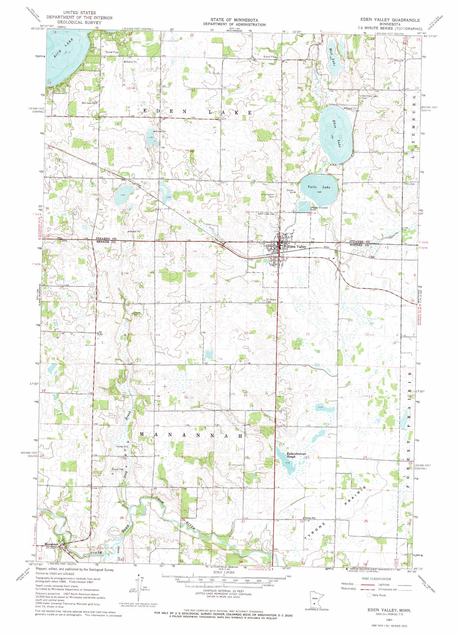
USGS Topo Quad 45094c5 - 1:24,000 scale
| Topo Map Name: | Eden Valley |
| USGS Topo Quad ID: | 45094c5 |
| Print Size: | ca. 21 1/4" wide x 27" high |
| Southeast Coordinates: | 45.25° N latitude / 94.5° W longitude |
| Map Center Coordinates: | 45.3125° N latitude / 94.5625° W longitude |
| U.S. State: | MN |
| Filename: | o45094c5.jpg |
| Download Map JPG Image: | Eden Valley topo map 1:24,000 scale |
| Map Type: | Topographic |
| Topo Series: | 7.5´ |
| Map Scale: | 1:24,000 |
| Source of Map Images: | United States Geological Survey (USGS) |
| Alternate Map Versions: |
Eden Valley MN 1967, updated 1969 Download PDF Buy paper map Eden Valley MN 2010 Download PDF Buy paper map Eden Valley MN 2013 Download PDF Buy paper map Eden Valley MN 2016 Download PDF Buy paper map |
1:24,000 Topo Quads surrounding Eden Valley
Greenwald |
Saint Martin |
Farming |
Avon |
Saint Joseph |
Lake Henry |
Paynesville |
Richmond |
Cold Spring |
Rockville |
Hawick |
Lake Koronis |
Eden Valley |
Watkins |
Kimball |
Atwater |
Grove City |
Litchfield North |
Forest City |
Kingston |
Lake Elizabeth |
Rosendale |
Litchfield South |
Darwin |
Dassel |
> Back to 45094a1 at 1:100,000 scale
> Back to 45094a1 at 1:250,000 scale
> Back to U.S. Topo Maps home
Eden Valley topo map: Gazetteer
Eden Valley: Flats
Tyrone Prairie elevation 341m 1118′Eden Valley: Lakes
Eden Lake elevation 333m 1092′Kalkenbrenner Lake elevation 339m 1112′
Mud Lake elevation 331m 1085′
Rice Lake elevation 342m 1122′
Vails Lake elevation 333m 1092′
Eden Valley: Parks
Eden Valley Baseball Park elevation 341m 1118′Eden Valley Baseball Park elevation 341m 1118′
Eden Valley: Populated Places
Eden Valley elevation 340m 1115′Manannah elevation 351m 1151′
Eden Valley: Post Offices
Eden Valley Post Office elevation 343m 1125′Eden Valley Post Office elevation 343m 1125′
Mananah Post Office (historical) elevation 351m 1151′
Mananah Post Office (historical) elevation 351m 1151′
Eden Valley: Streams
Grove Creek elevation 334m 1095′Middle Fork Crow River elevation 335m 1099′
Stag Brook elevation 334m 1095′
Eden Valley digital topo map on disk
Buy this Eden Valley topo map showing relief, roads, GPS coordinates and other geographical features, as a high-resolution digital map file on DVD: