Mayhew Topo Map Minnesota
To zoom in, hover over the map of Mayhew
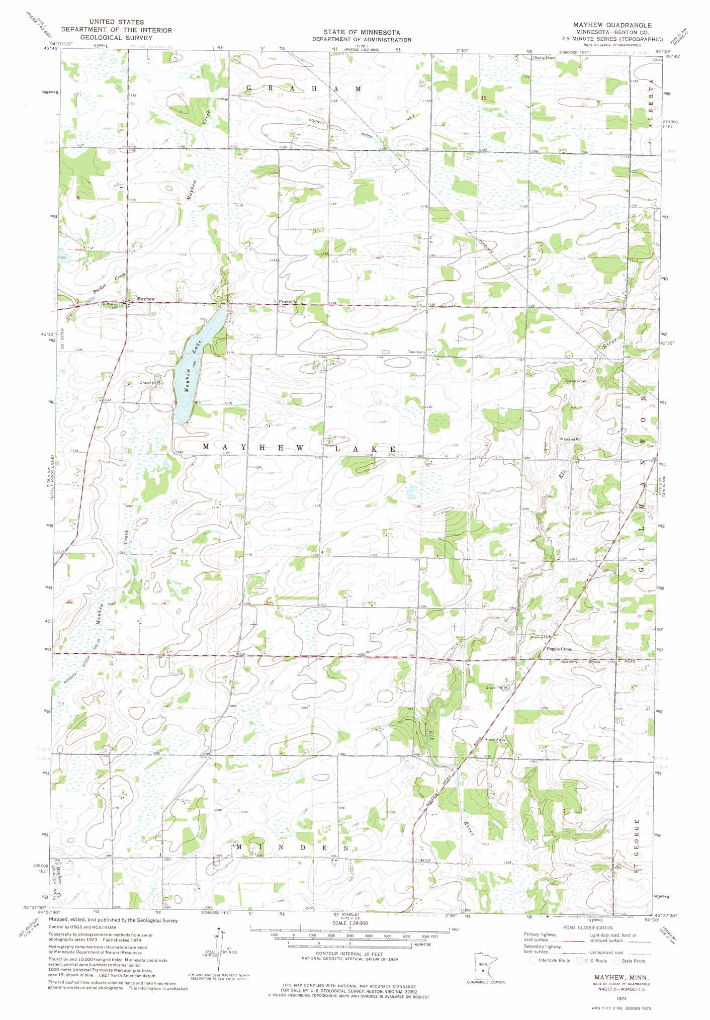
USGS Topo Quad 45094f1 - 1:24,000 scale
| Topo Map Name: | Mayhew |
| USGS Topo Quad ID: | 45094f1 |
| Print Size: | ca. 21 1/4" wide x 27" high |
| Southeast Coordinates: | 45.625° N latitude / 94° W longitude |
| Map Center Coordinates: | 45.6875° N latitude / 94.0625° W longitude |
| U.S. State: | MN |
| Filename: | o45094f1.jpg |
| Download Map JPG Image: | Mayhew topo map 1:24,000 scale |
| Map Type: | Topographic |
| Topo Series: | 7.5´ |
| Map Scale: | 1:24,000 |
| Source of Map Images: | United States Geological Survey (USGS) |
| Alternate Map Versions: |
Mayhew MN 1974, updated 1976 Download PDF Buy paper map Mayhew MN 2010 Download PDF Buy paper map Mayhew MN 2013 Download PDF Buy paper map Mayhew MN 2016 Download PDF Buy paper map |
1:24,000 Topo Quads surrounding Mayhew
Little Falls East |
Pierz Lake |
Pierz |
Ramey Nw |
Ramey Ne |
Royalton |
Rice |
Little Rock |
Ramey |
Rum River |
Saint Stephen |
Little Rock Lake |
Mayhew |
Foley |
Ronneby |
Saint Joseph |
Saint Cloud |
Cable |
Duelm |
Santiago |
Rockville |
Saint Augusta |
Clearwater |
Clear Lake |
Becker |
> Back to 45094e1 at 1:100,000 scale
> Back to 45094a1 at 1:250,000 scale
> Back to U.S. Topo Maps home
Mayhew topo map: Gazetteer
Mayhew: Canals
County Ditch Number Four elevation 337m 1105′County Ditch Number Seven elevation 354m 1161′
Mayhew: Dams
Mayhew Lake Dam elevation 331m 1085′Mayhew: Populated Places
Fruitville elevation 348m 1141′Mayhew elevation 345m 1131′
Popple Creek elevation 328m 1076′
Mayhew: Post Offices
Mayhew Post Office (historical) elevation 345m 1131′Mayhew: Reservoirs
Mayhew Lake elevation 331m 1085′Mayhew digital topo map on disk
Buy this Mayhew topo map showing relief, roads, GPS coordinates and other geographical features, as a high-resolution digital map file on DVD: