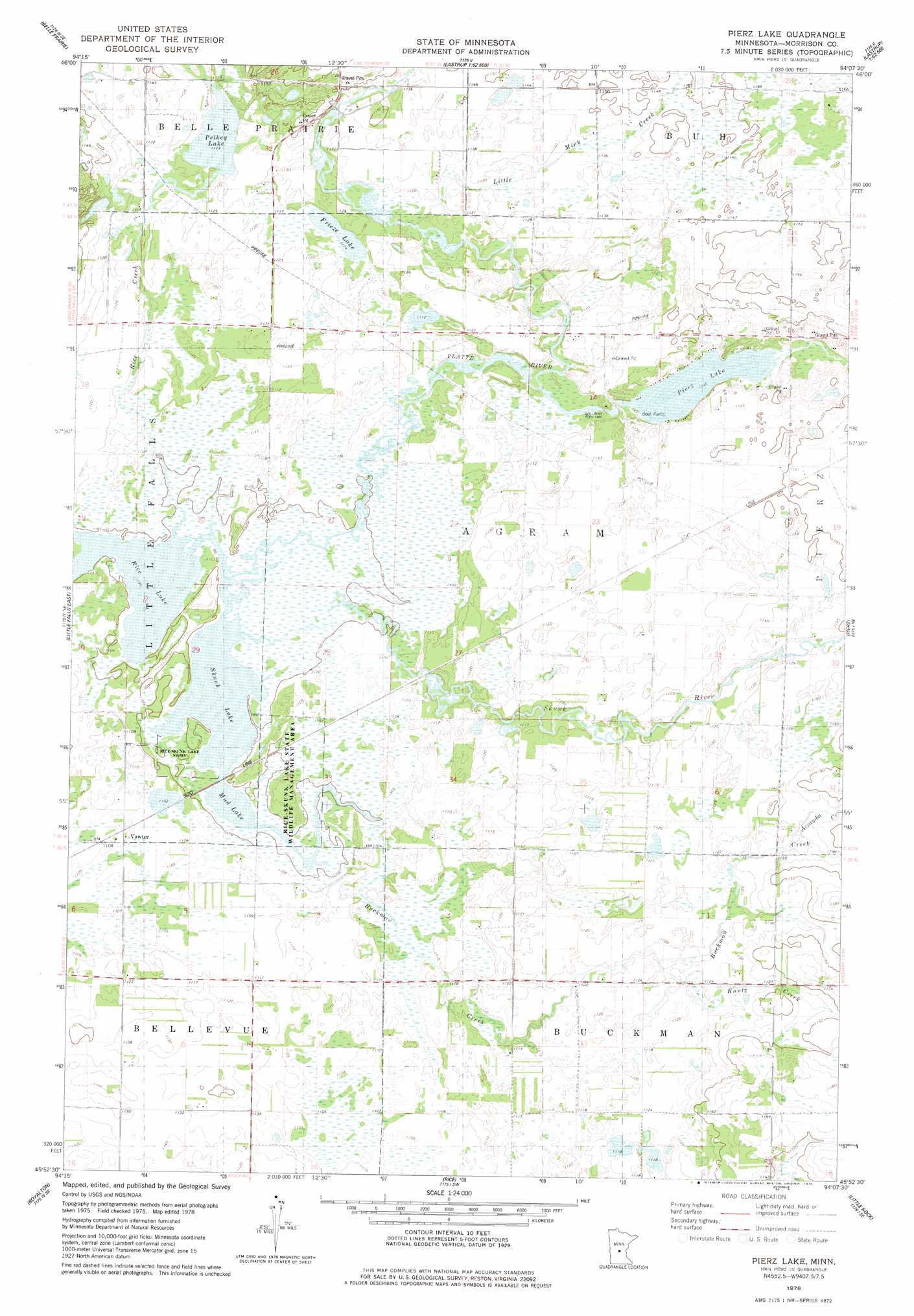
Pierz Lake Topo Map Minnesota
To zoom in, hover over the map of Pierz Lake
USGS Topo Quad 45094h2 - 1:24,000 scale
| Topo Map Name: | Pierz Lake |
| USGS Topo Quad ID: | 45094h2 |
| Print Size: | ca. 21 1/4" wide x 27" high |
| Southeast Coordinates: | 45.875° N latitude / 94.125° W longitude |
| Map Center Coordinates: | 45.9375° N latitude / 94.1875° W longitude |
| U.S. State: | MN |
| Filename: | o45094h2.jpg |
| Download Map JPG Image: | Pierz Lake topo map 1:24,000 scale |
| Map Type: | Topographic |
| Topo Series: | 7.5´ |
| Map Scale: | 1:24,000 |
| Source of Map Images: | United States Geological Survey (USGS) |
| Alternate Map Versions: |
Pierz Lake MN 1978, updated 1978 Download PDF Buy paper map Pierz Lake MN 2010 Download PDF Buy paper map Pierz Lake MN 2013 Download PDF Buy paper map Pierz Lake MN 2016 Download PDF Buy paper map |
1:24,000 Topo Quads surrounding Pierz Lake
Belle Prairie Nw |
Fort Ripley |
Lastrup Nw |
Shephard |
Platte Lake |
Randall |
Belle Prairie |
Freedhem |
Lastrup |
Hillman |
Little Falls West |
Little Falls East |
Pierz Lake |
Pierz |
Ramey Nw |
Bowlus |
Royalton |
Rice |
Little Rock |
Ramey |
Holdingford |
Saint Stephen |
Little Rock Lake |
Mayhew |
Foley |
> Back to 45094e1 at 1:100,000 scale
> Back to 45094a1 at 1:250,000 scale
> Back to U.S. Topo Maps home
Pierz Lake topo map: Gazetteer
Pierz Lake: Dams
Pierz Lake Dam elevation 338m 1108′Pierz Lake: Lakes
Frieze Lake elevation 339m 1112′Mud Lake elevation 333m 1092′
Pelkey Lake elevation 339m 1112′
Skunk Lake elevation 333m 1092′
Pierz Lake: Parks
Rice-Skunk Lake State Wildlife Management A elevation 336m 1102′Pierz Lake: Populated Places
Vawter elevation 338m 1108′Pierz Lake: Post Offices
Vawter Post Office (historical) elevation 338m 1108′Pierz Lake: Reservoirs
Pierz Lake elevation 338m 1108′Pierz Lake: Streams
Buckman Creek elevation 333m 1092′Kuntz Creek elevation 342m 1122′
Little Mink Creek elevation 338m 1108′
Mischke Creek elevation 344m 1128′
Rice Creek elevation 333m 1092′
Skunk River elevation 333m 1092′
Pierz Lake digital topo map on disk
Buy this Pierz Lake topo map showing relief, roads, GPS coordinates and other geographical features, as a high-resolution digital map file on DVD: