Flensburg Topo Map Minnesota
To zoom in, hover over the map of Flensburg
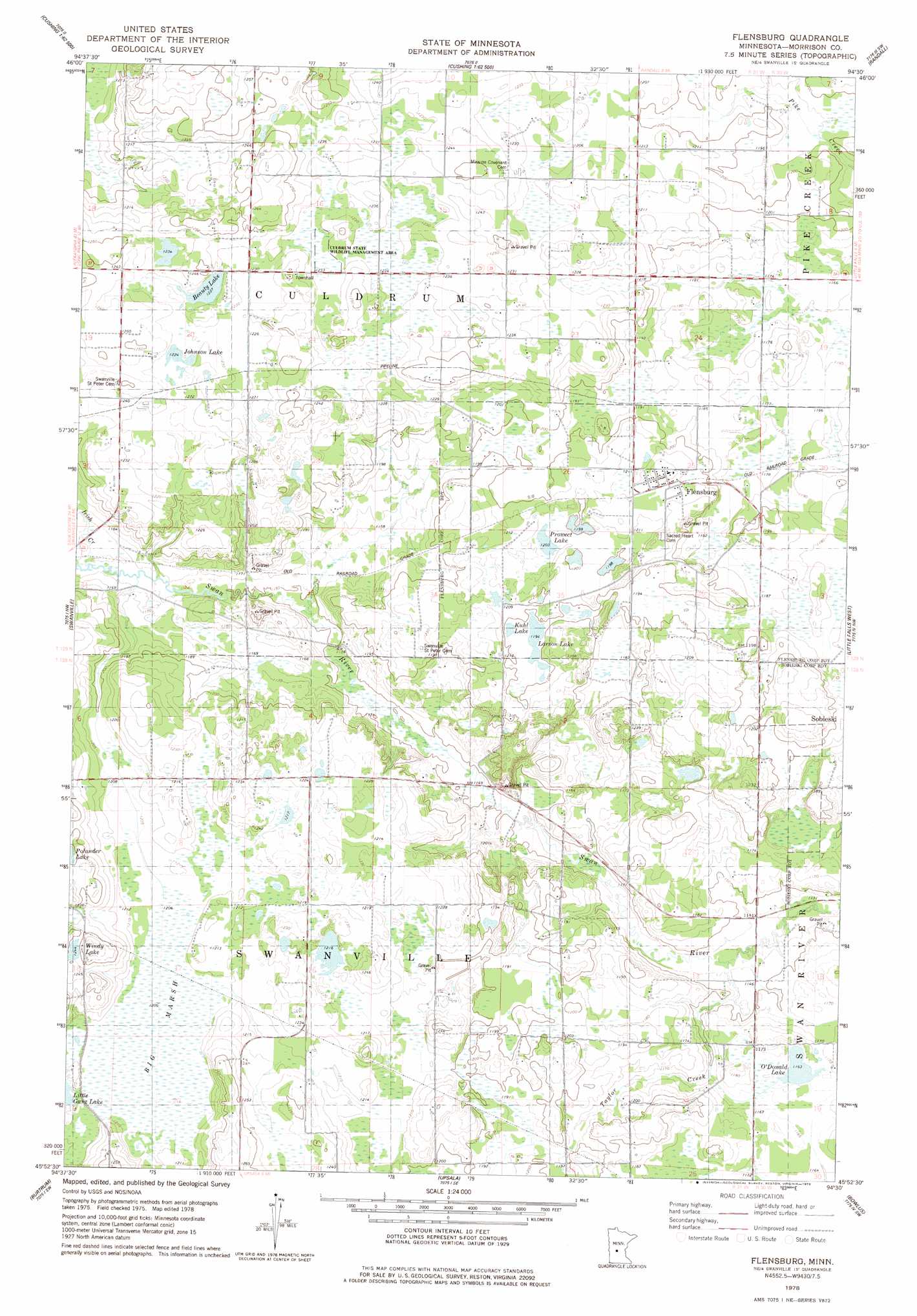
USGS Topo Quad 45094h5 - 1:24,000 scale
| Topo Map Name: | Flensburg |
| USGS Topo Quad ID: | 45094h5 |
| Print Size: | ca. 21 1/4" wide x 27" high |
| Southeast Coordinates: | 45.875° N latitude / 94.5° W longitude |
| Map Center Coordinates: | 45.9375° N latitude / 94.5625° W longitude |
| U.S. State: | MN |
| Filename: | o45094h5.jpg |
| Download Map JPG Image: | Flensburg topo map 1:24,000 scale |
| Map Type: | Topographic |
| Topo Series: | 7.5´ |
| Map Scale: | 1:24,000 |
| Source of Map Images: | United States Geological Survey (USGS) |
| Alternate Map Versions: |
Flensburg MN 1978, updated 1978 Download PDF Buy paper map Flensburg MN 2010 Download PDF Buy paper map Flensburg MN 2013 Download PDF Buy paper map Flensburg MN 2016 Download PDF Buy paper map |
1:24,000 Topo Quads surrounding Flensburg
Browerville Ne |
Lincoln |
Cushing |
Belle Prairie Nw |
Fort Ripley |
Browerville |
Lake Beauty |
Randall West |
Randall |
Belle Prairie |
Long Prairie |
Swanville |
Flensburg |
Little Falls West |
Little Falls East |
Ward Springs |
Burtrum |
Upsala |
Bowlus |
Royalton |
Melrose |
Freeport |
Albany |
Holdingford |
Saint Stephen |
> Back to 45094e1 at 1:100,000 scale
> Back to 45094a1 at 1:250,000 scale
> Back to U.S. Topo Maps home
Flensburg topo map: Gazetteer
Flensburg: Lakes
Beauty Lake elevation 373m 1223′Johnson Lake elevation 373m 1223′
Kuhl Lake elevation 363m 1190′
Larson Lake elevation 363m 1190′
O'Donald Lake elevation 354m 1161′
Prowect Lake elevation 367m 1204′
Flensburg: Parks
Culdrum State Wildlife Management Area elevation 374m 1227′Flensburg: Populated Places
Flensburg elevation 369m 1210′Flensburg: Post Offices
Flensburg Post Office elevation 369m 1210′Flensburg: Streams
Irish Creek elevation 354m 1161′Flensburg: Swamps
Big Marsh elevation 367m 1204′Flensburg digital topo map on disk
Buy this Flensburg topo map showing relief, roads, GPS coordinates and other geographical features, as a high-resolution digital map file on DVD: