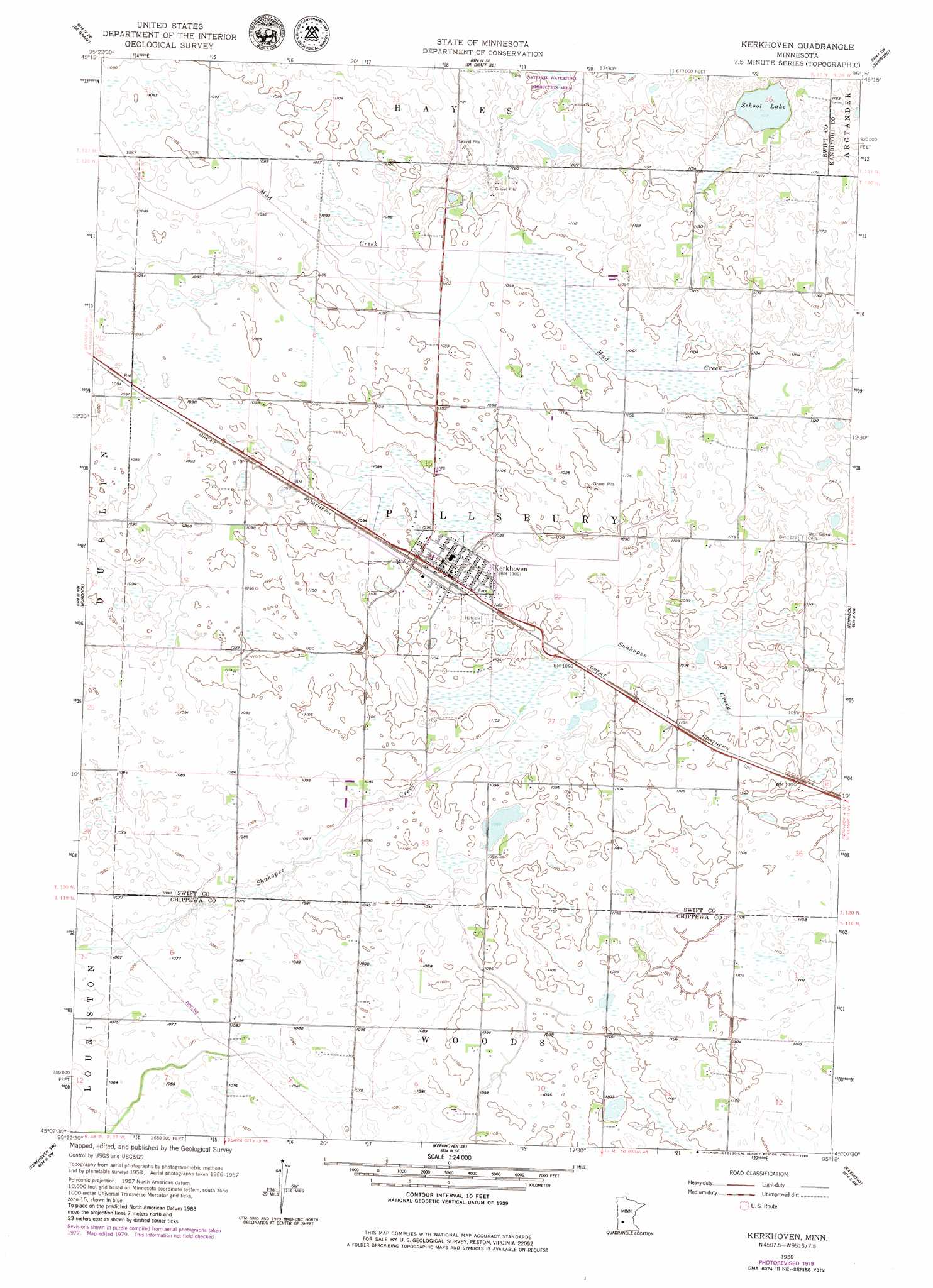
Kerkhoven Topo Map Minnesota
To zoom in, hover over the map of Kerkhoven
USGS Topo Quad 45095b3 - 1:24,000 scale
| Topo Map Name: | Kerkhoven |
| USGS Topo Quad ID: | 45095b3 |
| Print Size: | ca. 21 1/4" wide x 27" high |
| Southeast Coordinates: | 45.125° N latitude / 95.25° W longitude |
| Map Center Coordinates: | 45.1875° N latitude / 95.3125° W longitude |
| U.S. State: | MN |
| Filename: | o45095b3.jpg |
| Download Map JPG Image: | Kerkhoven topo map 1:24,000 scale |
| Map Type: | Topographic |
| Topo Series: | 7.5´ |
| Map Scale: | 1:24,000 |
| Source of Map Images: | United States Geological Survey (USGS) |
| Alternate Map Versions: |
Kerkhoven MN 1958, updated 1959 Download PDF Buy paper map Kerkhoven MN 1958, updated 1980 Download PDF Buy paper map Kerkhoven MN 2010 Download PDF Buy paper map Kerkhoven MN 2013 Download PDF Buy paper map Kerkhoven MN 2016 Download PDF Buy paper map |
1:24,000 Topo Quads surrounding Kerkhoven
Lake Hassel |
Swift Falls |
Lake Simon |
Lake Johanna |
Belgrade |
Benson |
De Graff |
De Graff Se |
Sunburg |
Mount Tom |
Gracelock Ne |
Murdock |
Kerkhoven |
Pennock |
Solomon Lake |
Gracelock |
Kerkhoven Sw |
Kerkhoven Se |
Raymond |
Willmar |
Asbury |
Maynard |
Clara City |
Prinsburg |
Blomkest |
> Back to 45095a1 at 1:100,000 scale
> Back to 45094a1 at 1:250,000 scale
> Back to U.S. Topo Maps home
Kerkhoven topo map: Gazetteer
Kerkhoven: Lakes
School Lake elevation 350m 1148′Kerkhoven: Populated Places
Kerkhoven elevation 335m 1099′Kerkhoven: Post Offices
Kerkhoven Post Office elevation 337m 1105′Kerkhoven Post Office elevation 337m 1105′
Kerkhoven digital topo map on disk
Buy this Kerkhoven topo map showing relief, roads, GPS coordinates and other geographical features, as a high-resolution digital map file on DVD: