Mount Tom Topo Map Minnesota
To zoom in, hover over the map of Mount Tom
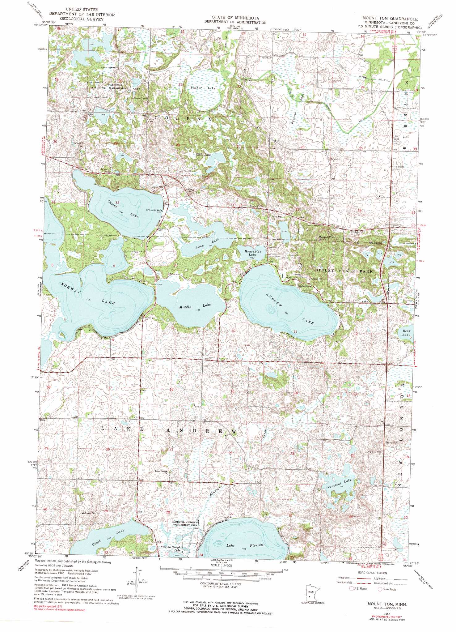
USGS Topo Quad 45095c1 - 1:24,000 scale
| Topo Map Name: | Mount Tom |
| USGS Topo Quad ID: | 45095c1 |
| Print Size: | ca. 21 1/4" wide x 27" high |
| Southeast Coordinates: | 45.25° N latitude / 95° W longitude |
| Map Center Coordinates: | 45.3125° N latitude / 95.0625° W longitude |
| U.S. State: | MN |
| Filename: | o45095c1.jpg |
| Download Map JPG Image: | Mount Tom topo map 1:24,000 scale |
| Map Type: | Topographic |
| Topo Series: | 7.5´ |
| Map Scale: | 1:24,000 |
| Source of Map Images: | United States Geological Survey (USGS) |
| Alternate Map Versions: |
Mount Tom MN 1967, updated 1968 Download PDF Buy paper map Mount Tom MN 1967, updated 1991 Download PDF Buy paper map Mount Tom MN 2010 Download PDF Buy paper map Mount Tom MN 2013 Download PDF Buy paper map Mount Tom MN 2016 Download PDF Buy paper map |
1:24,000 Topo Quads surrounding Mount Tom
Terrace |
Sedan |
Padua |
Elrosa |
Greenwald |
Lake Simon |
Lake Johanna |
Belgrade |
Georgeville |
Lake Henry |
De Graff Se |
Sunburg |
Mount Tom |
New London |
Hawick |
Kerkhoven |
Pennock |
Solomon Lake |
Spicer |
Atwater |
Kerkhoven Se |
Raymond |
Willmar |
Little Kandiyohi Lake |
Lake Elizabeth |
> Back to 45095a1 at 1:100,000 scale
> Back to 45094a1 at 1:250,000 scale
> Back to U.S. Topo Maps home
Mount Tom topo map: Gazetteer
Mount Tom: Canals
County Ditch Number B Four elevation 374m 1227′County Ditch Number B Three elevation 382m 1253′
County Ditch Number Thirtyseven elevation 373m 1223′
Mount Tom: Lakes
Andrew Lake elevation 363m 1190′Crook Lake elevation 340m 1115′
Games Lake elevation 365m 1197′
Henschien Lake elevation 364m 1194′
Lake Florida elevation 341m 1118′
Middle Lake elevation 364m 1194′
Norstedt Lake elevation 362m 1187′
Norway Lake elevation 365m 1197′
Skull Lake elevation 375m 1230′
Swan Lake elevation 364m 1194′
Mount Tom: Parks
Broberg-Lundborg State Monument elevation 386m 1266′Sibley State Park elevation 387m 1269′
Mount Tom: Summits
Mount Tom elevation 414m 1358′Mount Tom: Swamps
Prairie Lake elevation 376m 1233′Timber Lake elevation 377m 1236′
Mount Tom digital topo map on disk
Buy this Mount Tom topo map showing relief, roads, GPS coordinates and other geographical features, as a high-resolution digital map file on DVD: