De Graff Topo Map Minnesota
To zoom in, hover over the map of De Graff
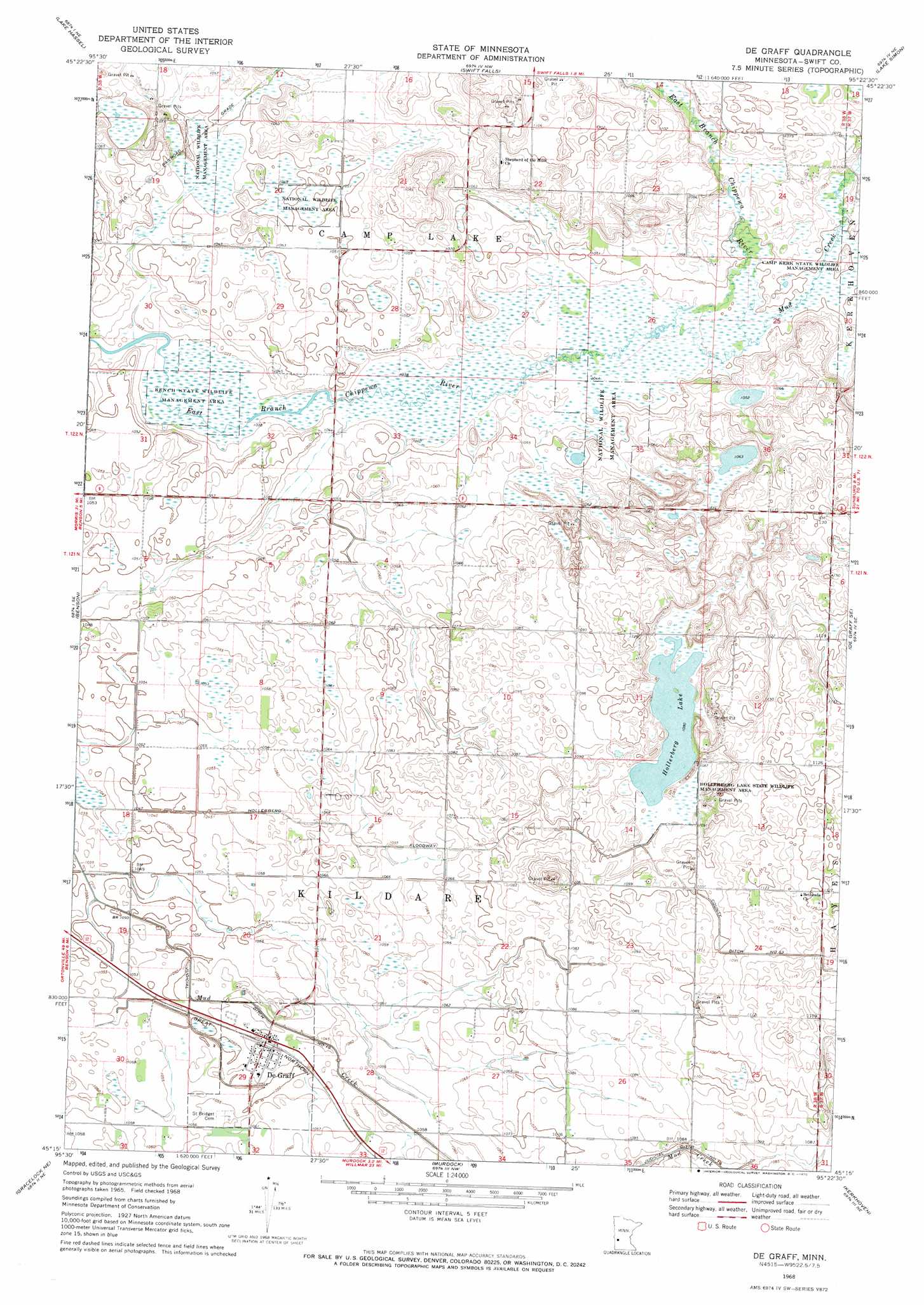
USGS Topo Quad 45095c4 - 1:24,000 scale
| Topo Map Name: | De Graff |
| USGS Topo Quad ID: | 45095c4 |
| Print Size: | ca. 21 1/4" wide x 27" high |
| Southeast Coordinates: | 45.25° N latitude / 95.375° W longitude |
| Map Center Coordinates: | 45.3125° N latitude / 95.4375° W longitude |
| U.S. State: | MN |
| Filename: | o45095c4.jpg |
| Download Map JPG Image: | De Graff topo map 1:24,000 scale |
| Map Type: | Topographic |
| Topo Series: | 7.5´ |
| Map Scale: | 1:24,000 |
| Source of Map Images: | United States Geological Survey (USGS) |
| Alternate Map Versions: |
De Graff MN 1968, updated 1970 Download PDF Buy paper map De Graff MN 2010 Download PDF Buy paper map De Graff MN 2013 Download PDF Buy paper map De Graff MN 2016 Download PDF Buy paper map |
1:24,000 Topo Quads surrounding De Graff
Cyrus |
Starbuck |
Lake Minnewaska |
Terrace |
Sedan |
Clontarf North |
Lake Hassel |
Swift Falls |
Lake Simon |
Lake Johanna |
Clontarf South |
Benson |
De Graff |
De Graff Se |
Sunburg |
Gracelock Nw |
Gracelock Ne |
Murdock |
Kerkhoven |
Pennock |
Gracelock Sw |
Gracelock |
Kerkhoven Sw |
Kerkhoven Se |
Raymond |
> Back to 45095a1 at 1:100,000 scale
> Back to 45094a1 at 1:250,000 scale
> Back to U.S. Topo Maps home
De Graff topo map: Gazetteer
De Graff: Canals
Hollerberg Floodway elevation 323m 1059′De Graff: Dams
Falk Wildlife Area Dam elevation 321m 1053′De Graff: Lakes
Hollerberg Lake elevation 329m 1079′De Graff: Parks
Bench State Wildlife Management Area elevation 316m 1036′Hollerberg Lake State Wildlife Management Ar elevation 331m 1085′
De Graff: Populated Places
De Graff elevation 323m 1059′De Graff: Post Offices
De Graff Post Office elevation 323m 1059′De Graff Post Office elevation 323m 1059′
De Graff: Streams
Mud Creek elevation 318m 1043′De Graff digital topo map on disk
Buy this De Graff topo map showing relief, roads, GPS coordinates and other geographical features, as a high-resolution digital map file on DVD: