Page Lake Topo Map Minnesota
To zoom in, hover over the map of Page Lake
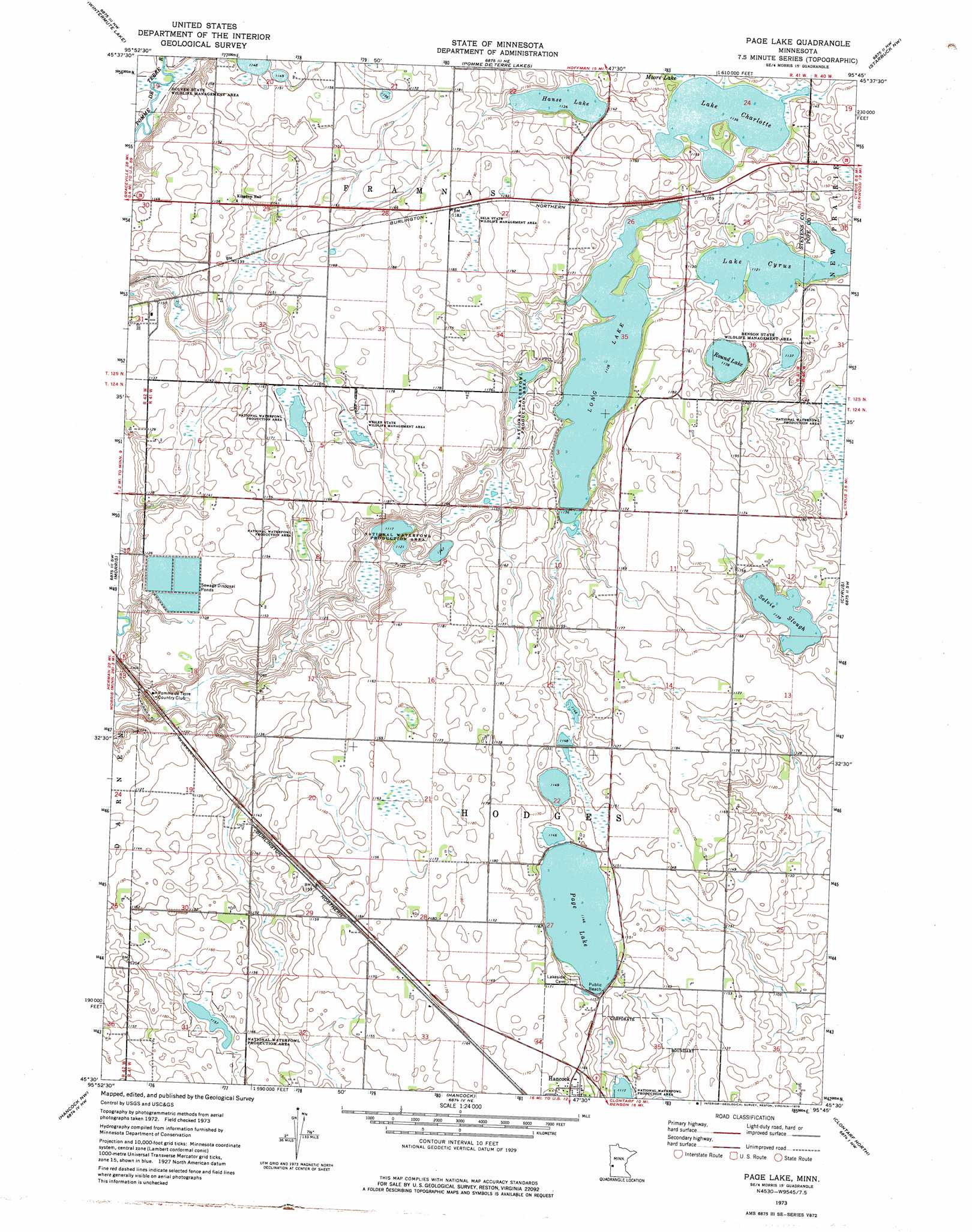
USGS Topo Quad 45095e7 - 1:24,000 scale
| Topo Map Name: | Page Lake |
| USGS Topo Quad ID: | 45095e7 |
| Print Size: | ca. 21 1/4" wide x 27" high |
| Southeast Coordinates: | 45.5° N latitude / 95.75° W longitude |
| Map Center Coordinates: | 45.5625° N latitude / 95.8125° W longitude |
| U.S. State: | MN |
| Filename: | o45095e7.jpg |
| Download Map JPG Image: | Page Lake topo map 1:24,000 scale |
| Map Type: | Topographic |
| Topo Series: | 7.5´ |
| Map Scale: | 1:24,000 |
| Source of Map Images: | United States Geological Survey (USGS) |
| Alternate Map Versions: |
Page Lake MN 1973, updated 1975 Download PDF Buy paper map Page Lake MN 2010 Download PDF Buy paper map Page Lake MN 2013 Download PDF Buy paper map Page Lake MN 2016 Download PDF Buy paper map |
1:24,000 Topo Quads surrounding Page Lake
Niemackl Lakes |
Patchen Lake |
Hoffman |
Kensington |
Farwell |
Donnelly |
Wintermute Lake |
Pomme De Terre Lakes |
Starbuck Nw |
Lowry |
Alberta |
Morris |
Page Lake |
Cyrus |
Starbuck |
Dry Wood Lake |
Hancock Nw |
Hancock |
Clontarf North |
Lake Hassel |
Lake Oliver |
Hancock Sw |
Danvers |
Clontarf South |
Benson |
> Back to 45095e1 at 1:100,000 scale
> Back to 45094a1 at 1:250,000 scale
> Back to U.S. Topo Maps home
Page Lake topo map: Gazetteer
Page Lake: Airports
Browns Airport elevation 361m 1184′Page Lake: Lakes
Hanse Lake elevation 346m 1135′Lake Charlotte elevation 346m 1135′
Lake Cyrus elevation 342m 1122′
Long Lake elevation 344m 1128′
Page Lake elevation 350m 1148′
Round Lake elevation 347m 1138′
Solvie Slough elevation 347m 1138′
Page Lake: Parks
Benson State Wildlife Management Area elevation 347m 1138′Dolven State Wildlife Management Area elevation 332m 1089′
Selk State Wildlife Management Area elevation 360m 1181′
Weiler State Wildlife Management Area elevation 350m 1148′
Page Lake digital topo map on disk
Buy this Page Lake topo map showing relief, roads, GPS coordinates and other geographical features, as a high-resolution digital map file on DVD: