Lowry Topo Map Minnesota
To zoom in, hover over the map of Lowry
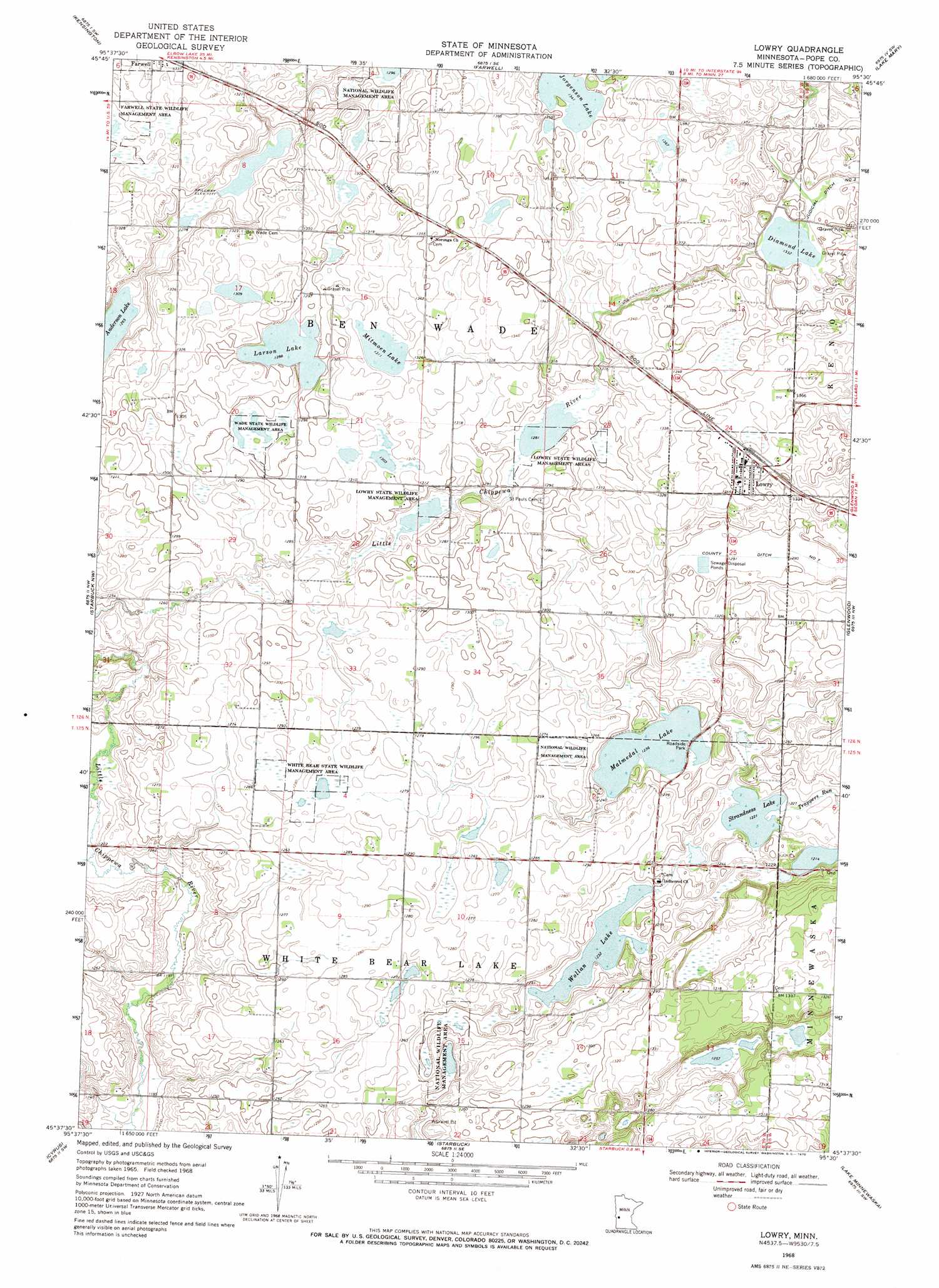
USGS Topo Quad 45095f5 - 1:24,000 scale
| Topo Map Name: | Lowry |
| USGS Topo Quad ID: | 45095f5 |
| Print Size: | ca. 21 1/4" wide x 27" high |
| Southeast Coordinates: | 45.625° N latitude / 95.5° W longitude |
| Map Center Coordinates: | 45.6875° N latitude / 95.5625° W longitude |
| U.S. State: | MN |
| Filename: | o45095f5.jpg |
| Download Map JPG Image: | Lowry topo map 1:24,000 scale |
| Map Type: | Topographic |
| Topo Series: | 7.5´ |
| Map Scale: | 1:24,000 |
| Source of Map Images: | United States Geological Survey (USGS) |
| Alternate Map Versions: |
Lowry MN 1968, updated 1970 Download PDF Buy paper map Lowry MN 2010 Download PDF Buy paper map Lowry MN 2013 Download PDF Buy paper map Lowry MN 2016 Download PDF Buy paper map |
1:24,000 Topo Quads surrounding Lowry
Erdahl |
Quam Lake |
Brandon |
Alexandria West |
Alexandria East |
Hoffman |
Kensington |
Farwell |
Lake Mary |
Forada |
Pomme De Terre Lakes |
Starbuck Nw |
Lowry |
Glenwood |
Villard |
Page Lake |
Cyrus |
Starbuck |
Lake Minnewaska |
Terrace |
Hancock |
Clontarf North |
Lake Hassel |
Swift Falls |
Lake Simon |
> Back to 45095e1 at 1:100,000 scale
> Back to 45094a1 at 1:250,000 scale
> Back to U.S. Topo Maps home
Lowry topo map: Gazetteer
Lowry: Canals
County Ditch Number Seven elevation 392m 1286′Judicial Ditch Number Three elevation 408m 1338′
Lowry: Lakes
Anderson Lake elevation 386m 1266′Diamond Lake elevation 406m 1332′
Jorgenson Lake elevation 409m 1341′
Larson Lake elevation 393m 1289′
Malmedal Lake elevation 377m 1236′
Mitmoen Lake elevation 400m 1312′
Strandness Lake elevation 372m 1220′
Wollan Lake elevation 376m 1233′
Lowry: Parks
Farwell State Wildlife Management Area elevation 399m 1309′Lowry State Wildlife Management Area elevation 391m 1282′
Starbuck at Magmental Lake Wayside Park elevation 378m 1240′
Wade State Wildlife Management Area elevation 392m 1286′
White Bear State Wildlife Management Area elevation 390m 1279′
Lowry: Populated Places
Lowry elevation 418m 1371′Lowry: Post Offices
Lowry Post Office elevation 418m 1371′Lowry digital topo map on disk
Buy this Lowry topo map showing relief, roads, GPS coordinates and other geographical features, as a high-resolution digital map file on DVD: