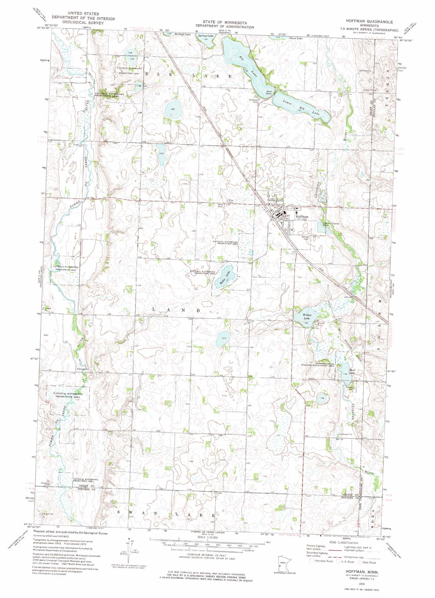
Hoffman Topo Map Minnesota
To zoom in, hover over the map of Hoffman
USGS Topo Quad 45095g7 - 1:24,000 scale
| Topo Map Name: | Hoffman |
| USGS Topo Quad ID: | 45095g7 |
| Print Size: | ca. 21 1/4" wide x 27" high |
| Southeast Coordinates: | 45.75° N latitude / 95.75° W longitude |
| Map Center Coordinates: | 45.8125° N latitude / 95.8125° W longitude |
| U.S. State: | MN |
| Filename: | o45095g7.jpg |
| Download Map JPG Image: | Hoffman topo map 1:24,000 scale |
| Map Type: | Topographic |
| Topo Series: | 7.5´ |
| Map Scale: | 1:24,000 |
| Source of Map Images: | United States Geological Survey (USGS) |
| Alternate Map Versions: |
Hoffman MN 1973, updated 1975 Download PDF Buy paper map Hoffman MN 2010 Download PDF Buy paper map Hoffman MN 2013 Download PDF Buy paper map Hoffman MN 2016 Download PDF Buy paper map |
1:24,000 Topo Quads surrounding Hoffman
Wendell |
Fourmile Lake |
Ashby |
Evansville |
Millerville |
Trisko Lake |
Elbow Lake |
Erdahl |
Quam Lake |
Brandon |
Niemackl Lakes |
Patchen Lake |
Hoffman |
Kensington |
Farwell |
Donnelly |
Wintermute Lake |
Pomme De Terre Lakes |
Starbuck Nw |
Lowry |
Alberta |
Morris |
Page Lake |
Cyrus |
Starbuck |
> Back to 45095e1 at 1:100,000 scale
> Back to 45094a1 at 1:250,000 scale
> Back to U.S. Topo Maps home
Hoffman topo map: Gazetteer
Hoffman: Lakes
Bolin Lake elevation 369m 1210′Elk Lake elevation 367m 1204′
Lower Elk Lake elevation 368m 1207′
Reed Lake elevation 361m 1184′
Wilson Lake elevation 361m 1184′
Hoffman: Parks
Chippewa State Wildlife Management Area elevation 364m 1194′Hoffman Park elevation 375m 1230′
Hoffman: Populated Places
Hoffman elevation 380m 1246′Hoffman: Post Offices
Hoffman Post Office elevation 380m 1246′Hoffman digital topo map on disk
Buy this Hoffman topo map showing relief, roads, GPS coordinates and other geographical features, as a high-resolution digital map file on DVD: