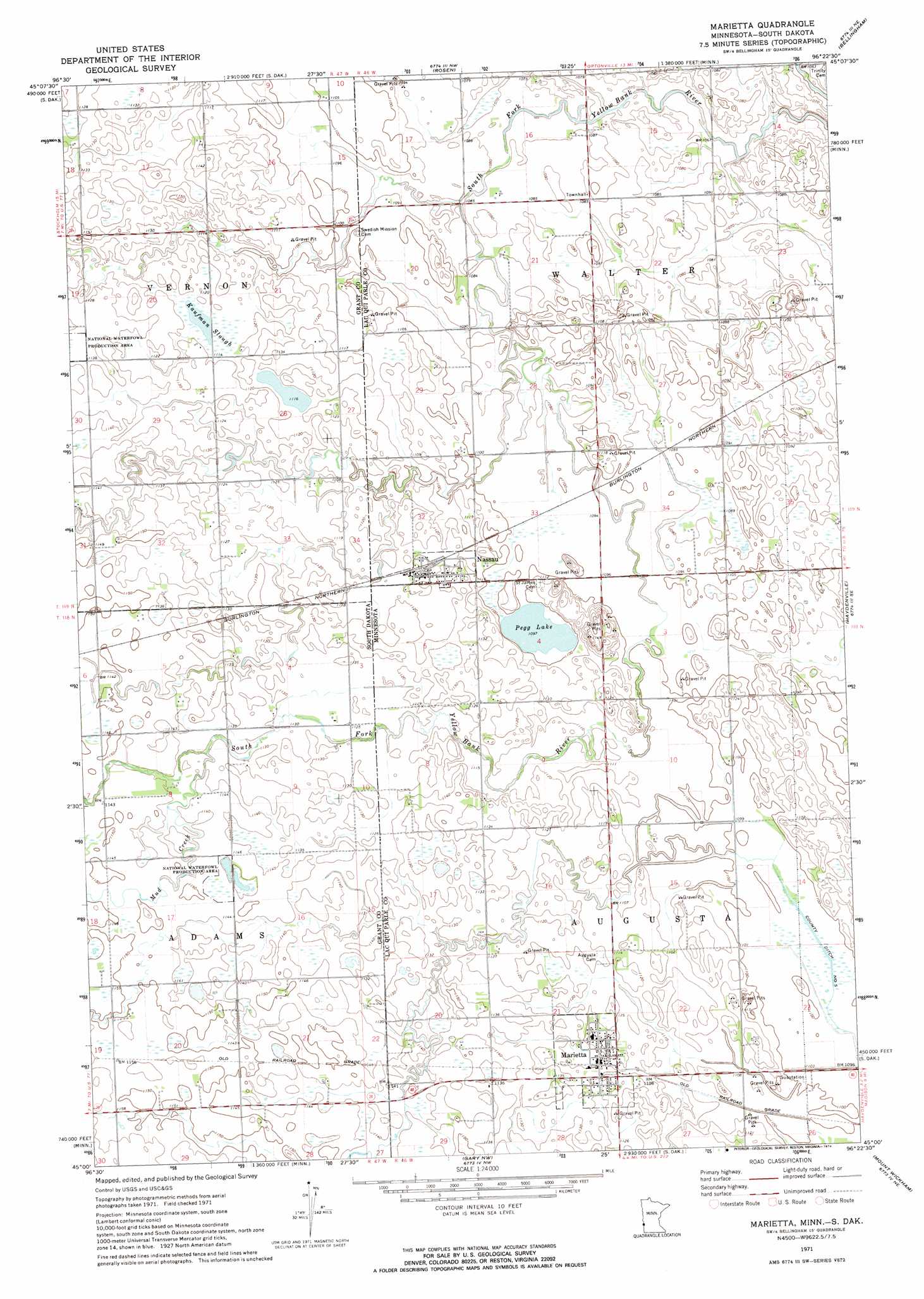
Marietta Topo Map Minnesota
To zoom in, hover over the map of Marietta
USGS Topo Quad 45096a4 - 1:24,000 scale
| Topo Map Name: | Marietta |
| USGS Topo Quad ID: | 45096a4 |
| Print Size: | ca. 21 1/4" wide x 27" high |
| Southeast Coordinates: | 45° N latitude / 96.375° W longitude |
| Map Center Coordinates: | 45.0625° N latitude / 96.4375° W longitude |
| U.S. States: | MN, SD |
| Filename: | o45096a4.jpg |
| Download Map JPG Image: | Marietta topo map 1:24,000 scale |
| Map Type: | Topographic |
| Topo Series: | 7.5´ |
| Map Scale: | 1:24,000 |
| Source of Map Images: | United States Geological Survey (USGS) |
| Alternate Map Versions: |
Marietta MN 1971, updated 1974 Download PDF Buy paper map Marietta MN 2010 Download PDF Buy paper map Marietta MN 2013 Download PDF Buy paper map Marietta MN 2016 Download PDF Buy paper map |
1:24,000 Topo Quads surrounding Marietta
Big Stone Lake Sw |
Big Stone Lake Se |
Ortonville |
Odessa |
Artichoke Lake |
Milbank West |
Milbank East |
Rosen |
Bellingham |
Correll |
La Bolt |
Revillo |
Marietta |
Haydenville |
Madison |
Tunerville |
Clear Lake Ne |
Gary Nw |
Mount Wickham |
Dawson Nw |
Clear Lake North |
Lake Francis |
Gary |
Gary Se |
Dawson Sw |
> Back to 45096a1 at 1:100,000 scale
> Back to 45096a1 at 1:250,000 scale
> Back to U.S. Topo Maps home
Marietta topo map: Gazetteer
Marietta: Guts
Kaufman Slough elevation 341m 1118′Marietta: Lakes
Pegg Lake elevation 335m 1099′Marietta: Populated Places
Marietta elevation 342m 1122′Nassau elevation 344m 1128′
Marietta: Post Offices
Marietta Post Office elevation 342m 1122′Marietta Post Office elevation 342m 1122′
Nassau Post Office elevation 344m 1128′
Nassau Post Office elevation 344m 1128′
Marietta: Streams
Mud Creek elevation 345m 1131′Marietta digital topo map on disk
Buy this Marietta topo map showing relief, roads, GPS coordinates and other geographical features, as a high-resolution digital map file on DVD:
Eastern North Dakota & Eastern South Dakota
Buy digital topo maps: Eastern North Dakota & Eastern South Dakota