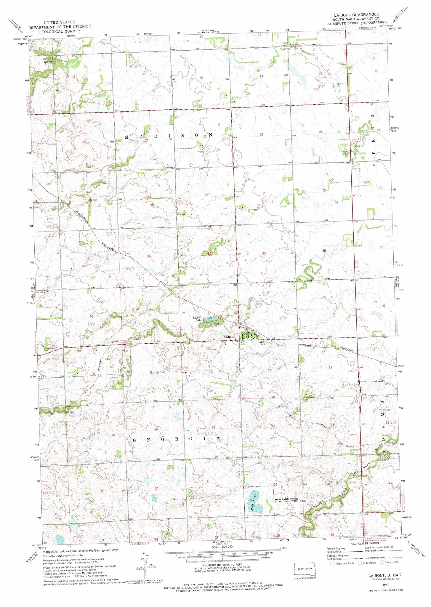
La Bolt Topo Map South Dakota
To zoom in, hover over the map of La Bolt
USGS Topo Quad 45096a6 - 1:24,000 scale
| Topo Map Name: | La Bolt |
| USGS Topo Quad ID: | 45096a6 |
| Print Size: | ca. 21 1/4" wide x 27" high |
| Southeast Coordinates: | 45° N latitude / 96.625° W longitude |
| Map Center Coordinates: | 45.0625° N latitude / 96.6875° W longitude |
| U.S. State: | SD |
| Filename: | o45096a6.jpg |
| Download Map JPG Image: | La Bolt topo map 1:24,000 scale |
| Map Type: | Topographic |
| Topo Series: | 7.5´ |
| Map Scale: | 1:24,000 |
| Source of Map Images: | United States Geological Survey (USGS) |
| Alternate Map Versions: |
LaBolt SD 1973, updated 1976 Download PDF Buy paper map LaBolt SD 2012 Download PDF Buy paper map LaBolt SD 2015 Download PDF Buy paper map |
1:24,000 Topo Quads surrounding La Bolt
Marvin |
Corona |
Big Stone Lake Sw |
Big Stone Lake Se |
Ortonville |
Antelope Valley |
Twin Brooks |
Milbank West |
Milbank East |
Rosen |
South Shore |
Stockholm |
La Bolt |
Revillo |
Marietta |
Kranzburg |
Goodwin |
Tunerville |
Clear Lake Ne |
Gary Nw |
Kranzburg Sw |
Bemis |
Clear Lake North |
Lake Francis |
Gary |
> Back to 45096a1 at 1:100,000 scale
> Back to 45096a1 at 1:250,000 scale
> Back to U.S. Topo Maps home
La Bolt topo map: Gazetteer
La Bolt: Dams
LaBold Lake Dam elevation 416m 1364′La Bolt: Lakes
LaBolt Lake elevation 416m 1364′Mud Lake elevation 463m 1519′
La Bolt: Parks
Mud Lake State Public Shooting Area elevation 464m 1522′La Bolt: Populated Places
LaBolt elevation 418m 1371′La Bolt digital topo map on disk
Buy this La Bolt topo map showing relief, roads, GPS coordinates and other geographical features, as a high-resolution digital map file on DVD:
Eastern North Dakota & Eastern South Dakota
Buy digital topo maps: Eastern North Dakota & Eastern South Dakota