Lake Oliver Topo Map Minnesota
To zoom in, hover over the map of Lake Oliver
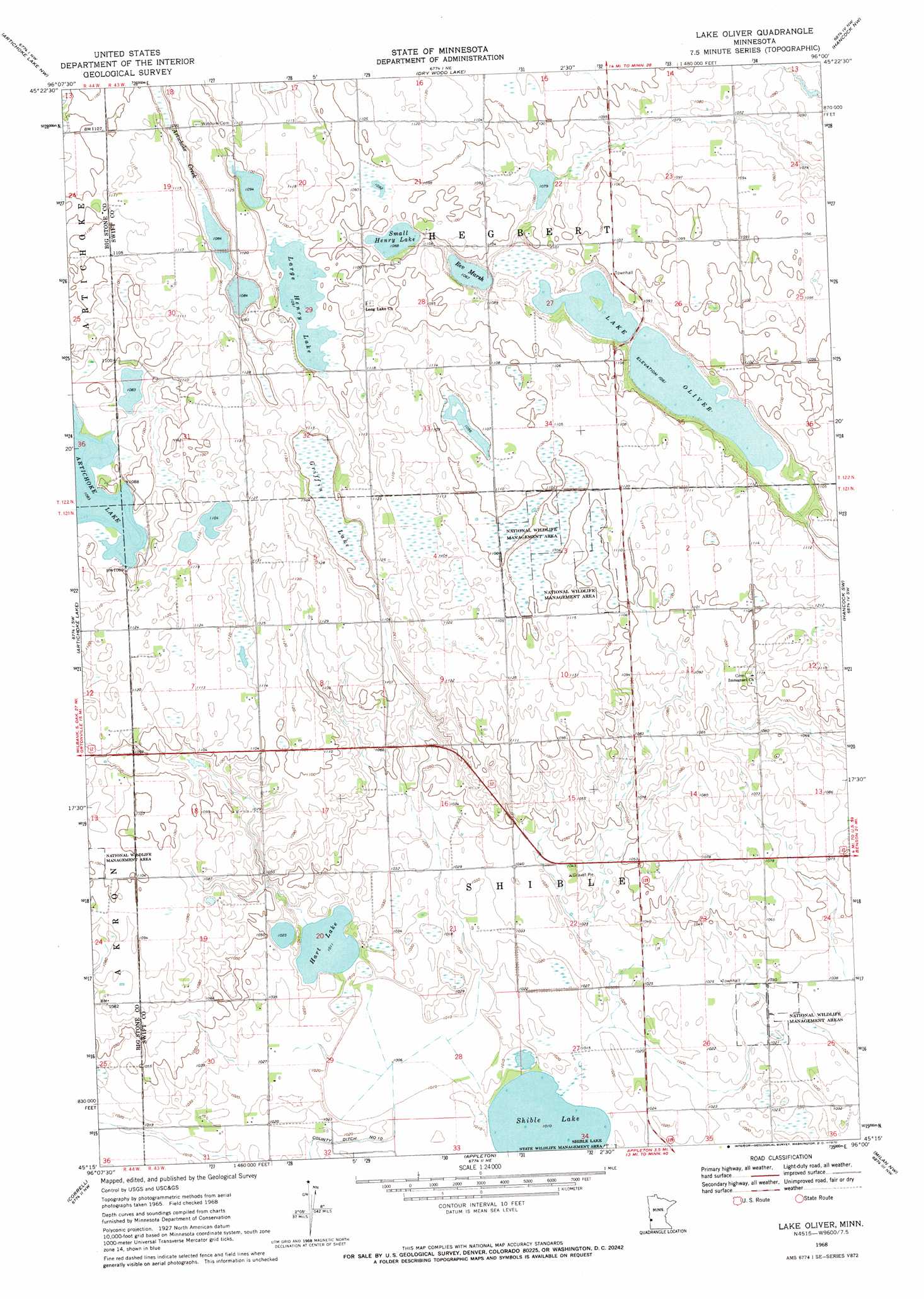
USGS Topo Quad 45096c1 - 1:24,000 scale
| Topo Map Name: | Lake Oliver |
| USGS Topo Quad ID: | 45096c1 |
| Print Size: | ca. 21 1/4" wide x 27" high |
| Southeast Coordinates: | 45.25° N latitude / 96° W longitude |
| Map Center Coordinates: | 45.3125° N latitude / 96.0625° W longitude |
| U.S. State: | MN |
| Filename: | o45096c1.jpg |
| Download Map JPG Image: | Lake Oliver topo map 1:24,000 scale |
| Map Type: | Topographic |
| Topo Series: | 7.5´ |
| Map Scale: | 1:24,000 |
| Source of Map Images: | United States Geological Survey (USGS) |
| Alternate Map Versions: |
Lake Oliver MN 1968, updated 1970 Download PDF Buy paper map Lake Oliver MN 2010 Download PDF Buy paper map Lake Oliver MN 2013 Download PDF Buy paper map Lake Oliver MN 2016 Download PDF Buy paper map |
1:24,000 Topo Quads surrounding Lake Oliver
Johnson |
Chokio |
Alberta |
Morris |
Page Lake |
Dismal Swamp |
Artichoke Lake Nw |
Dry Wood Lake |
Hancock Nw |
Hancock |
Odessa |
Artichoke Lake |
Lake Oliver |
Hancock Sw |
Danvers |
Bellingham |
Correll |
Appleton |
Milan Nw |
Big Bend City |
Haydenville |
Madison |
Cerro Gordo |
Milan |
Watson |
> Back to 45096a1 at 1:100,000 scale
> Back to 45096a1 at 1:250,000 scale
> Back to U.S. Topo Maps home
Lake Oliver topo map: Gazetteer
Lake Oliver: Canals
County Ditch Number Ten elevation 309m 1013′Lake Oliver: Lakes
Hart Lake elevation 308m 1010′Lake Oliver elevation 324m 1062′
Large Henry Lake elevation 333m 1092′
Rev Marsh elevation 324m 1062′
Shible Lake elevation 308m 1010′
Small Henry Lake elevation 330m 1082′
Lake Oliver: Parks
Shible Lake State Wildlife Management Area elevation 311m 1020′Lake Oliver: Swamps
Griffin Lake elevation 333m 1092′Lake Oliver digital topo map on disk
Buy this Lake Oliver topo map showing relief, roads, GPS coordinates and other geographical features, as a high-resolution digital map file on DVD:
Eastern North Dakota & Eastern South Dakota
Buy digital topo maps: Eastern North Dakota & Eastern South Dakota