Artichoke Lake Nw Topo Map Minnesota
To zoom in, hover over the map of Artichoke Lake Nw
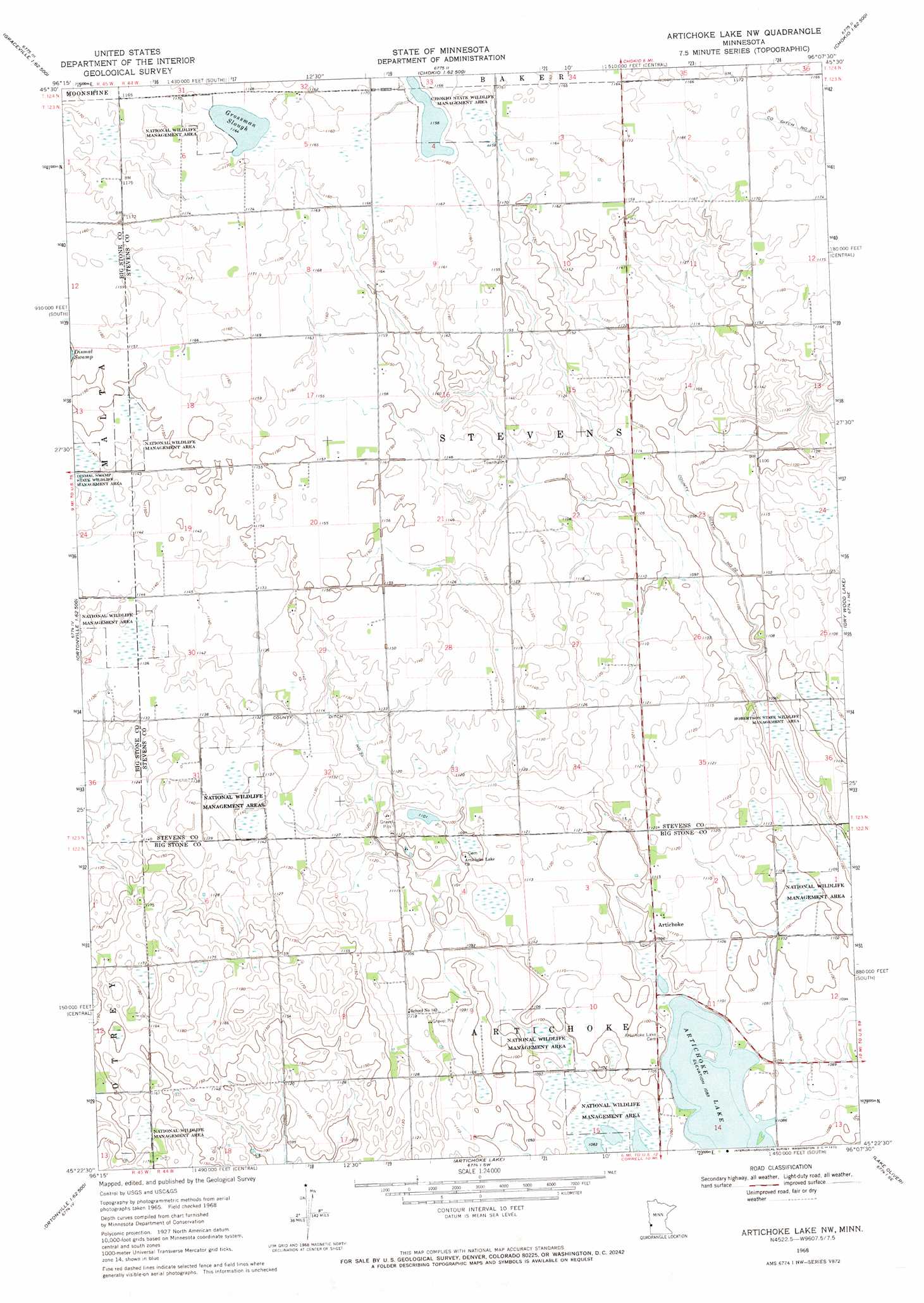
USGS Topo Quad 45096d2 - 1:24,000 scale
| Topo Map Name: | Artichoke Lake Nw |
| USGS Topo Quad ID: | 45096d2 |
| Print Size: | ca. 21 1/4" wide x 27" high |
| Southeast Coordinates: | 45.375° N latitude / 96.125° W longitude |
| Map Center Coordinates: | 45.4375° N latitude / 96.1875° W longitude |
| U.S. State: | MN |
| Filename: | o45096d2.jpg |
| Download Map JPG Image: | Artichoke Lake Nw topo map 1:24,000 scale |
| Map Type: | Topographic |
| Topo Series: | 7.5´ |
| Map Scale: | 1:24,000 |
| Source of Map Images: | United States Geological Survey (USGS) |
| Alternate Map Versions: |
Artichoke Lake NW MN 1968, updated 1970 Download PDF Buy paper map Artichoke Lake NW MN 2010 Download PDF Buy paper map Artichoke Lake NW MN 2013 Download PDF Buy paper map Artichoke Lake NW MN 2016 Download PDF Buy paper map |
1:24,000 Topo Quads surrounding Artichoke Lake Nw
Dumont |
Graceville Ne |
Chokio Nw |
Donnelly |
Wintermute Lake |
Graceville |
Johnson |
Chokio |
Alberta |
Morris |
Clinton |
Dismal Swamp |
Artichoke Lake Nw |
Dry Wood Lake |
Hancock Nw |
Ortonville |
Odessa |
Artichoke Lake |
Lake Oliver |
Hancock Sw |
Rosen |
Bellingham |
Correll |
Appleton |
Milan Nw |
> Back to 45096a1 at 1:100,000 scale
> Back to 45096a1 at 1:250,000 scale
> Back to U.S. Topo Maps home
Artichoke Lake Nw topo map: Gazetteer
Artichoke Lake Nw: Canals
County Ditch Number Twentyone elevation 338m 1108′County Ditch Number Twentytwo elevation 333m 1092′
Artichoke Lake Nw: Lakes
Grossman Slough elevation 355m 1164′Artichoke Lake Nw: Parks
Chokio State Wildlife Management Area elevation 354m 1161′Robertson State Wildlife Management Area elevation 333m 1092′
Artichoke Lake Nw: Populated Places
Artichoke elevation 333m 1092′Artichoke Lake Nw: Post Offices
Artichoke Lake Post Office elevation 334m 1095′Artichoke Lake Nw digital topo map on disk
Buy this Artichoke Lake Nw topo map showing relief, roads, GPS coordinates and other geographical features, as a high-resolution digital map file on DVD:
Eastern North Dakota & Eastern South Dakota
Buy digital topo maps: Eastern North Dakota & Eastern South Dakota