Wilmot Nw Topo Map South Dakota
To zoom in, hover over the map of Wilmot Nw
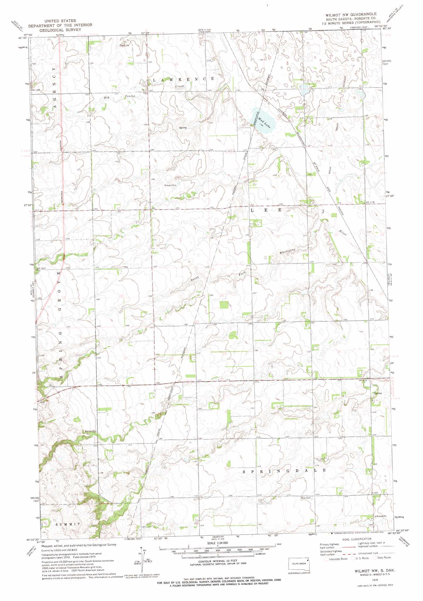
USGS Topo Quad 45096d8 - 1:24,000 scale
| Topo Map Name: | Wilmot Nw |
| USGS Topo Quad ID: | 45096d8 |
| Print Size: | ca. 21 1/4" wide x 27" high |
| Southeast Coordinates: | 45.375° N latitude / 96.875° W longitude |
| Map Center Coordinates: | 45.4375° N latitude / 96.9375° W longitude |
| U.S. State: | SD |
| Filename: | o45096d8.jpg |
| Download Map JPG Image: | Wilmot Nw topo map 1:24,000 scale |
| Map Type: | Topographic |
| Topo Series: | 7.5´ |
| Map Scale: | 1:24,000 |
| Source of Map Images: | United States Geological Survey (USGS) |
| Alternate Map Versions: |
Wilmot NW SD 1970, updated 1973 Download PDF Buy paper map Wilmot NW SD 1970, updated 1978 Download PDF Buy paper map Wilmot NW SD 2012 Download PDF Buy paper map Wilmot NW SD 2015 Download PDF Buy paper map |
1:24,000 Topo Quads surrounding Wilmot Nw
Whitestone Lake |
Sisseton |
Peever Nw |
Peever Ne |
Beardsley Nw |
Drywood Lakes |
Goodwill |
Peever |
Browns Valley |
Beardsley |
Enemy Swim Lake East |
Summit Ne |
Wilmot Nw |
Wilmot |
Big Stone Lake West |
Ortley |
Summit |
Marvin |
Corona |
Big Stone Lake Sw |
Lonesome Lake |
Still Lake Ne |
Antelope Valley |
Twin Brooks |
Milbank West |
> Back to 45096a1 at 1:100,000 scale
> Back to 45096a1 at 1:250,000 scale
> Back to U.S. Topo Maps home
Wilmot Nw topo map: Gazetteer
Wilmot Nw: Airports
Whipple Ranch Strip elevation 443m 1453′Wilmot Nw: Lakes
Mud Lake elevation 361m 1184′Wilmot Nw digital topo map on disk
Buy this Wilmot Nw topo map showing relief, roads, GPS coordinates and other geographical features, as a high-resolution digital map file on DVD:
Eastern North Dakota & Eastern South Dakota
Buy digital topo maps: Eastern North Dakota & Eastern South Dakota