Peever Topo Map South Dakota
To zoom in, hover over the map of Peever
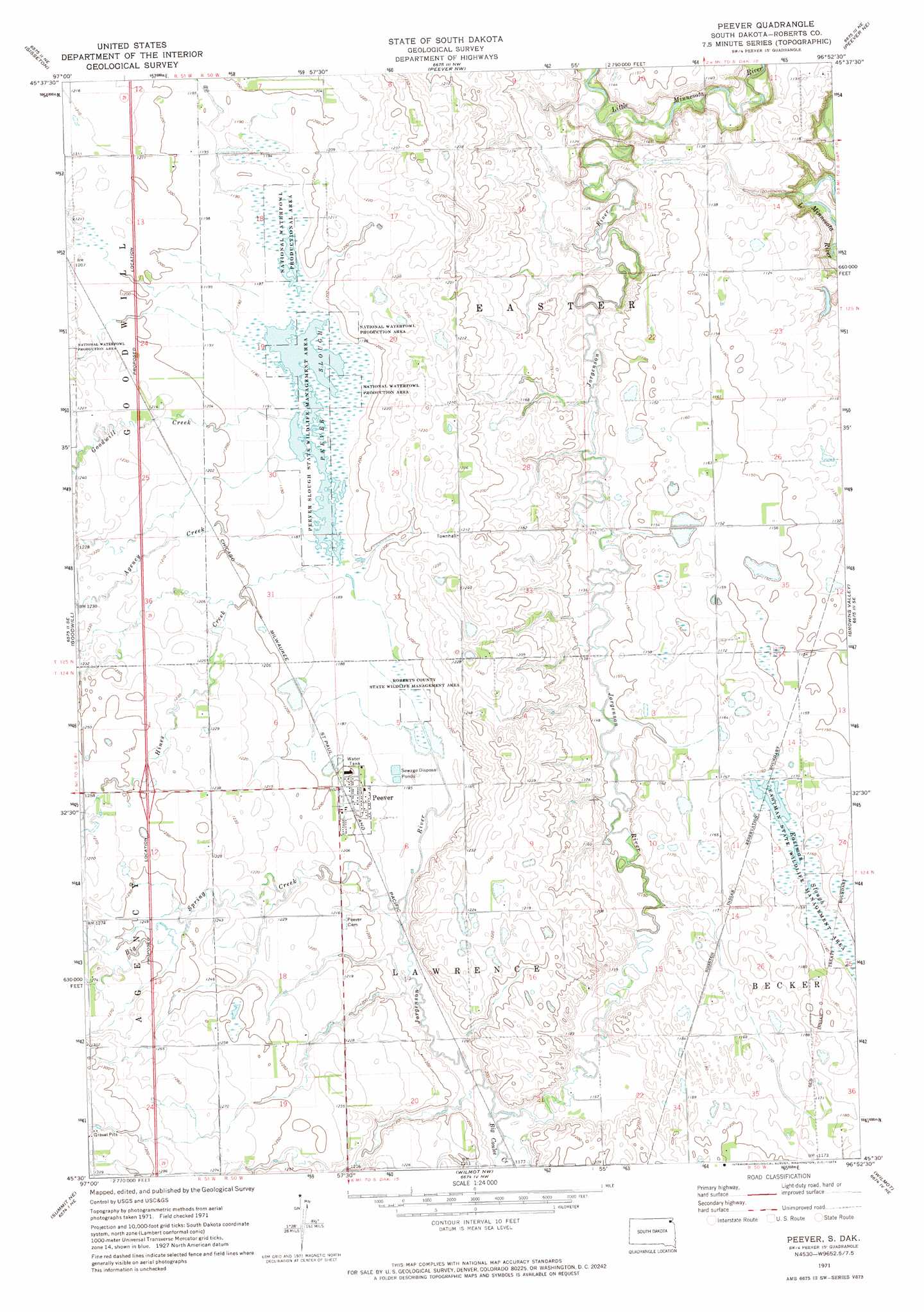
USGS Topo Quad 45096e8 - 1:24,000 scale
| Topo Map Name: | Peever |
| USGS Topo Quad ID: | 45096e8 |
| Print Size: | ca. 21 1/4" wide x 27" high |
| Southeast Coordinates: | 45.5° N latitude / 96.875° W longitude |
| Map Center Coordinates: | 45.5625° N latitude / 96.9375° W longitude |
| U.S. State: | SD |
| Filename: | o45096e8.jpg |
| Download Map JPG Image: | Peever topo map 1:24,000 scale |
| Map Type: | Topographic |
| Topo Series: | 7.5´ |
| Map Scale: | 1:24,000 |
| Source of Map Images: | United States Geological Survey (USGS) |
| Alternate Map Versions: |
Peever SD 1971, updated 1974 Download PDF Buy paper map Peever SD 2012 Download PDF Buy paper map Peever SD 2015 Download PDF Buy paper map |
1:24,000 Topo Quads surrounding Peever
Claire City Sw |
Claire City |
New Effington |
Victor |
Rosholt |
Whitestone Lake |
Sisseton |
Peever Nw |
Peever Ne |
Beardsley Nw |
Drywood Lakes |
Goodwill |
Peever |
Browns Valley |
Beardsley |
Enemy Swim Lake East |
Summit Ne |
Wilmot Nw |
Wilmot |
Big Stone Lake West |
Ortley |
Summit |
Marvin |
Corona |
Big Stone Lake Sw |
> Back to 45096e1 at 1:100,000 scale
> Back to 45096a1 at 1:250,000 scale
> Back to U.S. Topo Maps home
Peever topo map: Gazetteer
Peever: Guts
Eastman Slough elevation 354m 1161′Peever Slough elevation 361m 1184′
Peever: Parks
Eastman State Wildlife Management Area elevation 353m 1158′Peever Slough State Wildlife Management Area elevation 361m 1184′
Roberts County State Wildlife Management Area elevation 361m 1184′
Peever: Populated Places
Peever elevation 366m 1200′Peever Flats elevation 372m 1220′
Peever: Streams
Agency Creek elevation 362m 1187′Big Coulee Creek elevation 357m 1171′
Big Spring Creek elevation 360m 1181′
Goodwill Creek elevation 361m 1184′
Hines Creek elevation 363m 1190′
Jorgenson River elevation 326m 1069′
Peever digital topo map on disk
Buy this Peever topo map showing relief, roads, GPS coordinates and other geographical features, as a high-resolution digital map file on DVD:
Eastern North Dakota & Eastern South Dakota
Buy digital topo maps: Eastern North Dakota & Eastern South Dakota