Victor Topo Map South Dakota
To zoom in, hover over the map of Victor
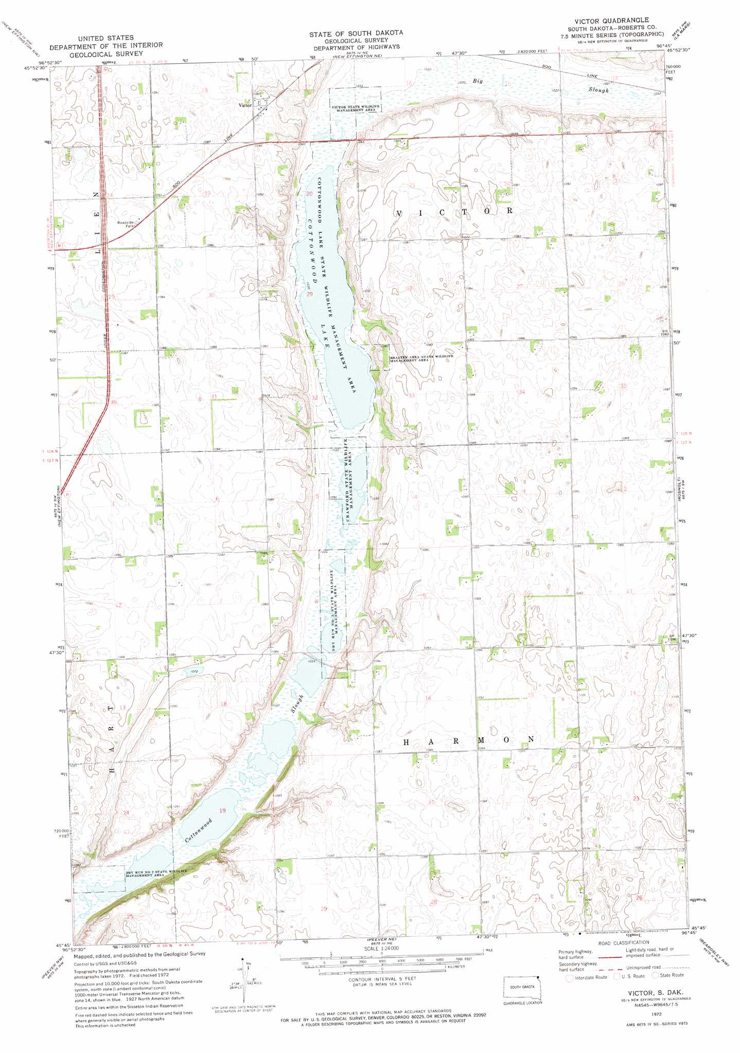
USGS Topo Quad 45096g7 - 1:24,000 scale
| Topo Map Name: | Victor |
| USGS Topo Quad ID: | 45096g7 |
| Print Size: | ca. 21 1/4" wide x 27" high |
| Southeast Coordinates: | 45.75° N latitude / 96.75° W longitude |
| Map Center Coordinates: | 45.8125° N latitude / 96.8125° W longitude |
| U.S. State: | SD |
| Filename: | o45096g7.jpg |
| Download Map JPG Image: | Victor topo map 1:24,000 scale |
| Map Type: | Topographic |
| Topo Series: | 7.5´ |
| Map Scale: | 1:24,000 |
| Source of Map Images: | United States Geological Survey (USGS) |
| Alternate Map Versions: |
Victor SD 1972, updated 1974 Download PDF Buy paper map Victor SD 2012 Download PDF Buy paper map Victor SD 2015 Download PDF Buy paper map |
1:24,000 Topo Quads surrounding Victor
Swan Lake |
Hankinson |
Hankinson Se |
Sonora |
Fairmount |
Claire City Ne |
New Effington Nw |
New Effington Ne |
La Mars |
Boisberg |
Claire City |
New Effington |
Victor |
Rosholt |
Wheaton West |
Sisseton |
Peever Nw |
Peever Ne |
Beardsley Nw |
Beardsley Ne |
Goodwill |
Peever |
Browns Valley |
Beardsley |
Barry |
> Back to 45096e1 at 1:100,000 scale
> Back to 45096a1 at 1:250,000 scale
> Back to U.S. Topo Maps home
Victor topo map: Gazetteer
Victor: Lakes
Cottonwood Lake elevation 314m 1030′Victor: Parks
Bratten Area State Wildlife Management Area elevation 328m 1076′Cottonwood Lake State Wildlife Management Area elevation 314m 1030′
Crawford State Wildlife Management Area elevation 313m 1026′
Dry Run Number 2 State Wildlife Management Area elevation 314m 1030′
Dry Run Number 3 State Wildlife Management Area elevation 313m 1026′
Victor State Wildlife Management Area elevation 315m 1033′
Victor: Populated Places
Victor elevation 329m 1079′Victor: Streams
Big Slough elevation 316m 1036′Victor digital topo map on disk
Buy this Victor topo map showing relief, roads, GPS coordinates and other geographical features, as a high-resolution digital map file on DVD:
Eastern North Dakota & Eastern South Dakota
Buy digital topo maps: Eastern North Dakota & Eastern South Dakota