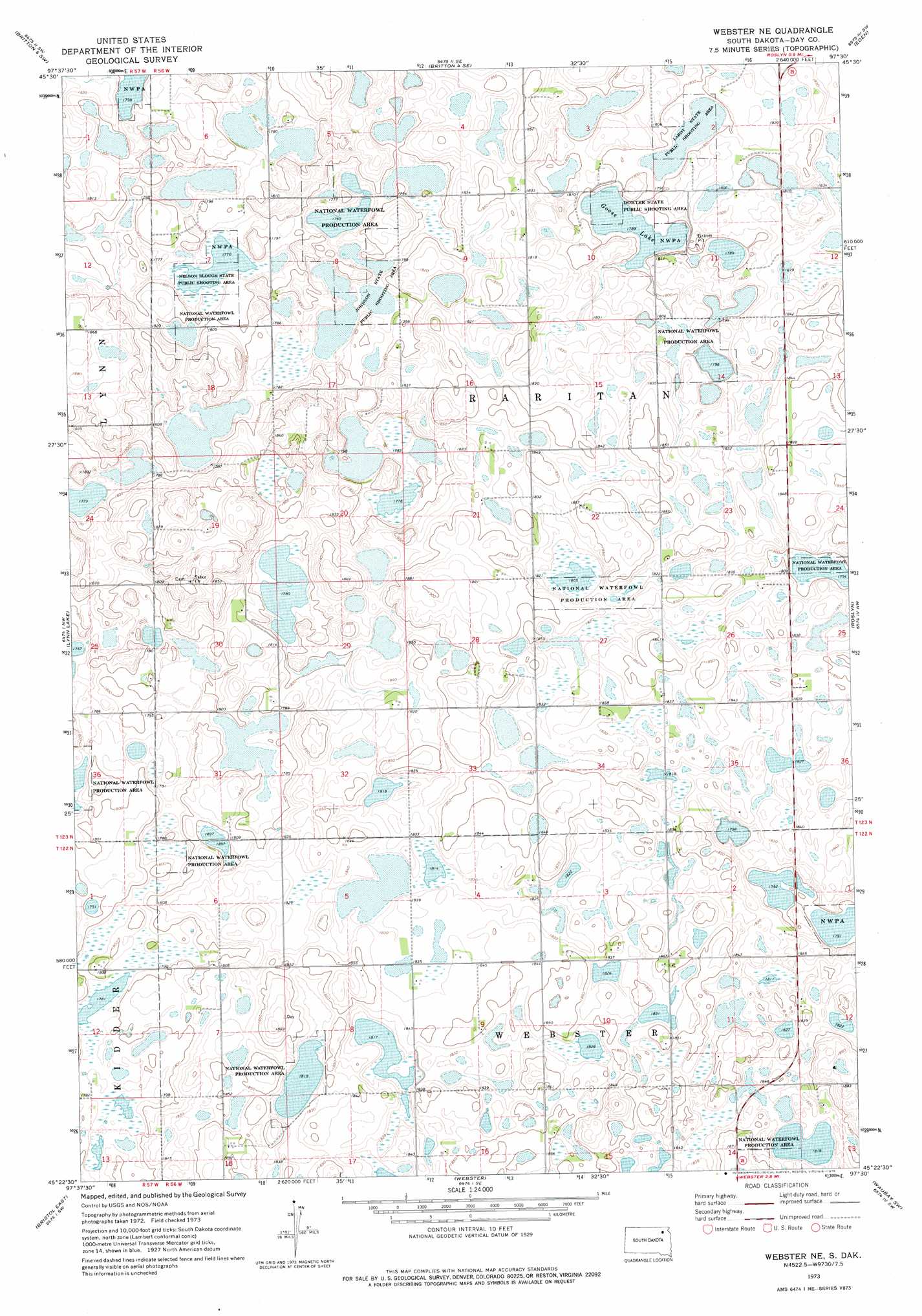
Webster Ne Topo Map South Dakota
To zoom in, hover over the map of Webster Ne
USGS Topo Quad 45097d5 - 1:24,000 scale
| Topo Map Name: | Webster Ne |
| USGS Topo Quad ID: | 45097d5 |
| Print Size: | ca. 21 1/4" wide x 27" high |
| Southeast Coordinates: | 45.375° N latitude / 97.5° W longitude |
| Map Center Coordinates: | 45.4375° N latitude / 97.5625° W longitude |
| U.S. State: | SD |
| Filename: | o45097d5.jpg |
| Download Map JPG Image: | Webster Ne topo map 1:24,000 scale |
| Map Type: | Topographic |
| Topo Series: | 7.5´ |
| Map Scale: | 1:24,000 |
| Source of Map Images: | United States Geological Survey (USGS) |
| Alternate Map Versions: |
Webster NE SD 1973, updated 1976 Download PDF Buy paper map Webster NE SD 2012 Download PDF Buy paper map Webster NE SD 2015 Download PDF Buy paper map |
1:24,000 Topo Quads surrounding Webster Ne
Spain |
Britton 4 Nw |
Britton 4 Ne |
Lake City |
South Red Iron Lake |
Langford |
Britton 4 Sw |
Britton 4 Se |
Eden |
Piyas Lake |
Pierpont |
Lynn Lake |
Webster Ne |
Roslyn |
Enemy Swim Lake West |
Bristol West |
Bristol East |
Webster |
Waubay Sw |
Waubay |
Lone Tree Lake |
Lily |
Swan Lake |
Florence Nw |
Florence Ne |
> Back to 45097a1 at 1:100,000 scale
> Back to 45096a1 at 1:250,000 scale
> Back to U.S. Topo Maps home
Webster Ne topo map: Gazetteer
Webster Ne: Lakes
Goose Lake elevation 546m 1791′Webster Ne: Parks
Dokter State Public Shooting Area elevation 546m 1791′Johnson State Public Shooting Area elevation 542m 1778′
Lardy State Public Shooting Area elevation 545m 1788′
Nelson Slough State Public Shooting Area elevation 540m 1771′
Webster Ne digital topo map on disk
Buy this Webster Ne topo map showing relief, roads, GPS coordinates and other geographical features, as a high-resolution digital map file on DVD:
Eastern North Dakota & Eastern South Dakota
Buy digital topo maps: Eastern North Dakota & Eastern South Dakota