Whitestone Lake Topo Map South Dakota
To zoom in, hover over the map of Whitestone Lake
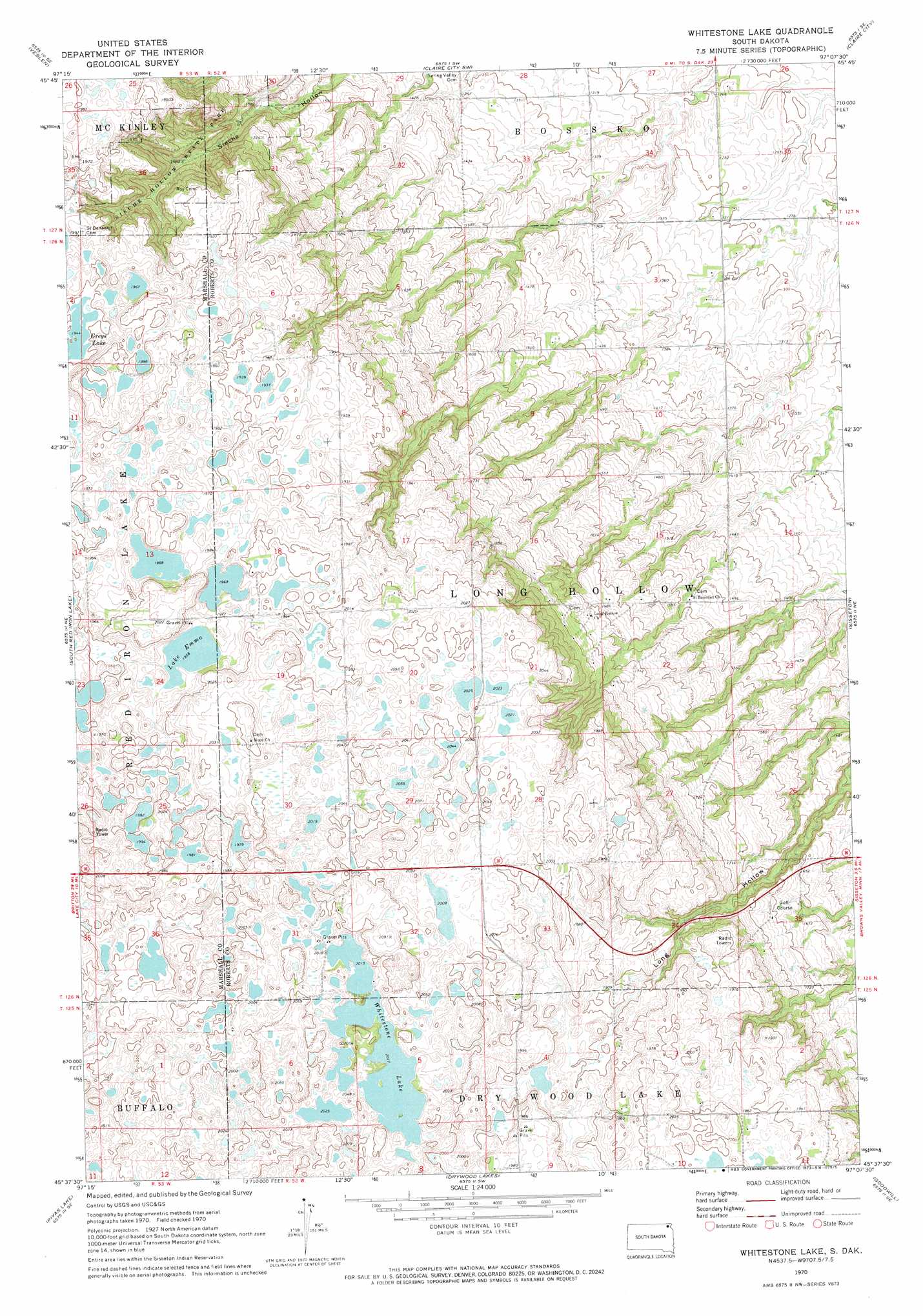
USGS Topo Quad 45097f2 - 1:24,000 scale
| Topo Map Name: | Whitestone Lake |
| USGS Topo Quad ID: | 45097f2 |
| Print Size: | ca. 21 1/4" wide x 27" high |
| Southeast Coordinates: | 45.625° N latitude / 97.125° W longitude |
| Map Center Coordinates: | 45.6875° N latitude / 97.1875° W longitude |
| U.S. State: | SD |
| Filename: | o45097f2.jpg |
| Download Map JPG Image: | Whitestone Lake topo map 1:24,000 scale |
| Map Type: | Topographic |
| Topo Series: | 7.5´ |
| Map Scale: | 1:24,000 |
| Source of Map Images: | United States Geological Survey (USGS) |
| Alternate Map Versions: |
Whitestone Lake SD 1970, updated 1973 Download PDF Buy paper map Whitestone Lake SD 2012 Download PDF Buy paper map Whitestone Lake SD 2015 Download PDF Buy paper map |
1:24,000 Topo Quads surrounding Whitestone Lake
Marlow |
Veblen Ne |
Claire City Nw |
Claire City Ne |
New Effington Nw |
Hillhead |
Veblen |
Claire City Sw |
Claire City |
New Effington |
Lake City |
South Red Iron Lake |
Whitestone Lake |
Sisseton |
Peever Nw |
Eden |
Piyas Lake |
Drywood Lakes |
Goodwill |
Peever |
Roslyn |
Enemy Swim Lake West |
Enemy Swim Lake East |
Summit Ne |
Wilmot Nw |
> Back to 45097e1 at 1:100,000 scale
> Back to 45096a1 at 1:250,000 scale
> Back to U.S. Topo Maps home
Whitestone Lake topo map: Gazetteer
Whitestone Lake: Lakes
Lake Emma elevation 597m 1958′Whitestone Lake elevation 615m 2017′
Whitestone Lake: Parks
Sieche Hollow State Park elevation 543m 1781′Whitestone Lake: Populated Places
Long Hollow Housing elevation 477m 1564′Whitestone Lake digital topo map on disk
Buy this Whitestone Lake topo map showing relief, roads, GPS coordinates and other geographical features, as a high-resolution digital map file on DVD:
Eastern North Dakota & Eastern South Dakota
Buy digital topo maps: Eastern North Dakota & Eastern South Dakota