Faulkton West Topo Map South Dakota
To zoom in, hover over the map of Faulkton West
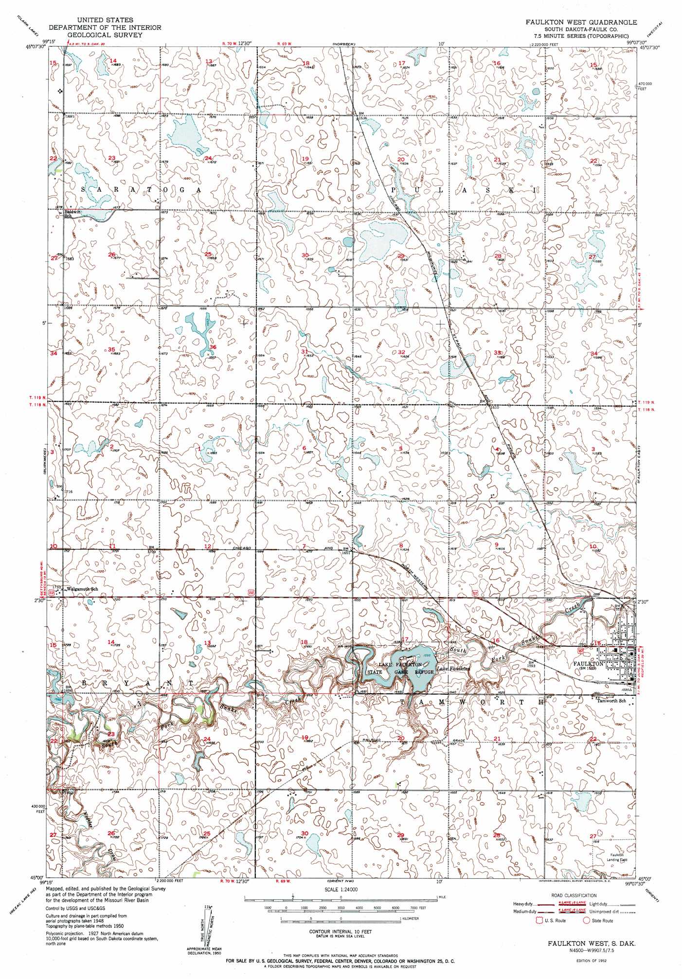
USGS Topo Quad 45099a2 - 1:24,000 scale
| Topo Map Name: | Faulkton West |
| USGS Topo Quad ID: | 45099a2 |
| Print Size: | ca. 21 1/4" wide x 27" high |
| Southeast Coordinates: | 45° N latitude / 99.125° W longitude |
| Map Center Coordinates: | 45.0625° N latitude / 99.1875° W longitude |
| U.S. State: | SD |
| Filename: | o45099a2.jpg |
| Download Map JPG Image: | Faulkton West topo map 1:24,000 scale |
| Map Type: | Topographic |
| Topo Series: | 7.5´ |
| Map Scale: | 1:24,000 |
| Source of Map Images: | United States Geological Survey (USGS) |
| Alternate Map Versions: |
Faulkton West SD 1952 Download PDF Buy paper map Faulkton West SD 2012 Download PDF Buy paper map Faulkton West SD 2015 Download PDF Buy paper map |
1:24,000 Topo Quads surrounding Faulkton West
Roscoe Sw |
Loyalton |
Stafford Dam |
Ipswich Se |
Mina Sw |
Onaka |
Clark Lake |
Norbeck |
Wecota |
Cresbard |
Onaka Sw |
Burkmere |
Faulkton West |
Faulkton East |
Cresbard Sw |
Rezac Lake Nw |
Rezac Lake Ne |
Orient Nw |
Orient |
Miranda |
Rice Lake |
Rezac Lake |
Orient Sw |
Polo |
Rockham Sw |
> Back to 45099a1 at 1:100,000 scale
> Back to 45098a1 at 1:250,000 scale
> Back to U.S. Topo Maps home
Faulkton West topo map: Gazetteer
Faulkton West: Dams
Faulkton Dam elevation 487m 1597′Faulkton West: Parks
Lake Fualkton State Game Refuge elevation 487m 1597′Faulkton West: Reservoirs
Lake Faulkton elevation 487m 1597′Faulkton West: Valleys
Vogeler Draw elevation 510m 1673′Faulkton West digital topo map on disk
Buy this Faulkton West topo map showing relief, roads, GPS coordinates and other geographical features, as a high-resolution digital map file on DVD:
Eastern North Dakota & Eastern South Dakota
Buy digital topo maps: Eastern North Dakota & Eastern South Dakota