Hosmer Ne Topo Map South Dakota
To zoom in, hover over the map of Hosmer Ne
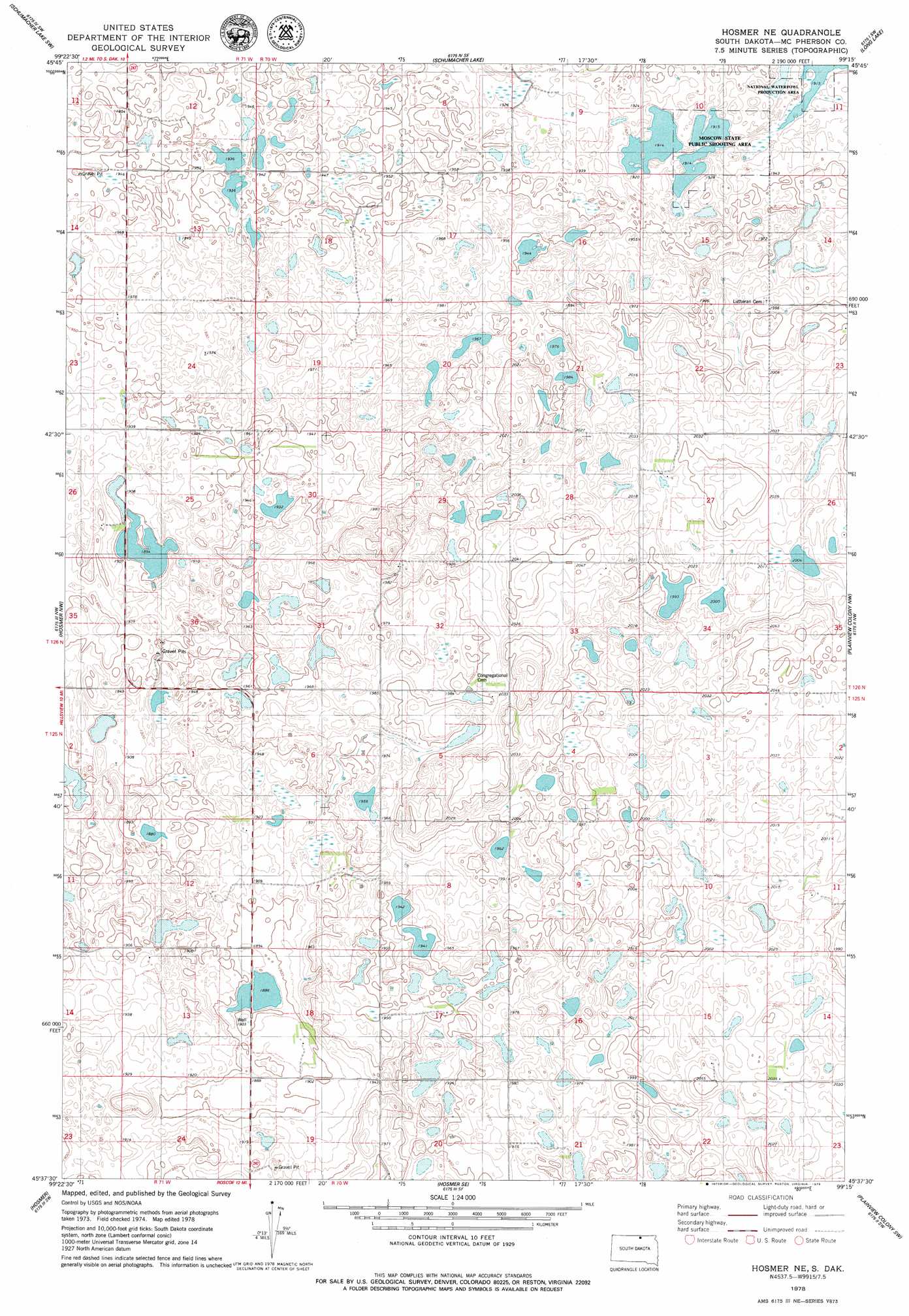
USGS Topo Quad 45099f3 - 1:24,000 scale
| Topo Map Name: | Hosmer Ne |
| USGS Topo Quad ID: | 45099f3 |
| Print Size: | ca. 21 1/4" wide x 27" high |
| Southeast Coordinates: | 45.625° N latitude / 99.25° W longitude |
| Map Center Coordinates: | 45.6875° N latitude / 99.3125° W longitude |
| U.S. State: | SD |
| Filename: | o45099f3.jpg |
| Download Map JPG Image: | Hosmer Ne topo map 1:24,000 scale |
| Map Type: | Topographic |
| Topo Series: | 7.5´ |
| Map Scale: | 1:24,000 |
| Source of Map Images: | United States Geological Survey (USGS) |
| Alternate Map Versions: |
Hosmer NE SD 1978, updated 1979 Download PDF Buy paper map Hosmer NE SD 2012 Download PDF Buy paper map Hosmer NE SD 2015 Download PDF Buy paper map |
1:24,000 Topo Quads surrounding Hosmer Ne
Ventura |
Wolff Lake |
Schumacher Lake Ne |
Long Lake Nw |
Long Lake Ne |
Eureka East |
Schumacher Lake Sw |
Schumacher Lake |
Long Lake |
Long Lake Se |
Hillsview |
Hosmer Nw |
Hosmer Ne |
Plainview Colony Nw |
Plainview Colony Ne |
Hillsview Se |
Hosmer |
Hosmer Se |
Plainview Colony Sw |
Plainview Colony |
Gretna |
Roscoe Nw |
Roscoe |
Beebe |
Ipswich |
> Back to 45099e1 at 1:100,000 scale
> Back to 45098a1 at 1:250,000 scale
> Back to U.S. Topo Maps home
Hosmer Ne topo map: Gazetteer
Hosmer Ne: Parks
Moscow State Public Shooting Area elevation 586m 1922′Hosmer Ne: Post Offices
Martel Post Office (historical) elevation 600m 1968′Hosmer Ne digital topo map on disk
Buy this Hosmer Ne topo map showing relief, roads, GPS coordinates and other geographical features, as a high-resolution digital map file on DVD:
Eastern North Dakota & Eastern South Dakota
Buy digital topo maps: Eastern North Dakota & Eastern South Dakota