La Plant Sw Topo Map South Dakota
To zoom in, hover over the map of La Plant Sw
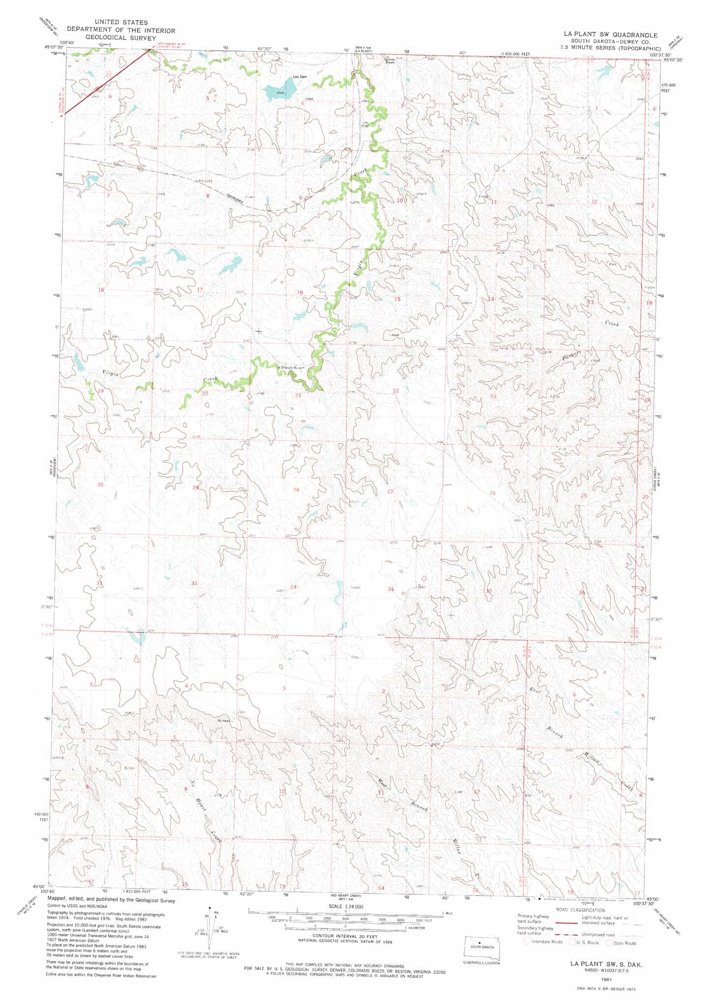
USGS Topo Quad 45100a6 - 1:24,000 scale
| Topo Map Name: | La Plant Sw |
| USGS Topo Quad ID: | 45100a6 |
| Print Size: | ca. 21 1/4" wide x 27" high |
| Southeast Coordinates: | 45° N latitude / 100.625° W longitude |
| Map Center Coordinates: | 45.0625° N latitude / 100.6875° W longitude |
| U.S. State: | SD |
| Filename: | o45100a6.jpg |
| Download Map JPG Image: | La Plant Sw topo map 1:24,000 scale |
| Map Type: | Topographic |
| Topo Series: | 7.5´ |
| Map Scale: | 1:24,000 |
| Source of Map Images: | United States Geological Survey (USGS) |
| Alternate Map Versions: |
La Plant SW SD 1981, updated 1981 Download PDF Buy paper map La Plant SW SD 2012 Download PDF Buy paper map La Plant SW SD 2015 Download PDF Buy paper map |
1:24,000 Topo Quads surrounding La Plant Sw
White Horse |
Glencross Se |
Trail City Sw |
Promise |
Moreau |
Ridgeview Nw |
Ridgeview Ne |
La Plant |
Virginia |
Patch Skin Buttes |
Ridgeview Sw |
Ridgeview |
La Plant Sw |
Stove Creek |
Patch Skin Buttes Sw |
Rousseau Creek Nw |
Charlie Creek |
No Heart Creek |
No Heart Creek Ne |
Artichoke Butte Nw |
Rousseau Creek Sw |
Rousseau Creek |
No Heart Creek Sw |
No Heart Creek Se |
Artichoke Butte Sw |
> Back to 45100a1 at 1:100,000 scale
> Back to 45100a1 at 1:250,000 scale
> Back to U.S. Topo Maps home
La Plant Sw topo map: Gazetteer
La Plant Sw: Dams
C Peterson Number 1 Dam elevation 679m 2227′D Booth Number 3 Dam elevation 653m 2142′
Lee Dam elevation 622m 2040′
La Plant Sw digital topo map on disk
Buy this La Plant Sw topo map showing relief, roads, GPS coordinates and other geographical features, as a high-resolution digital map file on DVD:
Eastern North Dakota & Eastern South Dakota
Buy digital topo maps: Eastern North Dakota & Eastern South Dakota