Ridgeview Topo Map South Dakota
To zoom in, hover over the map of Ridgeview
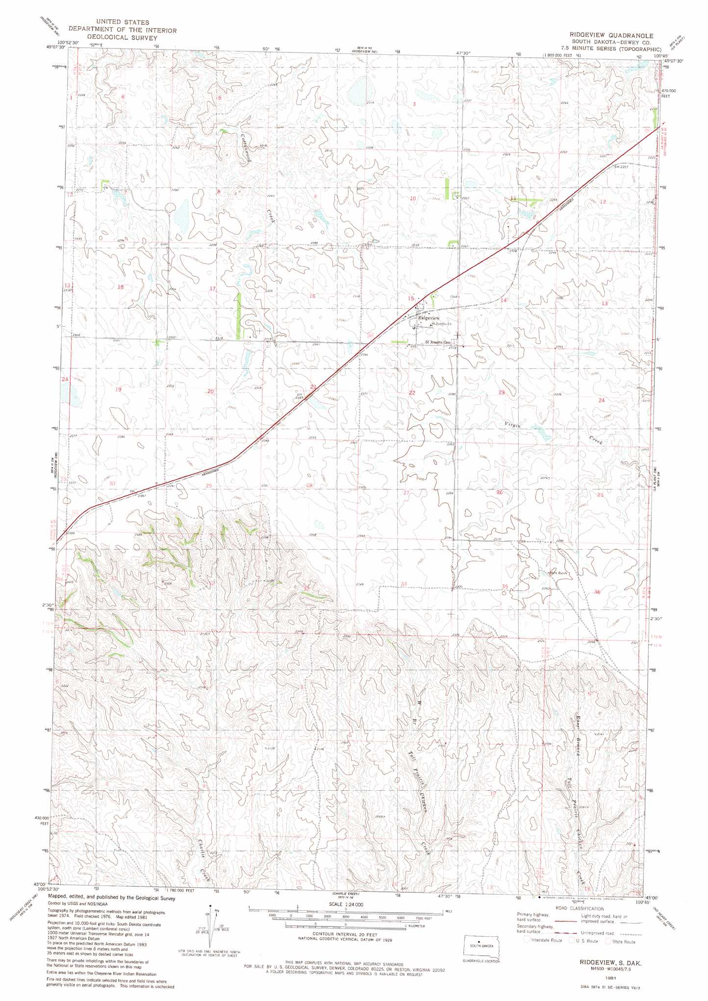
USGS Topo Quad 45100a7 - 1:24,000 scale
| Topo Map Name: | Ridgeview |
| USGS Topo Quad ID: | 45100a7 |
| Print Size: | ca. 21 1/4" wide x 27" high |
| Southeast Coordinates: | 45° N latitude / 100.75° W longitude |
| Map Center Coordinates: | 45.0625° N latitude / 100.8125° W longitude |
| U.S. State: | SD |
| Filename: | o45100a7.jpg |
| Download Map JPG Image: | Ridgeview topo map 1:24,000 scale |
| Map Type: | Topographic |
| Topo Series: | 7.5´ |
| Map Scale: | 1:24,000 |
| Source of Map Images: | United States Geological Survey (USGS) |
| Alternate Map Versions: |
Ridgeview SD 1981, updated 1981 Download PDF Buy paper map Ridgeview SD 2012 Download PDF Buy paper map Ridgeview SD 2015 Download PDF Buy paper map |
1:24,000 Topo Quads surrounding Ridgeview
Little Moreau Lake |
White Horse |
Glencross Se |
Trail City Sw |
Promise |
Parade Ne |
Ridgeview Nw |
Ridgeview Ne |
La Plant |
Virginia |
Parade |
Ridgeview Sw |
Ridgeview |
La Plant Sw |
Stove Creek |
Herbert Creek Ne |
Rousseau Creek Nw |
Charlie Creek |
No Heart Creek |
No Heart Creek Ne |
Herbert Creek Se |
Rousseau Creek Sw |
Rousseau Creek |
No Heart Creek Sw |
No Heart Creek Se |
> Back to 45100a1 at 1:100,000 scale
> Back to 45100a1 at 1:250,000 scale
> Back to U.S. Topo Maps home
Ridgeview topo map: Gazetteer
Ridgeview: Dams
C J Larson Number 1 Dam elevation 697m 2286′C Peterson Number 2 Dam elevation 683m 2240′
C Peterson Number 3 Dam elevation 683m 2240′
C Peterson Number 4 Dam elevation 685m 2247′
H Lesmeister Dam elevation 702m 2303′
Joe Gesinger Number 1 Dam elevation 708m 2322′
John Gesinger Number 1 Dam elevation 689m 2260′
R Bartels Number 1 Dam elevation 672m 2204′
Ridgeview: Populated Places
Ridgeview elevation 720m 2362′Ridgeview digital topo map on disk
Buy this Ridgeview topo map showing relief, roads, GPS coordinates and other geographical features, as a high-resolution digital map file on DVD:
Eastern North Dakota & Eastern South Dakota
Buy digital topo maps: Eastern North Dakota & Eastern South Dakota