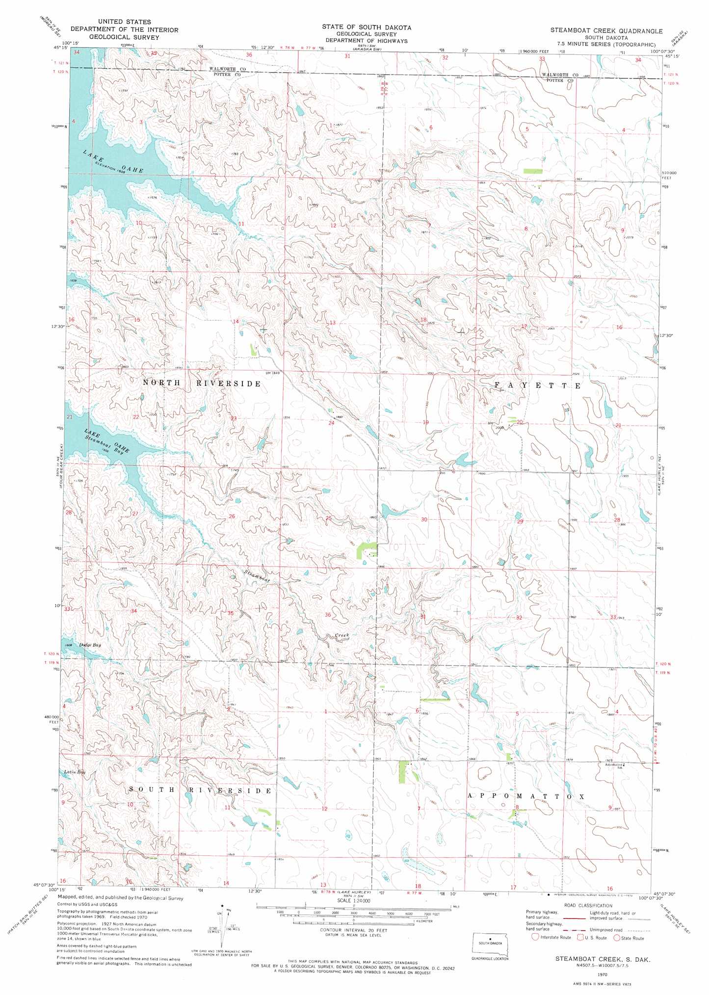
Steamboat Creek Topo Map South Dakota
To zoom in, hover over the map of Steamboat Creek
USGS Topo Quad 45100b2 - 1:24,000 scale
| Topo Map Name: | Steamboat Creek |
| USGS Topo Quad ID: | 45100b2 |
| Print Size: | ca. 21 1/4" wide x 27" high |
| Southeast Coordinates: | 45.125° N latitude / 100.125° W longitude |
| Map Center Coordinates: | 45.1875° N latitude / 100.1875° W longitude |
| U.S. State: | SD |
| Filename: | o45100b2.jpg |
| Download Map JPG Image: | Steamboat Creek topo map 1:24,000 scale |
| Map Type: | Topographic |
| Topo Series: | 7.5´ |
| Map Scale: | 1:24,000 |
| Source of Map Images: | United States Geological Survey (USGS) |
| Alternate Map Versions: |
Steamboat Creek SD 1970, updated 1972 Download PDF Buy paper map Steamboat Creek SD 2012 Download PDF Buy paper map Steamboat Creek SD 2015 Download PDF Buy paper map |
1:24,000 Topo Quads surrounding Steamboat Creek
Moreau Nw |
Moreau Ne |
Akaska Nw |
Akaska Ne |
Lowry Nw |
Moreau |
Moreau Se |
Akaska Sw |
Akaska |
Lowry |
Patch Skin Buttes |
Four Bear Creek |
Steamboat Creek |
Lake Hurley Ne |
Flight Lake |
Patch Skin Buttes Sw |
Patch Skin Buttes Se |
Lake Hurley |
Lake Hurley Se |
Gettysburg |
Artichoke Butte Nw |
Artichoke Butte Ne |
Agar Nw |
Agar Ne |
Gettysburg Muni Airport |
> Back to 45100a1 at 1:100,000 scale
> Back to 45100a1 at 1:250,000 scale
> Back to U.S. Topo Maps home
Steamboat Creek topo map: Gazetteer
Steamboat Creek: Bays
Steamboat Bay elevation 490m 1607′Steamboat Creek: Dams
A Holzwarth Dam elevation 532m 1745′F Genzler Dam elevation 502m 1646′
J Mangin Dam elevation 567m 1860′
R Heath Dam elevation 563m 1847′
R Lemler Dam elevation 585m 1919′
R Lemler Dam elevation 603m 1978′
Steamboat Creek: Post Offices
Eales Post Office (historical) elevation 569m 1866′Steamboat Creek: Streams
Steamboat Creek elevation 497m 1630′Steamboat Creek digital topo map on disk
Buy this Steamboat Creek topo map showing relief, roads, GPS coordinates and other geographical features, as a high-resolution digital map file on DVD:
Eastern North Dakota & Eastern South Dakota
Buy digital topo maps: Eastern North Dakota & Eastern South Dakota