Moreau Topo Map South Dakota
To zoom in, hover over the map of Moreau
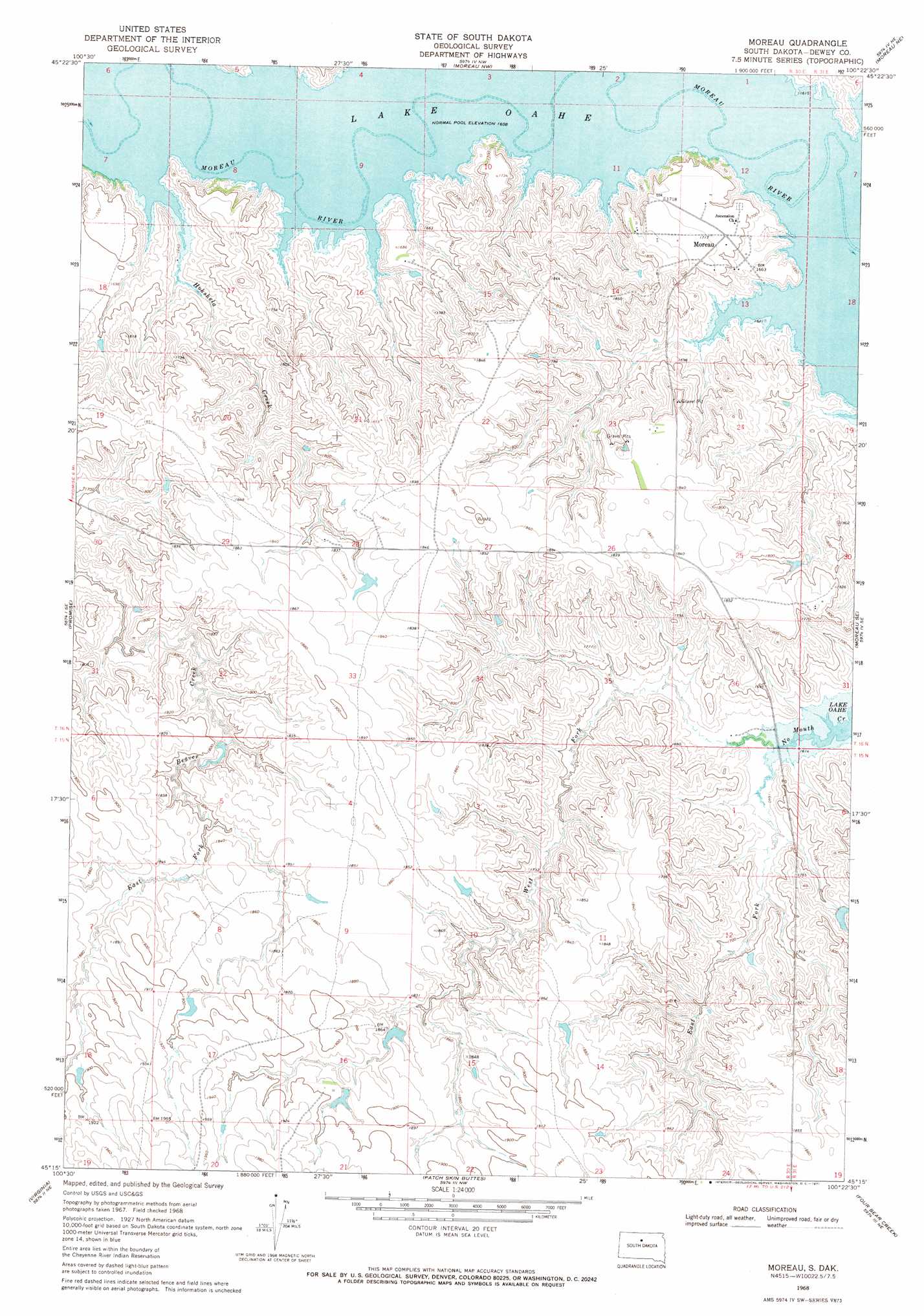
USGS Topo Quad 45100c4 - 1:24,000 scale
| Topo Map Name: | Moreau |
| USGS Topo Quad ID: | 45100c4 |
| Print Size: | ca. 21 1/4" wide x 27" high |
| Southeast Coordinates: | 45.25° N latitude / 100.375° W longitude |
| Map Center Coordinates: | 45.3125° N latitude / 100.4375° W longitude |
| U.S. State: | SD |
| Filename: | o45100c4.jpg |
| Download Map JPG Image: | Moreau topo map 1:24,000 scale |
| Map Type: | Topographic |
| Topo Series: | 7.5´ |
| Map Scale: | 1:24,000 |
| Source of Map Images: | United States Geological Survey (USGS) |
| Alternate Map Versions: |
Moreau SD 1968, updated 1971 Download PDF Buy paper map Moreau SD 2012 Download PDF Buy paper map Moreau SD 2015 Download PDF Buy paper map |
1:24,000 Topo Quads surrounding Moreau
Wakpala Sw |
Wakpala Se |
Mobridge |
Glenham |
Selby Sw |
Trail City |
Laundreaux Butte |
Moreau Nw |
Moreau Ne |
Akaska Nw |
Trail City Sw |
Promise |
Moreau |
Moreau Se |
Akaska Sw |
La Plant |
Virginia |
Patch Skin Buttes |
Four Bear Creek |
Steamboat Creek |
La Plant Sw |
Stove Creek |
Patch Skin Buttes Sw |
Patch Skin Buttes Se |
Lake Hurley |
> Back to 45100a1 at 1:100,000 scale
> Back to 45100a1 at 1:250,000 scale
> Back to U.S. Topo Maps home
Moreau topo map: Gazetteer
Moreau: Populated Places
Moreau elevation 523m 1715′Moreau: Streams
East Fork No Mouth Creek elevation 493m 1617′Hokshela Creek elevation 490m 1607′
Le Beau Creek elevation 490m 1607′
Moreau River elevation 490m 1607′
West Fork No Mouth Creek elevation 493m 1617′
Moreau digital topo map on disk
Buy this Moreau topo map showing relief, roads, GPS coordinates and other geographical features, as a high-resolution digital map file on DVD:
Eastern North Dakota & Eastern South Dakota
Buy digital topo maps: Eastern North Dakota & Eastern South Dakota