Little Eagle Sw Topo Map South Dakota
To zoom in, hover over the map of Little Eagle Sw
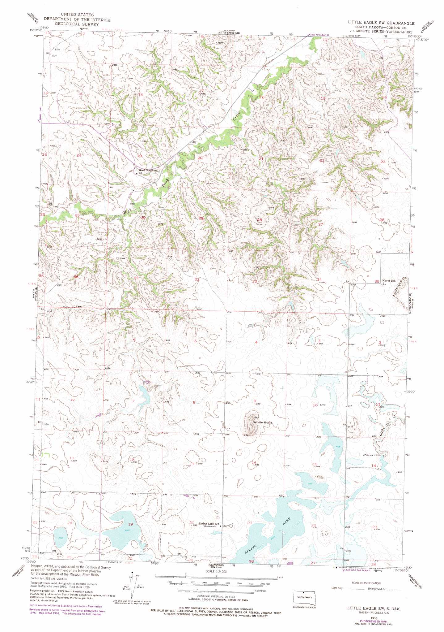
USGS Topo Quad 45100e8 - 1:24,000 scale
| Topo Map Name: | Little Eagle Sw |
| USGS Topo Quad ID: | 45100e8 |
| Print Size: | ca. 21 1/4" wide x 27" high |
| Southeast Coordinates: | 45.5° N latitude / 100.875° W longitude |
| Map Center Coordinates: | 45.5625° N latitude / 100.9375° W longitude |
| U.S. State: | SD |
| Filename: | o45100e8.jpg |
| Download Map JPG Image: | Little Eagle Sw topo map 1:24,000 scale |
| Map Type: | Topographic |
| Topo Series: | 7.5´ |
| Map Scale: | 1:24,000 |
| Source of Map Images: | United States Geological Survey (USGS) |
| Alternate Map Versions: |
Little Eagle SW SD 1956, updated 1957 Download PDF Buy paper map Little Eagle SW SD 1956, updated 1978 Download PDF Buy paper map Little Eagle SW SD 2012 Download PDF Buy paper map Little Eagle SW SD 2015 Download PDF Buy paper map |
1:24,000 Topo Quads surrounding Little Eagle Sw
Bullhead Sw |
Bullhead |
Mclaughlin Sw |
Mclaughlin |
Mahto |
Miscol |
Miscol Ne |
Little Eagle Nw |
Little Eagle |
Wakpala Nw |
Miscol Sw |
Miscol Se |
Little Eagle Sw |
Little Eagle Se |
Wakpala Sw |
Brewer Butte |
Timber Lake |
Glencross |
Glencross Ne |
Trail City |
Livermant Lake |
Little Moreau Lake |
White Horse |
Glencross Se |
Trail City Sw |
> Back to 45100e1 at 1:100,000 scale
> Back to 45100a1 at 1:250,000 scale
> Back to U.S. Topo Maps home
Little Eagle Sw topo map: Gazetteer
Little Eagle Sw: Dams
Gerald Martian Dam elevation 640m 2099′Standing Rock Tribe Dam elevation 639m 2096′
Little Eagle Sw: Lakes
Dogeagle Lake elevation 655m 2148′Spring Lake elevation 644m 2112′
Little Eagle Sw: Summits
Saddle Butte elevation 713m 2339′Little Eagle Sw digital topo map on disk
Buy this Little Eagle Sw topo map showing relief, roads, GPS coordinates and other geographical features, as a high-resolution digital map file on DVD:
Eastern North Dakota & Eastern South Dakota
Buy digital topo maps: Eastern North Dakota & Eastern South Dakota