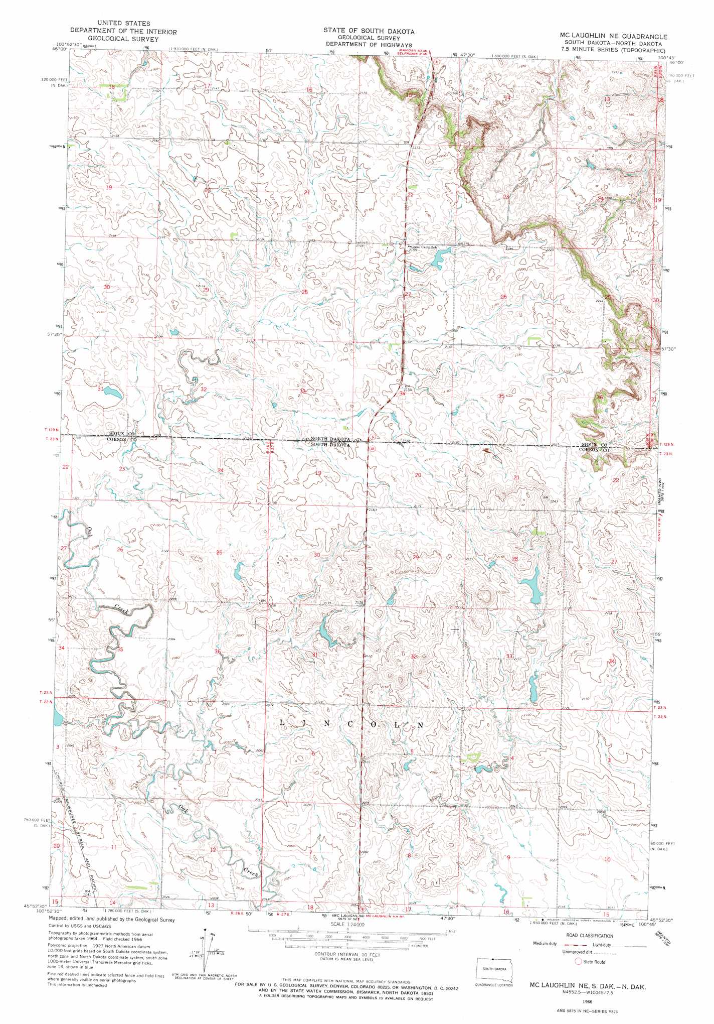
Mclaughlin Ne Topo Map South Dakota
To zoom in, hover over the map of Mclaughlin Ne
USGS Topo Quad 45100h7 - 1:24,000 scale
| Topo Map Name: | Mclaughlin Ne |
| USGS Topo Quad ID: | 45100h7 |
| Print Size: | ca. 21 1/4" wide x 27" high |
| Southeast Coordinates: | 45.875° N latitude / 100.75° W longitude |
| Map Center Coordinates: | 45.9375° N latitude / 100.8125° W longitude |
| U.S. States: | SD, ND |
| Filename: | o45100h7.jpg |
| Download Map JPG Image: | Mclaughlin Ne topo map 1:24,000 scale |
| Map Type: | Topographic |
| Topo Series: | 7.5´ |
| Map Scale: | 1:24,000 |
| Source of Map Images: | United States Geological Survey (USGS) |
| Alternate Map Versions: |
McLaughlin NE SD 1966, updated 1967 Download PDF Buy paper map McLaughlin NE SD 2011 Download PDF Buy paper map McLaughlin NE SD 2012 Download PDF Buy paper map McLaughlin NE SD 2015 Download PDF Buy paper map |
1:24,000 Topo Quads surrounding Mclaughlin Ne
Porcupine |
Froelich Dam |
Barren Butte |
Fort Yates Nw |
Fort Yates Ne |
Pamplin Hills |
Selfridge |
Selfridge Se |
Fort Yates |
Fort Yates Se |
Walker |
Maple Leaf |
Mclaughlin Ne |
Mahto Nw |
Mahto Ne |
Bullhead |
Mclaughlin Sw |
Mclaughlin |
Mahto |
Kline Buttes |
Miscol Ne |
Little Eagle Nw |
Little Eagle |
Wakpala Nw |
Wakpala |
> Back to 45100e1 at 1:100,000 scale
> Back to 45100a1 at 1:250,000 scale
> Back to U.S. Topo Maps home
Mclaughlin Ne topo map: Gazetteer
Mclaughlin Ne: Dams
Gustave Aman Dam elevation 630m 2066′T W Lyman Dam elevation 644m 2112′
Mclaughlin Ne digital topo map on disk
Buy this Mclaughlin Ne topo map showing relief, roads, GPS coordinates and other geographical features, as a high-resolution digital map file on DVD:
Eastern North Dakota & Eastern South Dakota
Buy digital topo maps: Eastern North Dakota & Eastern South Dakota