Irish Creek Ne Topo Map South Dakota
To zoom in, hover over the map of Irish Creek Ne
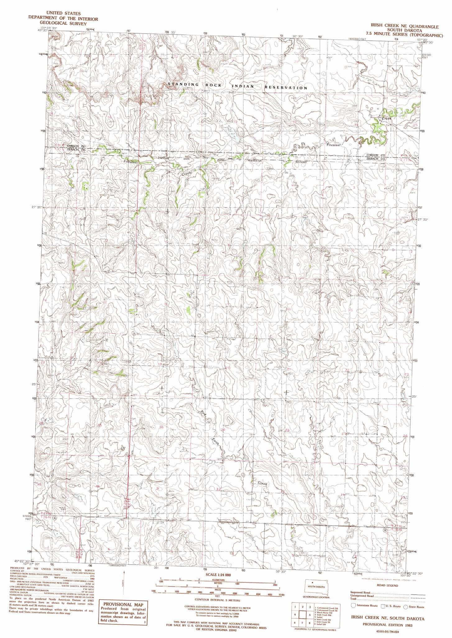
USGS Topo Quad 45101d5 - 1:24,000 scale
| Topo Map Name: | Irish Creek Ne |
| USGS Topo Quad ID: | 45101d5 |
| Print Size: | ca. 21 1/4" wide x 27" high |
| Southeast Coordinates: | 45.375° N latitude / 101.5° W longitude |
| Map Center Coordinates: | 45.4375° N latitude / 101.5625° W longitude |
| U.S. State: | SD |
| Filename: | o45101d5.jpg |
| Download Map JPG Image: | Irish Creek Ne topo map 1:24,000 scale |
| Map Type: | Topographic |
| Topo Series: | 7.5´ |
| Map Scale: | 1:24,000 |
| Source of Map Images: | United States Geological Survey (USGS) |
| Alternate Map Versions: |
Irish Creek NE SD 1983, updated 1983 Download PDF Buy paper map Irish Creek NE SD 1983, updated 1983 Download PDF Buy paper map Irish Creek NE SD 2012 Download PDF Buy paper map Irish Creek NE SD 2015 Download PDF Buy paper map |
1:24,000 Topo Quads surrounding Irish Creek Ne
Black Horse Butte Ne |
Cottonwood Creek Nw |
Cottonwood Creek Ne |
Black Horse |
Black Horse Ne |
Twin Butte |
Cottonwood Creek Sw |
Cottonwood Creek Se |
Black Horse Sw |
Black Horse Se |
Glad Valley |
Irish Creek Nw |
Irish Creek Ne |
Isabel |
Firesteel |
Glad Valley Se |
Irish Creek Sw |
Irish Creek Se |
Isabel Sw |
Peach Lake |
Redelm Ne |
Thunder Butte |
Dupree Ne |
Lantry Nw |
Lantry Ne |
> Back to 45101a1 at 1:100,000 scale
> Back to 45100a1 at 1:250,000 scale
> Back to U.S. Topo Maps home
Irish Creek Ne topo map: Gazetteer
Irish Creek Ne: Dams
A Drageset Number 4 Dam elevation 737m 2417′O Drageset Number 3 Dam elevation 747m 2450′
Irish Creek Ne digital topo map on disk
Buy this Irish Creek Ne topo map showing relief, roads, GPS coordinates and other geographical features, as a high-resolution digital map file on DVD:
Eastern North Dakota & Eastern South Dakota
Buy digital topo maps: Eastern North Dakota & Eastern South Dakota