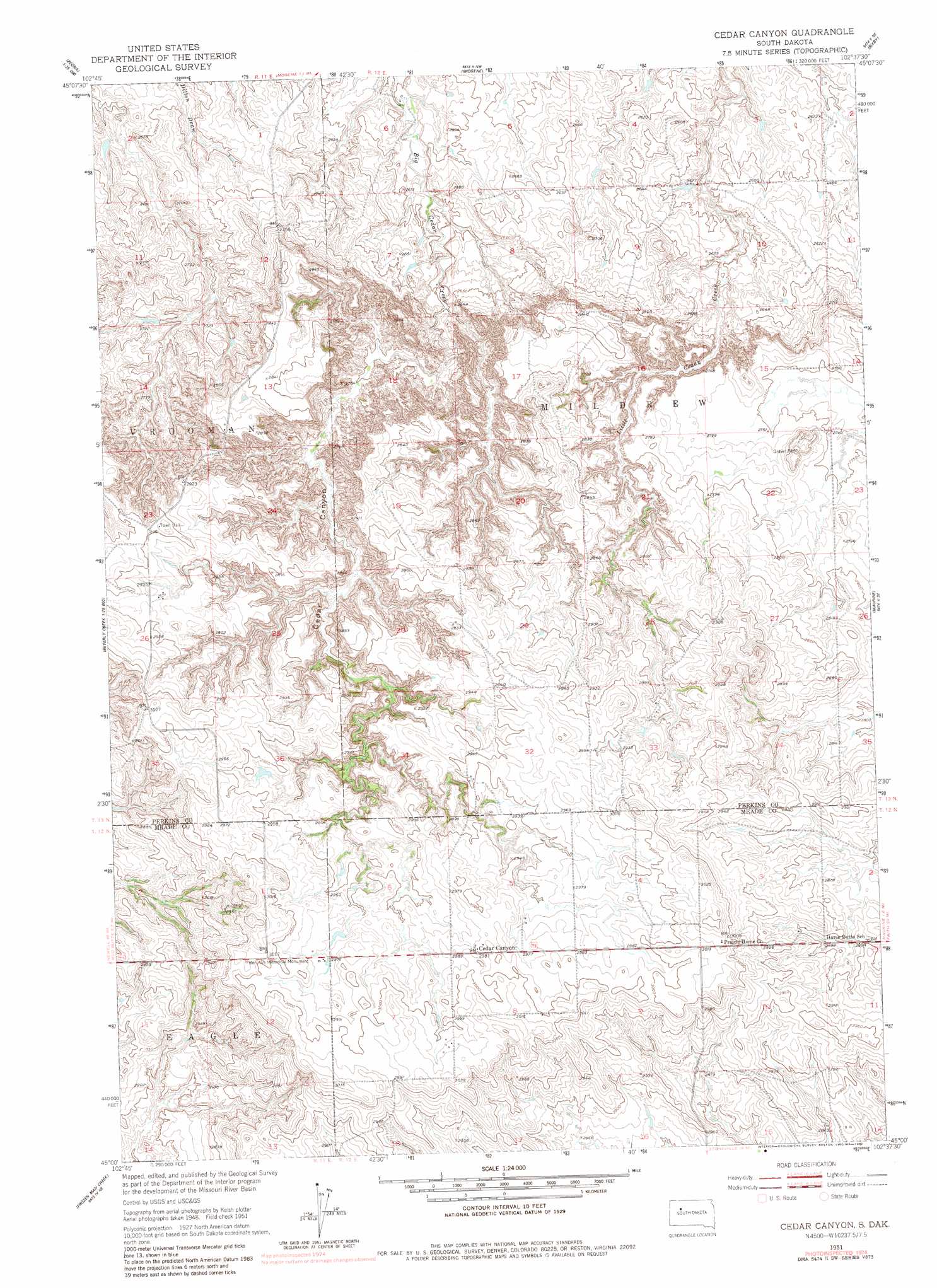
Cedar Canyon Topo Map South Dakota
To zoom in, hover over the map of Cedar Canyon
USGS Topo Quad 45102a6 - 1:24,000 scale
| Topo Map Name: | Cedar Canyon |
| USGS Topo Quad ID: | 45102a6 |
| Print Size: | ca. 21 1/4" wide x 27" high |
| Southeast Coordinates: | 45° N latitude / 102.625° W longitude |
| Map Center Coordinates: | 45.0625° N latitude / 102.6875° W longitude |
| U.S. State: | SD |
| Filename: | o45102a6.jpg |
| Download Map JPG Image: | Cedar Canyon topo map 1:24,000 scale |
| Map Type: | Topographic |
| Topo Series: | 7.5´ |
| Map Scale: | 1:24,000 |
| Source of Map Images: | United States Geological Survey (USGS) |
| Alternate Map Versions: |
Cedar Canyon SD 1951, updated 1953 Download PDF Buy paper map Cedar Canyon SD 1951, updated 1982 Download PDF Buy paper map Cedar Canyon SD 2012 Download PDF Buy paper map Cedar Canyon SD 2015 Download PDF Buy paper map |
1:24,000 Topo Quads surrounding Cedar Canyon
Sorum Sw |
Sorum Se |
Date |
Rabbit Butte |
Two Buttes |
Zeona Ne |
Imogene |
Bixby |
Deep Creek Nw |
|
Beverly Creek |
Cedar Canyon |
Maurine |
Signal Butte |
|
Camp Creek |
Frozen Man Creek |
Squaw Buttes |
Opal West |
Opal East |
Table Top Butte |
Bull Run Creek |
Big Draw |
Opal West Se |
Opal East Sw |
> Back to 45102a1 at 1:100,000 scale
> Back to 45102a1 at 1:250,000 scale
> Back to U.S. Topo Maps home
Cedar Canyon topo map: Gazetteer
Cedar Canyon: Dams
White Ranch Dam elevation 804m 2637′Cedar Canyon: Parks
Ben Ash Historical Monument elevation 920m 3018′Cedar Canyon: Populated Places
Cedar Canyon elevation 911m 2988′Cedar Canyon: Valleys
Cedar Canyon elevation 795m 2608′Cedar Canyon digital topo map on disk
Buy this Cedar Canyon topo map showing relief, roads, GPS coordinates and other geographical features, as a high-resolution digital map file on DVD:
Eastern Montana & Western North Dakota
Buy digital topo maps: Eastern Montana & Western North Dakota