Faith Nw Topo Map South Dakota
To zoom in, hover over the map of Faith Nw
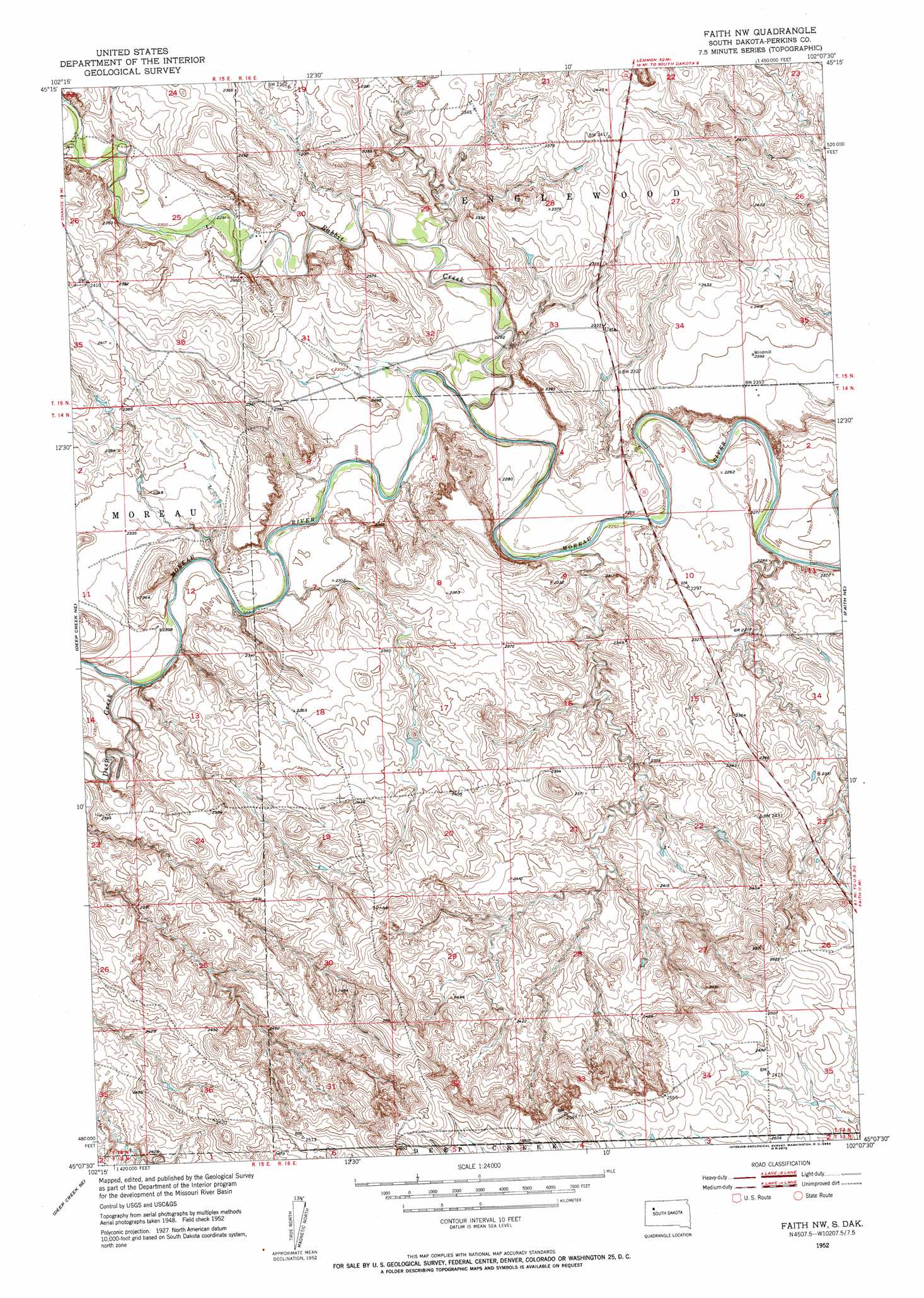
USGS Topo Quad 45102b2 - 1:24,000 scale
| Topo Map Name: | Faith Nw |
| USGS Topo Quad ID: | 45102b2 |
| Print Size: | ca. 21 1/4" wide x 27" high |
| Southeast Coordinates: | 45.125° N latitude / 102.125° W longitude |
| Map Center Coordinates: | 45.1875° N latitude / 102.1875° W longitude |
| U.S. State: | SD |
| Filename: | o45102b2.jpg |
| Download Map JPG Image: | Faith Nw topo map 1:24,000 scale |
| Map Type: | Topographic |
| Topo Series: | 7.5´ |
| Map Scale: | 1:24,000 |
| Source of Map Images: | United States Geological Survey (USGS) |
| Alternate Map Versions: |
Faith NW SD 1952, updated 1954 Download PDF Buy paper map Faith NW SD 2012 Download PDF Buy paper map Faith NW SD 2015 Download PDF Buy paper map |
1:24,000 Topo Quads surrounding Faith Nw
Owen Lake |
Chance |
Coal Springs Nw |
Coal Springs |
Glad Valley Nw |
Two Buttes |
Sunrise Butte |
Coal Springs Sw |
Coal Springs Se |
Glad Valley Sw |
Deep Creek Nw |
Deep Creek Ne |
Faith Nw |
Faith Ne |
Redelm Nw |
Signal Butte |
Deep Creek Se |
Faith Sw |
Faith |
Red Elm Sw |
Opal East |
Lemmon Butte |
Avance |
Durkee Lake |
Bessie Butte |
> Back to 45102a1 at 1:100,000 scale
> Back to 45102a1 at 1:250,000 scale
> Back to U.S. Topo Maps home
Faith Nw topo map: Gazetteer
Faith Nw: Populated Places
Usta elevation 712m 2335′Faith Nw: Streams
Deep Creek elevation 697m 2286′Porcupine Creek elevation 694m 2276′
Rabbit Creek elevation 686m 2250′
Faith Nw digital topo map on disk
Buy this Faith Nw topo map showing relief, roads, GPS coordinates and other geographical features, as a high-resolution digital map file on DVD:
Eastern Montana & Western North Dakota
Buy digital topo maps: Eastern Montana & Western North Dakota