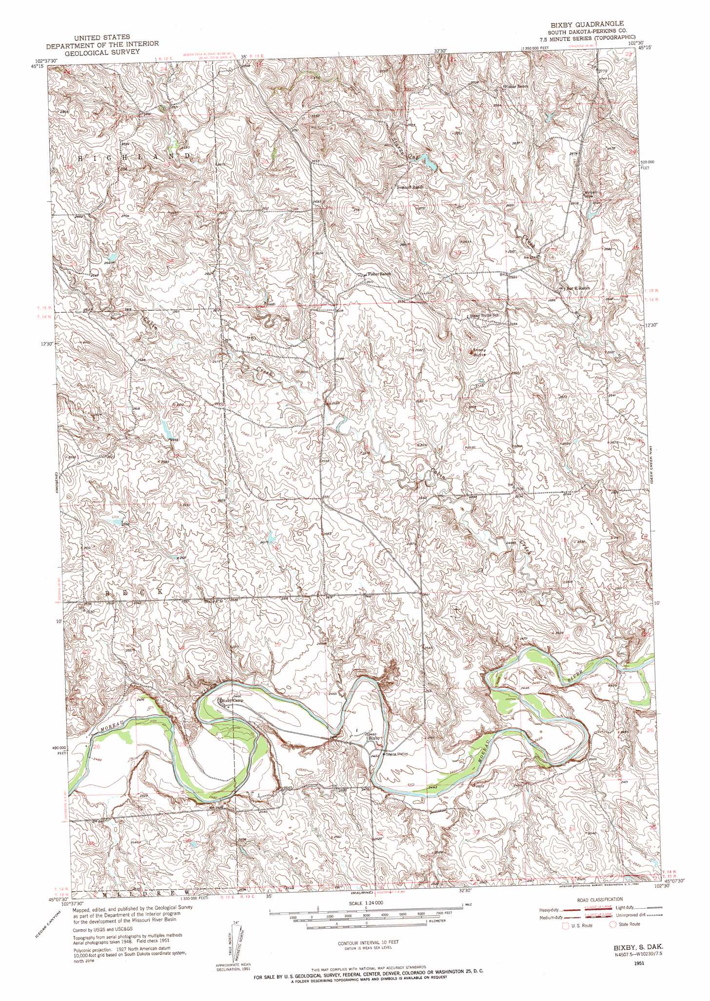
Bixby Topo Map South Dakota
To zoom in, hover over the map of Bixby
USGS Topo Quad 45102b5 - 1:24,000 scale
| Topo Map Name: | Bixby |
| USGS Topo Quad ID: | 45102b5 |
| Print Size: | ca. 21 1/4" wide x 27" high |
| Southeast Coordinates: | 45.125° N latitude / 102.5° W longitude |
| Map Center Coordinates: | 45.1875° N latitude / 102.5625° W longitude |
| U.S. State: | SD |
| Filename: | o45102b5.jpg |
| Download Map JPG Image: | Bixby topo map 1:24,000 scale |
| Map Type: | Topographic |
| Topo Series: | 7.5´ |
| Map Scale: | 1:24,000 |
| Source of Map Images: | United States Geological Survey (USGS) |
| Alternate Map Versions: |
Bixby SD 1951, updated 1955 Download PDF Buy paper map Bixby SD 2012 Download PDF Buy paper map Bixby SD 2015 Download PDF Buy paper map |
1:24,000 Topo Quads surrounding Bixby
Sorum Ne |
Daviston |
Date Ne |
Owen Lake |
Chance |
Sorum Se |
Date |
Rabbit Butte |
Two Buttes |
Sunrise Butte |
Zeona Ne |
Imogene |
Bixby |
Deep Creek Nw |
Deep Creek Ne |
Beverly Creek |
Cedar Canyon |
Maurine |
Signal Butte |
Deep Creek Se |
Frozen Man Creek |
Squaw Buttes |
Opal West |
Opal East |
Lemmon Butte |
> Back to 45102a1 at 1:100,000 scale
> Back to 45102a1 at 1:250,000 scale
> Back to U.S. Topo Maps home
Bixby topo map: Gazetteer
Bixby: Areas
Moreau River Badlands elevation 781m 2562′Bixby: Dams
Mark Fischer Dam elevation 789m 2588′Zeke Allart Dam elevation 802m 2631′
Bixby: Populated Places
Bixby elevation 750m 2460′Bixby: Post Offices
Bixby Post Office elevation 767m 2516′Bixby: Streams
Cabin Creek elevation 734m 2408′Bixby: Summits
Stony Butte elevation 815m 2673′Bixby digital topo map on disk
Buy this Bixby topo map showing relief, roads, GPS coordinates and other geographical features, as a high-resolution digital map file on DVD:
Eastern Montana & Western North Dakota
Buy digital topo maps: Eastern Montana & Western North Dakota