Rabbit Butte Topo Map South Dakota
To zoom in, hover over the map of Rabbit Butte
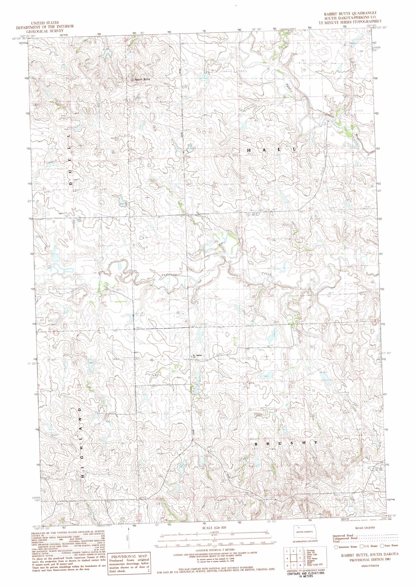
USGS Topo Quad 45102c5 - 1:24,000 scale
| Topo Map Name: | Rabbit Butte |
| USGS Topo Quad ID: | 45102c5 |
| Print Size: | ca. 21 1/4" wide x 27" high |
| Southeast Coordinates: | 45.25° N latitude / 102.5° W longitude |
| Map Center Coordinates: | 45.3125° N latitude / 102.5625° W longitude |
| U.S. State: | SD |
| Filename: | o45102c5.jpg |
| Download Map JPG Image: | Rabbit Butte topo map 1:24,000 scale |
| Map Type: | Topographic |
| Topo Series: | 7.5´ |
| Map Scale: | 1:24,000 |
| Source of Map Images: | United States Geological Survey (USGS) |
| Alternate Map Versions: |
Rabbit Butte SD 2012 Download PDF Buy paper map Rabbit Butte SD 2015 Download PDF Buy paper map |
1:24,000 Topo Quads surrounding Rabbit Butte
Prairie City |
Grandmas Butte |
Square Top Butte |
Bison |
Box Car Buttes |
Sorum Ne |
Daviston |
Date Ne |
Owen Lake |
Chance |
Sorum Se |
Date |
Rabbit Butte |
Two Buttes |
Sunrise Butte |
Zeona Ne |
Imogene |
Bixby |
Deep Creek Nw |
Deep Creek Ne |
Beverly Creek |
Cedar Canyon |
Maurine |
Signal Butte |
Deep Creek Se |
> Back to 45102a1 at 1:100,000 scale
> Back to 45102a1 at 1:250,000 scale
> Back to U.S. Topo Maps home
Rabbit Butte topo map: Gazetteer
Rabbit Butte: Dams
Ben Clark Dam elevation 786m 2578′Eldrod Kolb Dam elevation 784m 2572′
Martin Sander Dam elevation 801m 2627′
Smaltz Brothers Dam elevation 815m 2673′
Wayne Besler Dam elevation 806m 2644′
Rabbit Butte: Summits
Rabbit Butte elevation 889m 2916′Rabbit Butte digital topo map on disk
Buy this Rabbit Butte topo map showing relief, roads, GPS coordinates and other geographical features, as a high-resolution digital map file on DVD:
Eastern Montana & Western North Dakota
Buy digital topo maps: Eastern Montana & Western North Dakota