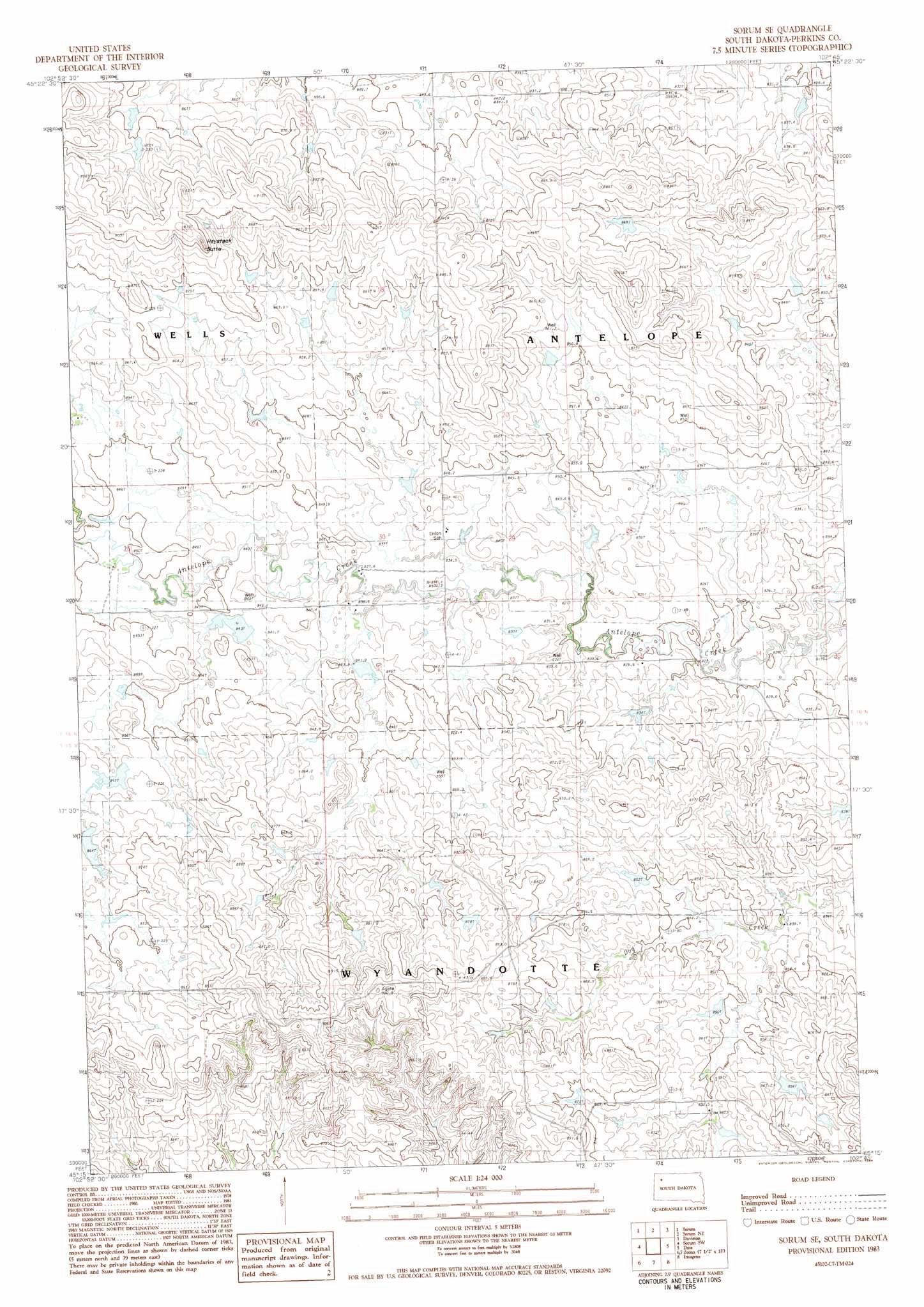
Sorum Se Topo Map South Dakota
To zoom in, hover over the map of Sorum Se
USGS Topo Quad 45102c7 - 1:24,000 scale
| Topo Map Name: | Sorum Se |
| USGS Topo Quad ID: | 45102c7 |
| Print Size: | ca. 21 1/4" wide x 27" high |
| Southeast Coordinates: | 45.25° N latitude / 102.75° W longitude |
| Map Center Coordinates: | 45.3125° N latitude / 102.8125° W longitude |
| U.S. State: | SD |
| Filename: | o45102c7.jpg |
| Download Map JPG Image: | Sorum Se topo map 1:24,000 scale |
| Map Type: | Topographic |
| Topo Series: | 7.5´ |
| Map Scale: | 1:24,000 |
| Source of Map Images: | United States Geological Survey (USGS) |
| Alternate Map Versions: |
Sorum SE SD 1983, updated 1984 Download PDF Buy paper map Sorum SE SD 2012 Download PDF Buy paper map Sorum SE SD 2015 Download PDF Buy paper map |
1:24,000 Topo Quads surrounding Sorum Se
Reva |
White Hill |
Prairie City |
Grandmas Butte |
Square Top Butte |
Flat Top Butte |
Sorum |
Sorum Ne |
Daviston |
Date Ne |
Sheep Mountain |
Sorum Sw |
Sorum Se |
Date |
Rabbit Butte |
Fish Draw |
Zeona Ne |
Imogene |
Bixby |
|
Tomato Can Buttes |
Beverly Creek |
Cedar Canyon |
Maurine |
> Back to 45102a1 at 1:100,000 scale
> Back to 45102a1 at 1:250,000 scale
> Back to U.S. Topo Maps home
Sorum Se topo map: Gazetteer
Sorum Se: Dams
Herman Van Den Berg Dam elevation 862m 2828′Leland Edwards Dam elevation 861m 2824′
Leland Edwards Dam elevation 855m 2805′
Sorum Se: Summits
Haystack Butte elevation 916m 3005′Sorum Se digital topo map on disk
Buy this Sorum Se topo map showing relief, roads, GPS coordinates and other geographical features, as a high-resolution digital map file on DVD:
Eastern Montana & Western North Dakota
Buy digital topo maps: Eastern Montana & Western North Dakota