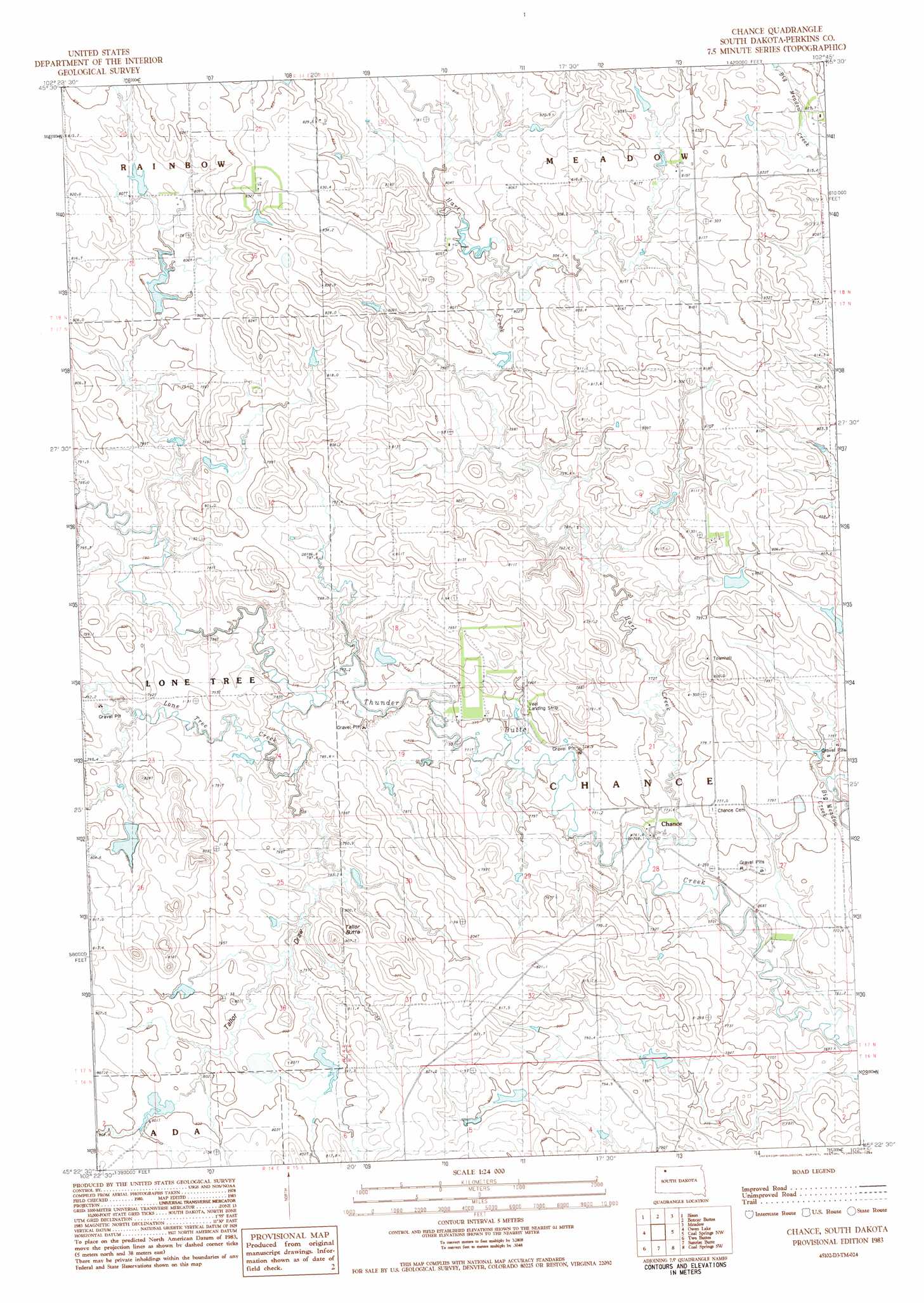
Chance Topo Map South Dakota
To zoom in, hover over the map of Chance
USGS Topo Quad 45102d3 - 1:24,000 scale
| Topo Map Name: | Chance |
| USGS Topo Quad ID: | 45102d3 |
| Print Size: | ca. 21 1/4" wide x 27" high |
| Southeast Coordinates: | 45.375° N latitude / 102.25° W longitude |
| Map Center Coordinates: | 45.4375° N latitude / 102.3125° W longitude |
| U.S. State: | SD |
| Filename: | o45102d3.jpg |
| Download Map JPG Image: | Chance topo map 1:24,000 scale |
| Map Type: | Topographic |
| Topo Series: | 7.5´ |
| Map Scale: | 1:24,000 |
| Source of Map Images: | United States Geological Survey (USGS) |
| Alternate Map Versions: |
Chance SD 1983, updated 1984 Download PDF Buy paper map Chance SD 2012 Download PDF Buy paper map Chance SD 2015 Download PDF Buy paper map |
1:24,000 Topo Quads surrounding Chance
Cole Dam |
Bison Nw |
Bison Ne |
Meadow Nw |
Meadow Ne |
Square Top Butte |
Bison |
Box Car Buttes |
Meadow |
Meadow Se |
Date Ne |
Owen Lake |
Chance |
Coal Springs Nw |
Coal Springs |
Rabbit Butte |
Two Buttes |
Sunrise Butte |
Coal Springs Sw |
Coal Springs Se |
Bixby |
Deep Creek Nw |
Deep Creek Ne |
Faith Nw |
Faith Ne |
> Back to 45102a1 at 1:100,000 scale
> Back to 45102a1 at 1:250,000 scale
> Back to U.S. Topo Maps home
Chance topo map: Gazetteer
Chance: Dams
Floyd Hall Dam elevation 798m 2618′Lenard Chapman Dam elevation 800m 2624′
Lenard Chapman Dam elevation 807m 2647′
Tom Gabbert Dam elevation 801m 2627′
Chance: Populated Places
Chance elevation 766m 2513′Chance: Streams
Cone Tree Creek elevation 771m 2529′Hart Creek elevation 763m 2503′
Chance: Summits
Tailor Butte elevation 821m 2693′Chance: Valleys
Tailor Draw elevation 777m 2549′Chance digital topo map on disk
Buy this Chance topo map showing relief, roads, GPS coordinates and other geographical features, as a high-resolution digital map file on DVD:
Eastern Montana & Western North Dakota
Buy digital topo maps: Eastern Montana & Western North Dakota