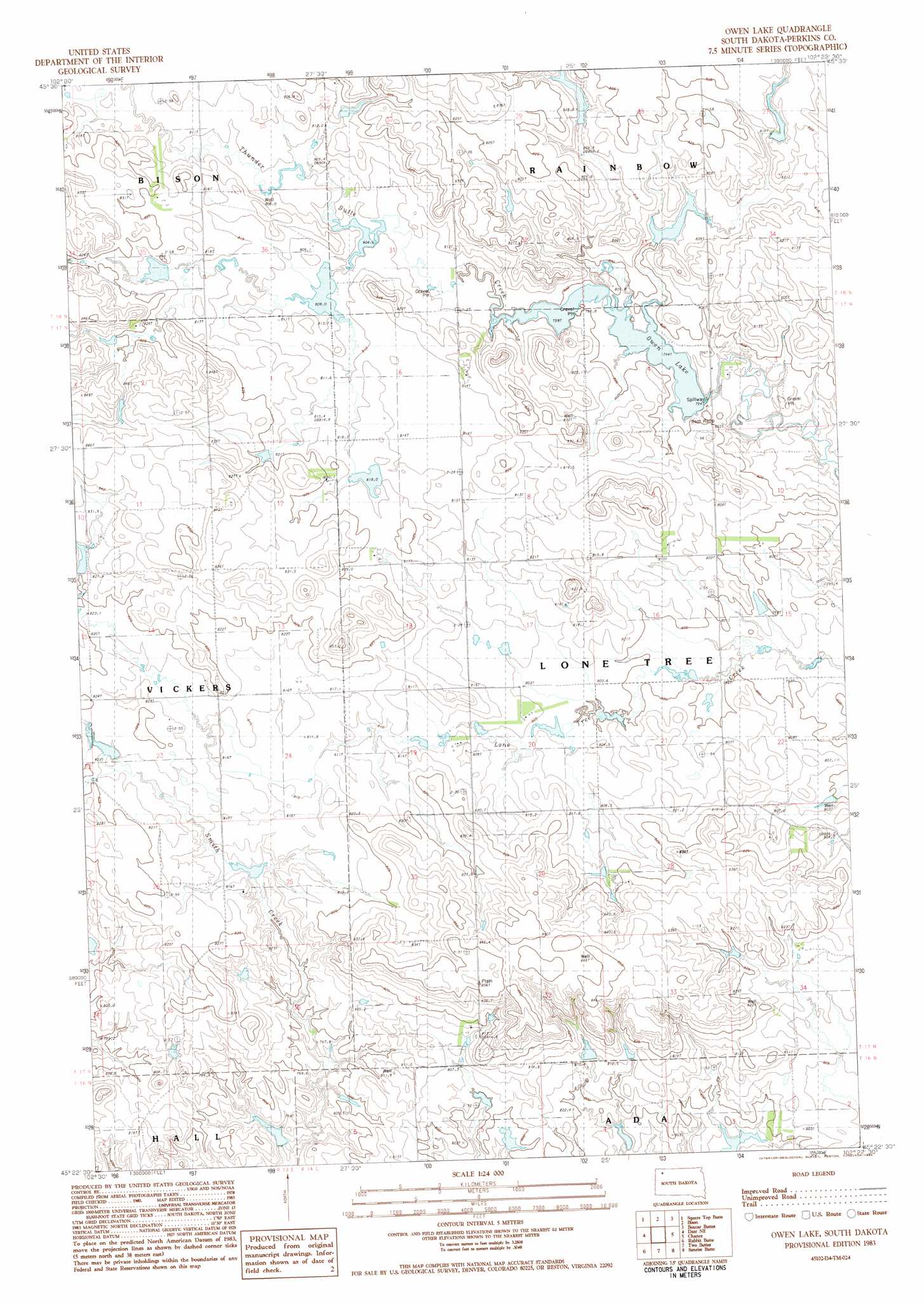
Owen Lake Topo Map South Dakota
To zoom in, hover over the map of Owen Lake
USGS Topo Quad 45102d4 - 1:24,000 scale
| Topo Map Name: | Owen Lake |
| USGS Topo Quad ID: | 45102d4 |
| Print Size: | ca. 21 1/4" wide x 27" high |
| Southeast Coordinates: | 45.375° N latitude / 102.375° W longitude |
| Map Center Coordinates: | 45.4375° N latitude / 102.4375° W longitude |
| U.S. State: | SD |
| Filename: | o45102d4.jpg |
| Download Map JPG Image: | Owen Lake topo map 1:24,000 scale |
| Map Type: | Topographic |
| Topo Series: | 7.5´ |
| Map Scale: | 1:24,000 |
| Source of Map Images: | United States Geological Survey (USGS) |
| Alternate Map Versions: |
Owen Lake SD 1983, updated 1984 Download PDF Buy paper map Owen Lake SD 2012 Download PDF Buy paper map Owen Lake SD 2015 Download PDF Buy paper map |
1:24,000 Topo Quads surrounding Owen Lake
Little Nasty Creek |
Cole Dam |
Bison Nw |
Bison Ne |
Meadow Nw |
Grandmas Butte |
Square Top Butte |
Bison |
Box Car Buttes |
Meadow |
Daviston |
Date Ne |
Owen Lake |
Chance |
Coal Springs Nw |
Date |
Rabbit Butte |
Two Buttes |
Sunrise Butte |
Coal Springs Sw |
Imogene |
Bixby |
Deep Creek Nw |
Deep Creek Ne |
Faith Nw |
> Back to 45102a1 at 1:100,000 scale
> Back to 45102a1 at 1:250,000 scale
> Back to U.S. Topo Maps home
Owen Lake topo map: Gazetteer
Owen Lake: Dams
Bison Dam elevation 802m 2631′Gary Larson Dam elevation 818m 2683′
Gary Larson Dam elevation 801m 2627′
Joe Wunder Dam elevation 817m 2680′
John Penor Dam elevation 809m 2654′
John Penor Dam elevation 837m 2746′
Louie Englehardt Dam elevation 785m 2575′
Rowbotham Dam elevation 818m 2683′
Rudolph Larson Dam elevation 804m 2637′
Owen Lake: Lakes
Owen Lake elevation 797m 2614′Owen Lake digital topo map on disk
Buy this Owen Lake topo map showing relief, roads, GPS coordinates and other geographical features, as a high-resolution digital map file on DVD:
Eastern Montana & Western North Dakota
Buy digital topo maps: Eastern Montana & Western North Dakota