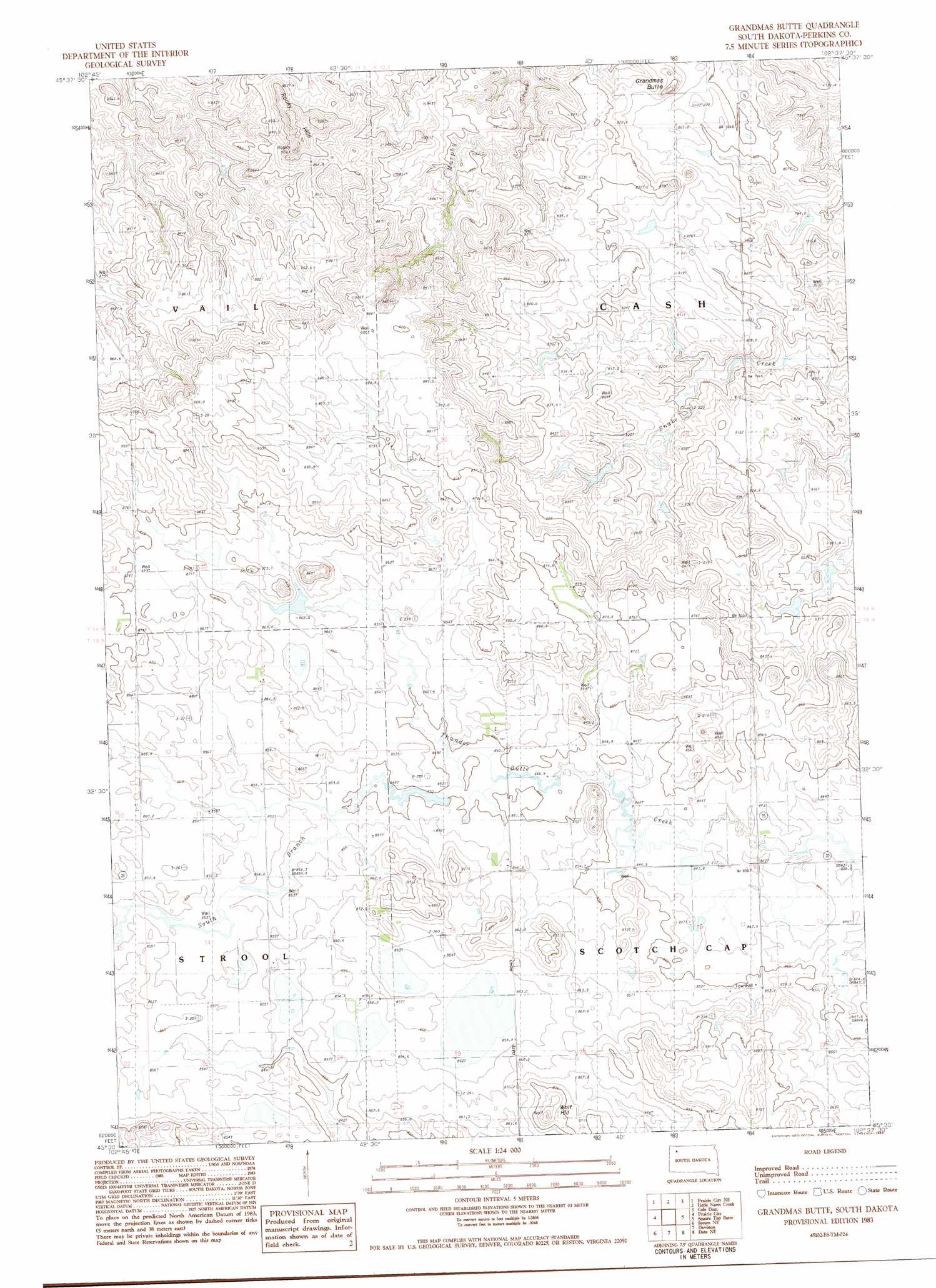
Grandmas Butte Topo Map South Dakota
To zoom in, hover over the map of Grandmas Butte
USGS Topo Quad 45102e6 - 1:24,000 scale
| Topo Map Name: | Grandmas Butte |
| USGS Topo Quad ID: | 45102e6 |
| Print Size: | ca. 21 1/4" wide x 27" high |
| Southeast Coordinates: | 45.5° N latitude / 102.625° W longitude |
| Map Center Coordinates: | 45.5625° N latitude / 102.6875° W longitude |
| U.S. State: | SD |
| Filename: | o45102e6.jpg |
| Download Map JPG Image: | Grandmas Butte topo map 1:24,000 scale |
| Map Type: | Topographic |
| Topo Series: | 7.5´ |
| Map Scale: | 1:24,000 |
| Source of Map Images: | United States Geological Survey (USGS) |
| Alternate Map Versions: |
Grandmas Butte SD 1983, updated 1984 Download PDF Buy paper map Grandmas Butte SD 2012 Download PDF Buy paper map Grandmas Butte SD 2015 Download PDF Buy paper map |
1:24,000 Topo Quads surrounding Grandmas Butte
Cow Butte Sw |
Cow Butte Se |
Lodgepole |
Lodgepole Se |
Haynes Sw |
Prairie City Nw |
Prairie City Ne |
Little Nasty Creek |
Cole Dam |
Bison Nw |
White Hill |
Prairie City |
Grandmas Butte |
Square Top Butte |
Bison |
Sorum |
Sorum Ne |
Daviston |
Date Ne |
Owen Lake |
Sorum Sw |
Sorum Se |
Date |
Rabbit Butte |
Two Buttes |
> Back to 45102e1 at 1:100,000 scale
> Back to 45102a1 at 1:250,000 scale
> Back to U.S. Topo Maps home
Grandmas Butte topo map: Gazetteer
Grandmas Butte: Dams
Morris Hamilton Dam elevation 836m 2742′Grandmas Butte: Streams
South Branch Thunder Butte Creek elevation 850m 2788′Grandmas Butte: Summits
Grandmas Butte elevation 843m 2765′Rocky Hills elevation 909m 2982′
Wolf Hill elevation 896m 2939′
Grandmas Butte digital topo map on disk
Buy this Grandmas Butte topo map showing relief, roads, GPS coordinates and other geographical features, as a high-resolution digital map file on DVD:
Eastern Montana & Western North Dakota
Buy digital topo maps: Eastern Montana & Western North Dakota