Prairie City Topo Map South Dakota
To zoom in, hover over the map of Prairie City
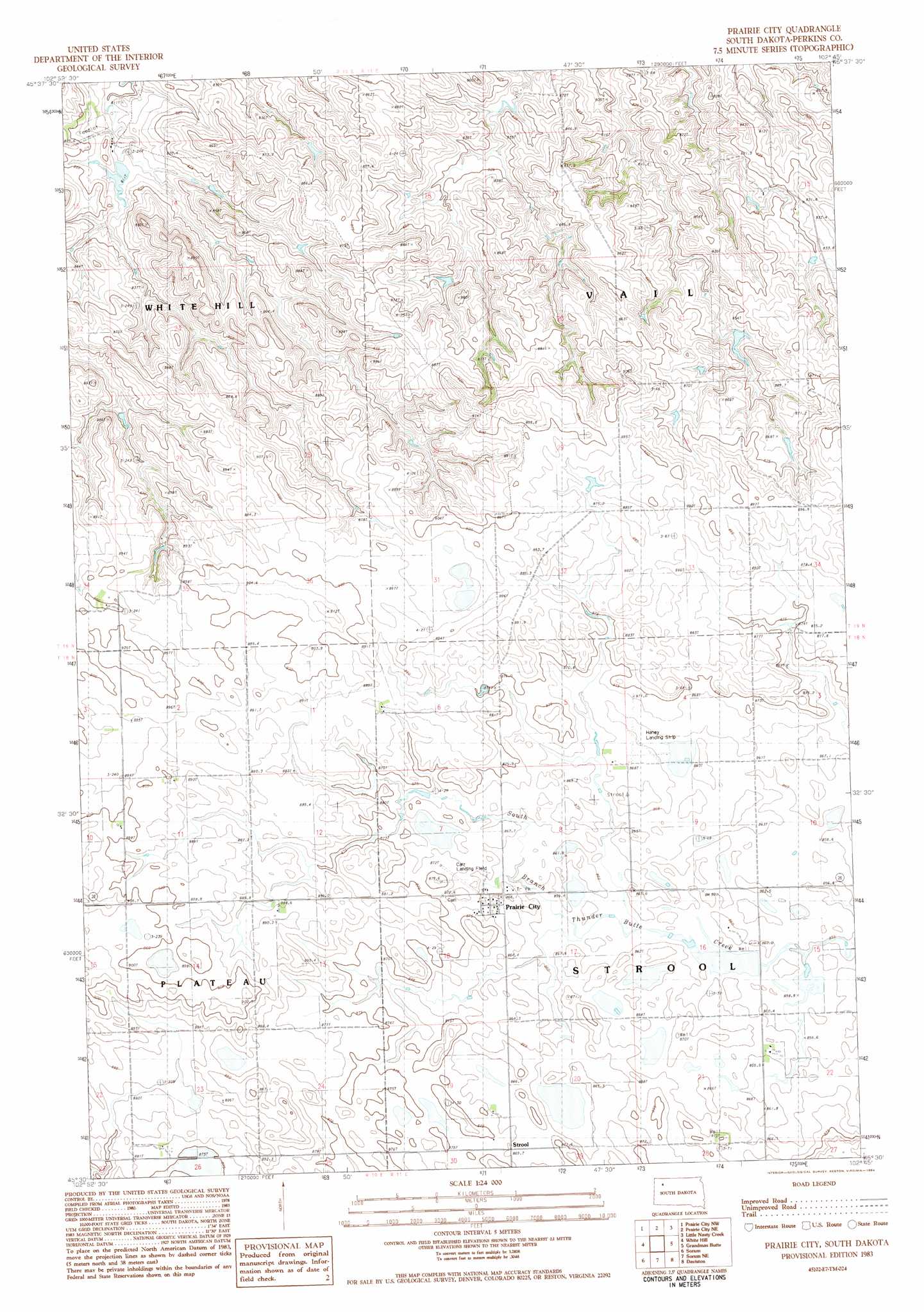
USGS Topo Quad 45102e7 - 1:24,000 scale
| Topo Map Name: | Prairie City |
| USGS Topo Quad ID: | 45102e7 |
| Print Size: | ca. 21 1/4" wide x 27" high |
| Southeast Coordinates: | 45.5° N latitude / 102.75° W longitude |
| Map Center Coordinates: | 45.5625° N latitude / 102.8125° W longitude |
| U.S. State: | SD |
| Filename: | o45102e7.jpg |
| Download Map JPG Image: | Prairie City topo map 1:24,000 scale |
| Map Type: | Topographic |
| Topo Series: | 7.5´ |
| Map Scale: | 1:24,000 |
| Source of Map Images: | United States Geological Survey (USGS) |
| Alternate Map Versions: |
Prairie City SD 1983, updated 1984 Download PDF Buy paper map Prairie City SD 2012 Download PDF Buy paper map Prairie City SD 2015 Download PDF Buy paper map |
1:24,000 Topo Quads surrounding Prairie City
Ralph |
Cow Butte Sw |
Cow Butte Se |
Lodgepole |
Lodgepole Se |
Reva Ne |
Prairie City Nw |
Prairie City Ne |
Little Nasty Creek |
Cole Dam |
Reva |
White Hill |
Prairie City |
Grandmas Butte |
Square Top Butte |
Flat Top Butte |
Sorum |
Sorum Ne |
Daviston |
Date Ne |
Sheep Mountain |
Sorum Sw |
Sorum Se |
Date |
Rabbit Butte |
> Back to 45102e1 at 1:100,000 scale
> Back to 45102a1 at 1:250,000 scale
> Back to U.S. Topo Maps home
Prairie City topo map: Gazetteer
Prairie City: Airports
Carr Landing Field elevation 865m 2837′Haney Landing Strop elevation 866m 2841′
Prairie City: Dams
Simpson Brothers Dam elevation 823m 2700′Prairie City: Populated Places
Prairie City elevation 866m 2841′Strool elevation 869m 2851′
Prairie City digital topo map on disk
Buy this Prairie City topo map showing relief, roads, GPS coordinates and other geographical features, as a high-resolution digital map file on DVD:
Eastern Montana & Western North Dakota
Buy digital topo maps: Eastern Montana & Western North Dakota