Lemmon Topo Map South Dakota
To zoom in, hover over the map of Lemmon
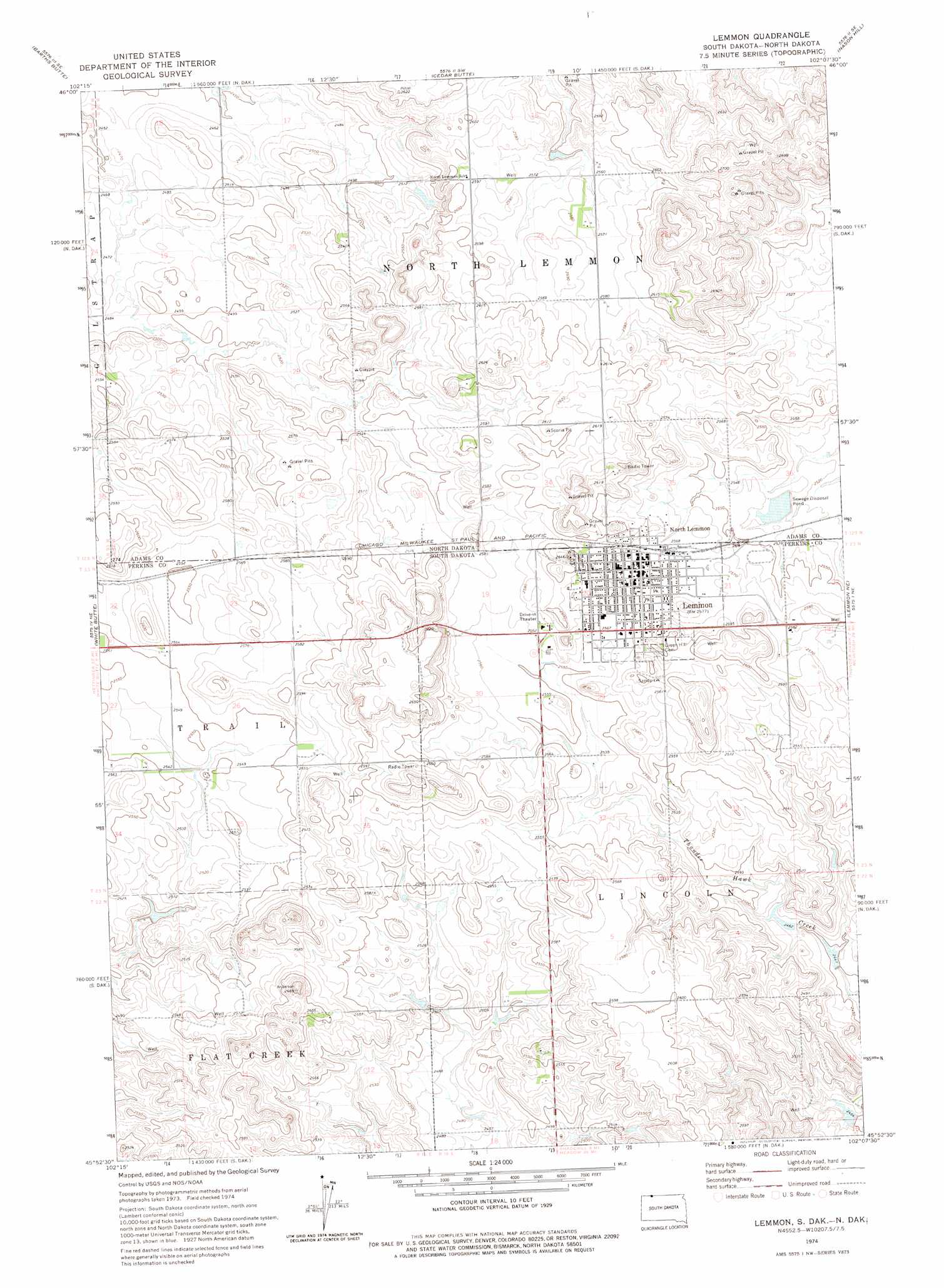
USGS Topo Quad 45102h2 - 1:24,000 scale
| Topo Map Name: | Lemmon |
| USGS Topo Quad ID: | 45102h2 |
| Print Size: | ca. 21 1/4" wide x 27" high |
| Southeast Coordinates: | 45.875° N latitude / 102.125° W longitude |
| Map Center Coordinates: | 45.9375° N latitude / 102.1875° W longitude |
| U.S. States: | SD, ND |
| Filename: | o45102h2.jpg |
| Download Map JPG Image: | Lemmon topo map 1:24,000 scale |
| Map Type: | Topographic |
| Topo Series: | 7.5´ |
| Map Scale: | 1:24,000 |
| Source of Map Images: | United States Geological Survey (USGS) |
| Alternate Map Versions: |
Lemmon SD 2011 Download PDF Buy paper map Lemmon SD 2012 Download PDF Buy paper map Lemmon SD 2015 Download PDF Buy paper map |
1:24,000 Topo Quads surrounding Lemmon
Pearl Butte Nw |
Long Butte |
Plum Butte |
Plum Butte Ne |
Coffin Buttes |
Pearl Butte |
Barths Butte |
Cedar Butte |
Nason Hill |
Round Top |
Haynes |
White Butte |
Lemmon |
Lemmon Ne |
Thunder Hawk |
Haynes Sw |
Haynes Se |
Sommerville |
Lemmon Lake |
Thunder Hawk Sw |
Bison Nw |
Bison Ne |
Meadow Nw |
Meadow Ne |
Black Horse Butte Nw |
> Back to 45102e1 at 1:100,000 scale
> Back to 45102a1 at 1:250,000 scale
> Back to U.S. Topo Maps home
Lemmon topo map: Gazetteer
Lemmon: Populated Places
Lemmon elevation 783m 2568′North Lemmon elevation 786m 2578′
Lemmon digital topo map on disk
Buy this Lemmon topo map showing relief, roads, GPS coordinates and other geographical features, as a high-resolution digital map file on DVD:
Eastern Montana & Western North Dakota
Buy digital topo maps: Eastern Montana & Western North Dakota