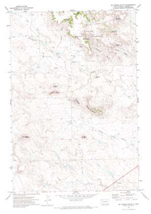
Mckenzie Butte Topo Map South Dakota
To zoom in, hover over the map of Mckenzie Butte
USGS Topo Quad 45103f5 - 1:24,000 scale
| Topo Map Name: | Mckenzie Butte |
| USGS Topo Quad ID: | 45103f5 |
| Print Size: | ca. 21 1/4" wide x 27" high |
| Southeast Coordinates: | 45.625° N latitude / 103.5° W longitude |
| Map Center Coordinates: | 45.6875° N latitude / 103.5625° W longitude |
| U.S. State: | SD |
| Filename: | o45103f5.jpg |
| Download Map JPG Image: | Mckenzie Butte topo map 1:24,000 scale |
| Map Type: | Topographic |
| Topo Series: | 7.5´ |
| Map Scale: | 1:24,000 |
| Source of Map Images: | United States Geological Survey (USGS) |
| Alternate Map Versions: |
McKenzie Butte SD 1971, updated 1974 Download PDF Buy paper map McKenzie Butte SD 1993, updated 1996 Download PDF Buy paper map McKenzie Butte SD 2005, updated 2007 Download PDF Buy paper map McKenzie Butte SD 2012 Download PDF Buy paper map McKenzie Butte SD 2015 Download PDF Buy paper map |
| FStopo: | US Forest Service topo McKenzie Butte is available: Download FStopo PDF Download FStopo TIF |
1:24,000 Topo Quads surrounding Mckenzie Butte
> Back to 45103e1 at 1:100,000 scale
> Back to 45102a1 at 1:250,000 scale
> Back to U.S. Topo Maps home
Mckenzie Butte topo map: Gazetteer
Mckenzie Butte: Dams
Alcorn Dam elevation 930m 3051′Argyle Dam elevation 965m 3166′
Niemi Number 1 Dam elevation 910m 2985′
Niemi Number 2 Dam elevation 931m 3054′
Niemi Number 3 Dam elevation 909m 2982′
Niemi Number 4 Dam elevation 891m 2923′
Niemi Number 5 Dam elevation 897m 2942′
Mckenzie Butte: Mines
Hilton Mine elevation 956m 3136′Mckenzie Butte: Ranges
South Cave Hills elevation 1021m 3349′Mckenzie Butte: Springs
Casper Gulch Spring elevation 984m 3228′John Brown Spring Number One elevation 975m 3198′
John Brown Spring Number Two elevation 968m 3175′
Johnson Spring elevation 969m 3179′
McKenzie Spring elevation 968m 3175′
Mckenzie Butte: Streams
Boot Creek elevation 903m 2962′Cottonwood Creek elevation 890m 2919′
Mckenzie Butte: Summits
Juhala Hill elevation 1063m 3487′McKenzie Butte elevation 1063m 3487′
Penttila Butte elevation 1050m 3444′
Red Butte elevation 1030m 3379′
Sheep Mountain elevation 1084m 3556′
Thumb Butte elevation 1011m 3316′
Van Offern Butte elevation 925m 3034′
Mckenzie Butte: Valleys
Casper Gulch elevation 904m 2965′Holdup Canyon elevation 901m 2956′
McKenzie Gulch elevation 884m 2900′
Mckenzie Butte digital topo map on disk
Buy this Mckenzie Butte topo map showing relief, roads, GPS coordinates and other geographical features, as a high-resolution digital map file on DVD:
Eastern Montana & Western North Dakota
Buy digital topo maps: Eastern Montana & Western North Dakota


