Black Point Ne Topo Map Montana
To zoom in, hover over the map of Black Point Ne
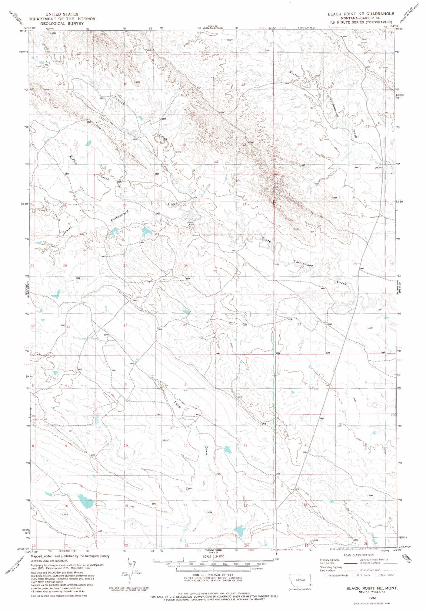
USGS Topo Quad 45104b5 - 1:24,000 scale
| Topo Map Name: | Black Point Ne |
| USGS Topo Quad ID: | 45104b5 |
| Print Size: | ca. 21 1/4" wide x 27" high |
| Southeast Coordinates: | 45.125° N latitude / 104.5° W longitude |
| Map Center Coordinates: | 45.1875° N latitude / 104.5625° W longitude |
| U.S. State: | MT |
| Filename: | o45104b5.jpg |
| Download Map JPG Image: | Black Point Ne topo map 1:24,000 scale |
| Map Type: | Topographic |
| Topo Series: | 7.5´ |
| Map Scale: | 1:24,000 |
| Source of Map Images: | United States Geological Survey (USGS) |
| Alternate Map Versions: |
Black Point NE MT 1982, updated 1982 Download PDF Buy paper map Black Point NE MT 2011 Download PDF Buy paper map Black Point NE MT 2014 Download PDF Buy paper map |
1:24,000 Topo Quads surrounding Black Point Ne
Knudson Draw Ne |
Whitetail Creek |
Ridgway |
Prairie Dog Creek |
Lone Tree Creek |
Phillipi Reservoir |
Tip Top Butte |
Potato Buttes |
Finger Buttes West |
Finger Buttes East |
Greasy Hill |
Black Point |
Black Point Ne |
Alzada Nw |
Albion |
Hammond Se |
Cochran Reservoir |
Gomer Draw |
Alzada |
Sevenmile Creek |
Storm Draw |
Page Draw |
Gaff Creek |
Antelope Gulch |
Devils Run |
> Back to 45104a1 at 1:100,000 scale
> Back to 45104a1 at 1:250,000 scale
> Back to U.S. Topo Maps home
Black Point Ne topo map: Gazetteer
Black Point Ne: Dams
Nuhn Number 3 Dam elevation 1074m 3523′Black Point Ne: Streams
Duncan Creek elevation 1056m 3464′Middle Creek elevation 1056m 3464′
Trough Creek elevation 1067m 3500′
Black Point Ne digital topo map on disk
Buy this Black Point Ne topo map showing relief, roads, GPS coordinates and other geographical features, as a high-resolution digital map file on DVD:
Eastern Montana & Western North Dakota
Buy digital topo maps: Eastern Montana & Western North Dakota