Cactus Creek West Topo Map Montana
To zoom in, hover over the map of Cactus Creek West
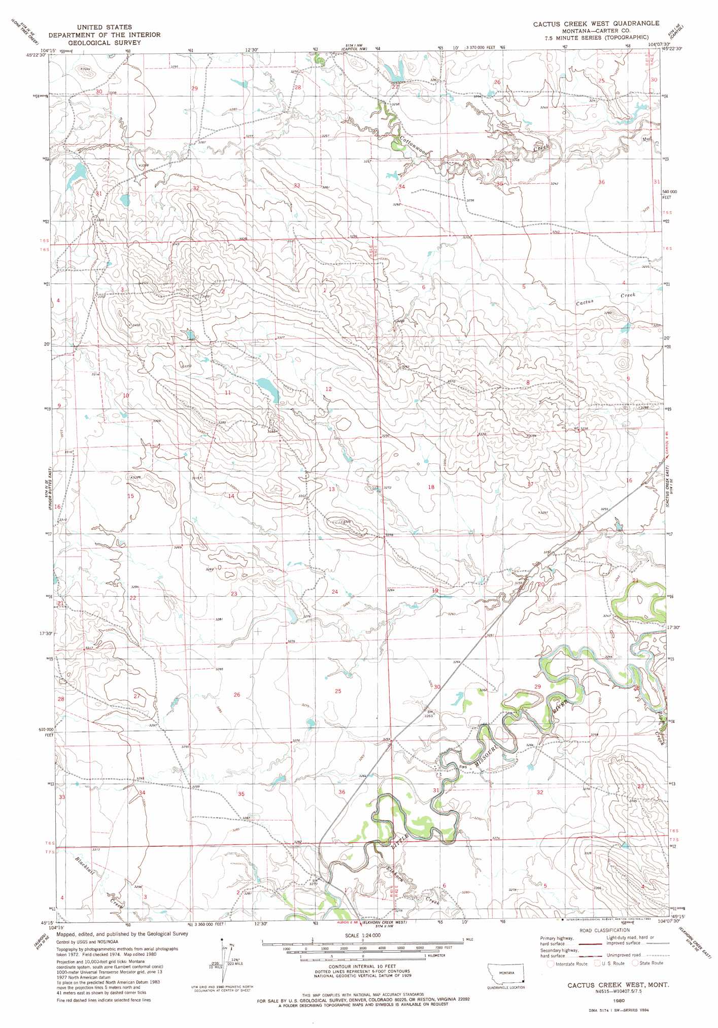
USGS Topo Quad 45104c2 - 1:24,000 scale
| Topo Map Name: | Cactus Creek West |
| USGS Topo Quad ID: | 45104c2 |
| Print Size: | ca. 21 1/4" wide x 27" high |
| Southeast Coordinates: | 45.25° N latitude / 104.125° W longitude |
| Map Center Coordinates: | 45.3125° N latitude / 104.1875° W longitude |
| U.S. State: | MT |
| Filename: | o45104c2.jpg |
| Download Map JPG Image: | Cactus Creek West topo map 1:24,000 scale |
| Map Type: | Topographic |
| Topo Series: | 7.5´ |
| Map Scale: | 1:24,000 |
| Source of Map Images: | United States Geological Survey (USGS) |
| Alternate Map Versions: |
Cactus Creek West MT 1980, updated 1980 Download PDF Buy paper map Cactus Creek West MT 1980, updated 1983 Download PDF Buy paper map Cactus Creek West MT 2011 Download PDF Buy paper map Cactus Creek West MT 2014 Download PDF Buy paper map |
1:24,000 Topo Quads surrounding Cactus Creek West
School Section Creek |
Belltower Butte |
Timber Hill |
Capitol Rock |
Camp Crook |
Prairie Dog Creek |
Lone Tree Creek |
Capitol Nw |
Capitol |
J K Butte |
Finger Buttes West |
Finger Buttes East |
Cactus Creek West |
Cactus Creek East |
Gustave |
Alzada Nw |
Albion |
Elkhorn Creek West |
Elkhorn Creek East |
Indian Butte |
Alzada |
Sevenmile Creek |
Elkhorn Creek Sw |
Elkhorn Creek Se |
Greasewood Draw |
> Back to 45104a1 at 1:100,000 scale
> Back to 45104a1 at 1:250,000 scale
> Back to U.S. Topo Maps home
Cactus Creek West topo map: Gazetteer
Cactus Creek West: Streams
Elkhorn Creek elevation 996m 3267′Plum Creek elevation 989m 3244′
Cactus Creek West: Wells
06S62E21ACAB01 Well elevation 989m 3244′07S62E06BCBD01 Well elevation 997m 3270′
Cactus Creek West digital topo map on disk
Buy this Cactus Creek West topo map showing relief, roads, GPS coordinates and other geographical features, as a high-resolution digital map file on DVD:
Eastern Montana & Western North Dakota
Buy digital topo maps: Eastern Montana & Western North Dakota