Knudson Draw Topo Map Montana
To zoom in, hover over the map of Knudson Draw
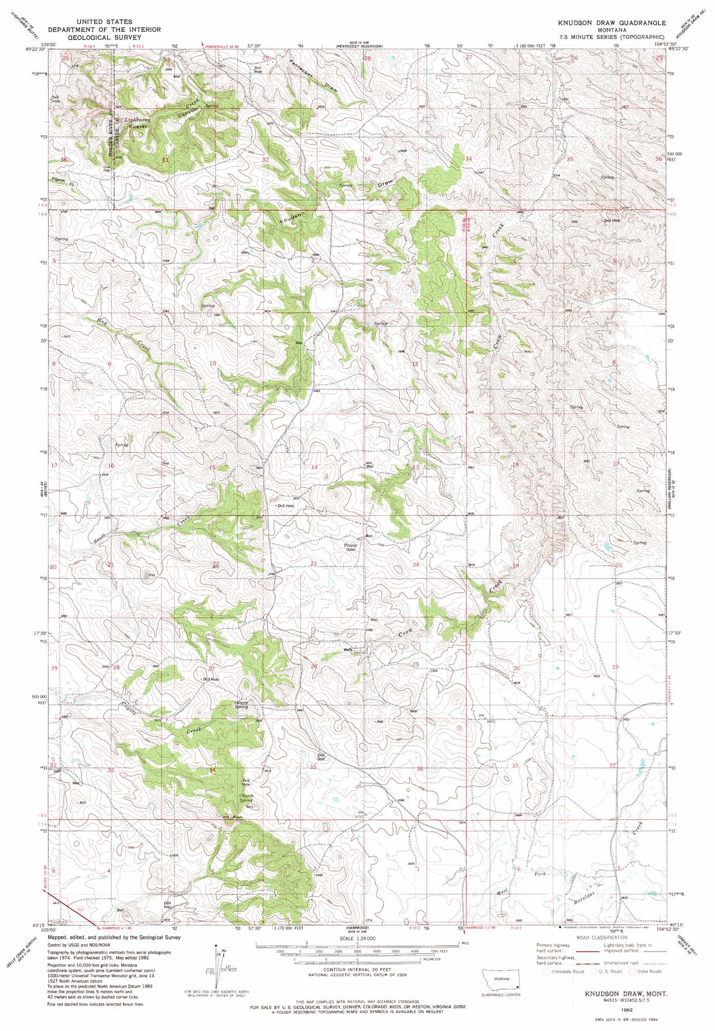
USGS Topo Quad 45104c8 - 1:24,000 scale
| Topo Map Name: | Knudson Draw |
| USGS Topo Quad ID: | 45104c8 |
| Print Size: | ca. 21 1/4" wide x 27" high |
| Southeast Coordinates: | 45.25° N latitude / 104.875° W longitude |
| Map Center Coordinates: | 45.3125° N latitude / 104.9375° W longitude |
| U.S. State: | MT |
| Filename: | o45104c8.jpg |
| Download Map JPG Image: | Knudson Draw topo map 1:24,000 scale |
| Map Type: | Topographic |
| Topo Series: | 7.5´ |
| Map Scale: | 1:24,000 |
| Source of Map Images: | United States Geological Survey (USGS) |
| Alternate Map Versions: |
Knudson Draw MT 1982, updated 1982 Download PDF Buy paper map Knudson Draw MT 2011 Download PDF Buy paper map Knudson Draw MT 2014 Download PDF Buy paper map |
1:24,000 Topo Quads surrounding Knudson Draw
Deer Creek Buttes |
Mckenzie Creek |
Pocochichee Butte |
W L Butte |
Dutchman Creek |
Little Pilgrim Butte |
Lightning Butte |
Pentecost Reservoir |
Knudson Draw Ne |
Whitetail Creek |
Dry Creek Butte |
Boyes |
Knudson Draw |
Phillipi Reservoir |
Tip Top Butte |
Sanburn Reservoir |
Belle Creek North |
Hammond |
Greasy Hill |
Black Point |
Belle Creek Sw |
Belle Creek South |
Stack Rocks |
Hammond Se |
Cochran Reservoir |
> Back to 45104a1 at 1:100,000 scale
> Back to 45104a1 at 1:250,000 scale
> Back to U.S. Topo Maps home
Knudson Draw topo map: Gazetteer
Knudson Draw: Dams
Whitetail Dam elevation 1027m 3369′Knudson Draw: Post Offices
Piniele Post Office (historical) elevation 1142m 3746′Knudson Draw: Springs
Church Spring elevation 1148m 3766′Selway Spring elevation 1154m 3786′
Knudson Draw: Streams
West Fork Boxelder Creek elevation 1110m 3641′Knudson Draw: Valleys
Knudson Draw elevation 1017m 3336′Knudson Draw: Wells
06S55E04DACB01 Well elevation 1141m 3743′06S55E09ABCC01 Well elevation 1099m 3605′
06S55E15BACA01 Well elevation 1154m 3786′
06S55E23AADD01 Well elevation 1135m 3723′
06S55E25BBBB01 Well elevation 1130m 3707′
06S55E25CDDB01 Well elevation 1155m 3789′
06S56E30DD__01 Well elevation 1117m 3664′
07S55E01ADD_01 Well elevation 1117m 3664′
07S55E02ABDC01 Well elevation 1140m 3740′
07S55E04DCBC01 Well elevation 1049m 3441′
Knudson Draw digital topo map on disk
Buy this Knudson Draw topo map showing relief, roads, GPS coordinates and other geographical features, as a high-resolution digital map file on DVD:
Eastern Montana & Western North Dakota
Buy digital topo maps: Eastern Montana & Western North Dakota