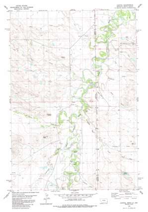
Capitol Topo Map Montana
To zoom in, hover over the map of Capitol
USGS Topo Quad 45104d1 - 1:24,000 scale
| Topo Map Name: | Capitol |
| USGS Topo Quad ID: | 45104d1 |
| Print Size: | ca. 21 1/4" wide x 27" high |
| Southeast Coordinates: | 45.375° N latitude / 104° W longitude |
| Map Center Coordinates: | 45.4375° N latitude / 104.0625° W longitude |
| U.S. States: | MT, SD |
| Filename: | o45104d1.jpg |
| Download Map JPG Image: | Capitol topo map 1:24,000 scale |
| Map Type: | Topographic |
| Topo Series: | 7.5´ |
| Map Scale: | 1:24,000 |
| Source of Map Images: | United States Geological Survey (USGS) |
| Alternate Map Versions: |
Capitol MT 1980, updated 1980 Download PDF Buy paper map Capitol MT 1980, updated 1986 Download PDF Buy paper map Capitol MT 2011 Download PDF Buy paper map Capitol MT 2014 Download PDF Buy paper map |
1:24,000 Topo Quads surrounding Capitol
> Back to 45104a1 at 1:100,000 scale
> Back to 45104a1 at 1:250,000 scale
> Back to U.S. Topo Maps home
Capitol topo map: Gazetteer
Capitol: Airports
Sky Ranch for Boys Airstrip elevation 972m 3188′Capitol: Bends
Burnt Bend elevation 973m 3192′Harring Bend elevation 964m 3162′
Johnson Bend elevation 973m 3192′
Petes Bend elevation 973m 3192′
Capitol: Dams
Davis Irrigation Dam elevation 990m 3248′Fly Swatter Number 1 Dam elevation 977m 3205′
Price Number 1 Dam elevation 993m 3257′
Capitol: Islands
The Island elevation 975m 3198′Capitol: Populated Places
Capitol elevation 970m 3182′Capitol: Post Offices
Capitol Post Office (historical) elevation 970m 3182′Capitol: Reservoirs
Davis Reservoir elevation 991m 3251′Capitol: Streams
Bull Creek elevation 991m 3251′Claim Creek elevation 963m 3159′
Cottonwood Creek elevation 969m 3179′
Fortyeight Mile Creek elevation 971m 3185′
Fortyeight Mile Creek elevation 971m 3185′
Hackberry Creek elevation 970m 3182′
Hawk Creek elevation 964m 3162′
Hawk Creek elevation 964m 3162′
Plum Creek elevation 963m 3159′
Roburge Creek elevation 974m 3195′
Roburge Creek elevation 975m 3198′
Sand Creek elevation 963m 3159′
Tie Creek elevation 961m 3152′
Capitol: Summits
Indian Butte elevation 1014m 3326′Kay Hill elevation 1022m 3353′
Mud Butte elevation 1004m 3293′
Three Peaks elevation 1020m 3346′
Capitol: Valleys
Big Dam Draw elevation 970m 3182′Ferguson Draw elevation 1001m 3284′
Larue Draw elevation 982m 3221′
Little Dam Draw elevation 970m 3182′
Sagebrush Draw elevation 972m 3188′
Capitol: Wells
04S62E27CBDC01 Well elevation 966m 3169′04S62E34DC__01 Well elevation 973m 3192′
05S62E09BBDD01 Well elevation 980m 3215′
Capitol digital topo map on disk
Buy this Capitol topo map showing relief, roads, GPS coordinates and other geographical features, as a high-resolution digital map file on DVD:
Eastern Montana & Western North Dakota
Buy digital topo maps: Eastern Montana & Western North Dakota


