Lone Tree Creek Topo Map Montana
To zoom in, hover over the map of Lone Tree Creek
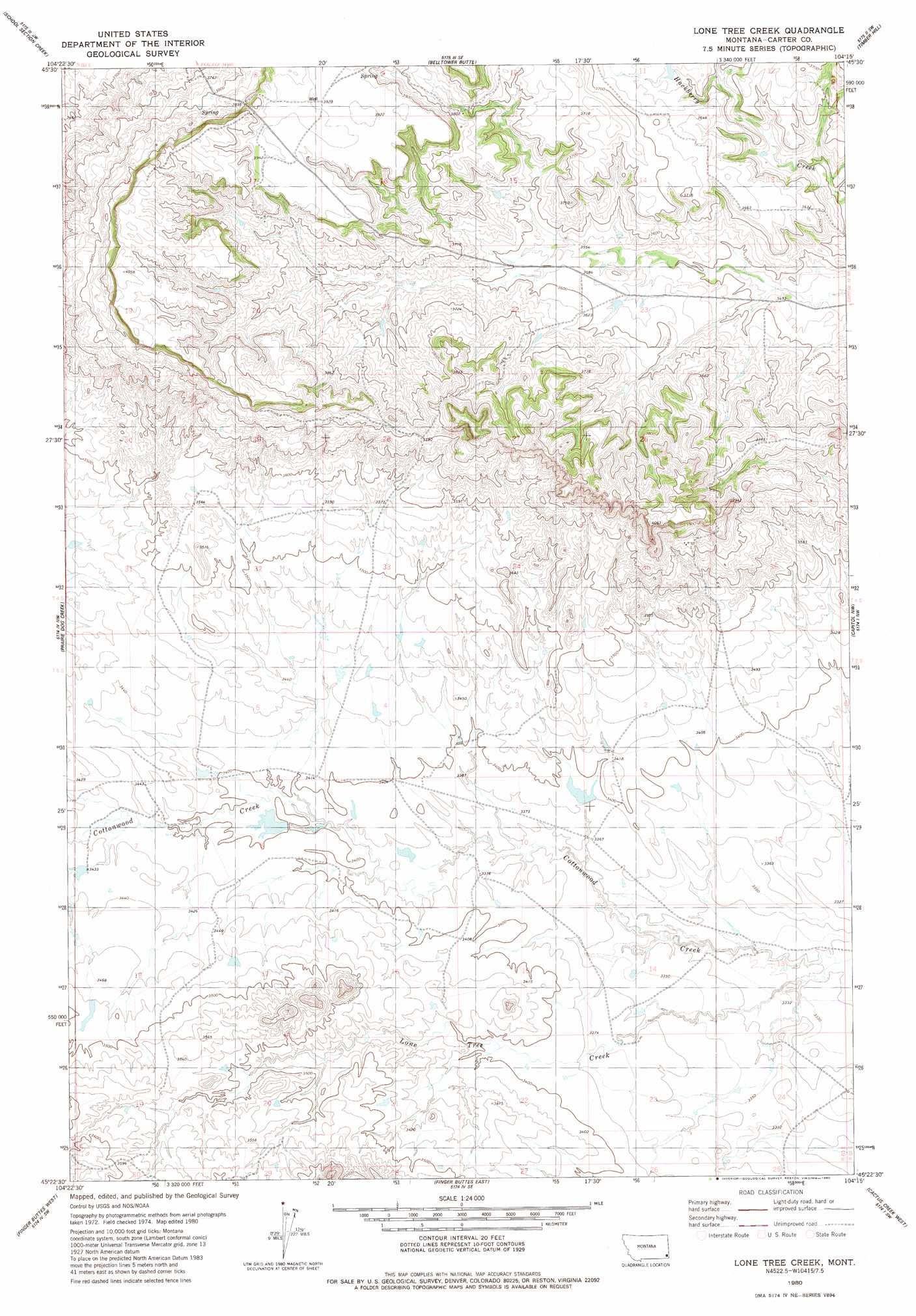
USGS Topo Quad 45104d3 - 1:24,000 scale
| Topo Map Name: | Lone Tree Creek |
| USGS Topo Quad ID: | 45104d3 |
| Print Size: | ca. 21 1/4" wide x 27" high |
| Southeast Coordinates: | 45.375° N latitude / 104.25° W longitude |
| Map Center Coordinates: | 45.4375° N latitude / 104.3125° W longitude |
| U.S. State: | MT |
| Filename: | o45104d3.jpg |
| Download Map JPG Image: | Lone Tree Creek topo map 1:24,000 scale |
| Map Type: | Topographic |
| Topo Series: | 7.5´ |
| Map Scale: | 1:24,000 |
| Source of Map Images: | United States Geological Survey (USGS) |
| Alternate Map Versions: |
Lone Tree Creek MT 1980, updated 1980 Download PDF Buy paper map Lone Tree Creek MT 2011 Download PDF Buy paper map Lone Tree Creek MT 2014 Download PDF Buy paper map |
1:24,000 Topo Quads surrounding Lone Tree Creek
Dead Boy Divide |
Taylor Hills |
Belltower |
Rustler Divide |
North Slick Creek |
Ikey Creek |
School Section Creek |
Belltower Butte |
Timber Hill |
Capitol Rock |
Ridgway |
Prairie Dog Creek |
Lone Tree Creek |
Capitol Nw |
Capitol |
Potato Buttes |
Finger Buttes West |
Finger Buttes East |
Cactus Creek West |
Cactus Creek East |
Black Point Ne |
Alzada Nw |
Albion |
Elkhorn Creek West |
Elkhorn Creek East |
> Back to 45104a1 at 1:100,000 scale
> Back to 45104a1 at 1:250,000 scale
> Back to U.S. Topo Maps home
Lone Tree Creek topo map: Gazetteer
Lone Tree Creek: Streams
Lone Tree Creek elevation 1012m 3320′Lone Tree Creek: Wells
04S60E08DDAD01 Well elevation 1201m 3940′04S60E22CDDB01 Well elevation 1156m 3792′
19N58E03DBBB01 Well elevation 1049m 3441′
Lone Tree Creek digital topo map on disk
Buy this Lone Tree Creek topo map showing relief, roads, GPS coordinates and other geographical features, as a high-resolution digital map file on DVD:
Eastern Montana & Western North Dakota
Buy digital topo maps: Eastern Montana & Western North Dakota