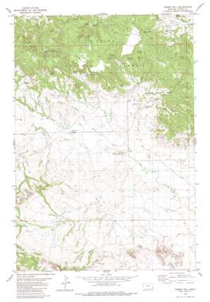
Timber Hill Topo Map Montana
To zoom in, hover over the map of Timber Hill
USGS Topo Quad 45104e2 - 1:24,000 scale
| Topo Map Name: | Timber Hill |
| USGS Topo Quad ID: | 45104e2 |
| Print Size: | ca. 21 1/4" wide x 27" high |
| Southeast Coordinates: | 45.5° N latitude / 104.125° W longitude |
| Map Center Coordinates: | 45.5625° N latitude / 104.1875° W longitude |
| U.S. State: | MT |
| Filename: | o45104e2.jpg |
| Download Map JPG Image: | Timber Hill topo map 1:24,000 scale |
| Map Type: | Topographic |
| Topo Series: | 7.5´ |
| Map Scale: | 1:24,000 |
| Source of Map Images: | United States Geological Survey (USGS) |
| Alternate Map Versions: |
Timber Hill MT 1980, updated 1980 Download PDF Buy paper map Timber Hill MT 1993, updated 1996 Download PDF Buy paper map Timber Hill MT 2011 Download PDF Buy paper map Timber Hill MT 2014 Download PDF Buy paper map |
| FStopo: | US Forest Service topo Timber Hill is available: Download FStopo PDF Download FStopo TIF |
1:24,000 Topo Quads surrounding Timber Hill
> Back to 45104e1 at 1:100,000 scale
> Back to 45104a1 at 1:250,000 scale
> Back to U.S. Topo Maps home
Timber Hill topo map: Gazetteer
Timber Hill: Dams
German Number 2 Dam elevation 1065m 3494′Padden Number 2 Dam elevation 1017m 3336′
Timber Hill: Post Offices
Rema Post Office (historical) elevation 1041m 3415′Timber Hill: Reservoirs
Brewer Reservoir elevation 1179m 3868′Gergen Reservoir elevation 1143m 3750′
Pot Hole Reservoir elevation 1100m 3608′
Timber Hill: Ridges
Belltower Divide elevation 1241m 4071′Timber Hill: Springs
Ballinger Spring elevation 1141m 3743′Big Noise Spring elevation 1187m 3894′
Big Tree Spring elevation 1178m 3864′
Curley Spring elevation 1175m 3854′
Double F Spring Number 1 elevation 1161m 3809′
Double F Spring Number 2 elevation 1170m 3838′
Gergen Spring elevation 1175m 3854′
Icebox Spring elevation 1170m 3838′
Lost Farm Spring Number 1 elevation 1194m 3917′
Lost Farm Spring Number 2 elevation 1171m 3841′
Maverick Spring Number 1 elevation 1193m 3914′
Maverick Spring Number 2 elevation 1181m 3874′
McClary Spring Number 1 elevation 1117m 3664′
Picnic Spring elevation 1160m 3805′
Sawdust Spring elevation 1134m 3720′
Sawmill Spring elevation 1177m 3861′
V Bar M Spring elevation 1133m 3717′
White Rock Spring elevation 1185m 3887′
Timber Hill: Streams
Gergen Creek elevation 1050m 3444′North Tie Creek elevation 1018m 3339′
Timber Hill: Summits
Timber Hill elevation 1074m 3523′Timber Hill: Valleys
Big Tree Draw elevation 1086m 3562′Blacktail Draw elevation 1071m 3513′
Cheesman Draw elevation 1086m 3562′
Weller Draw elevation 1040m 3412′
Timber Hill: Wells
03S61E24CDBD01 Well elevation 1041m 3415′04S61E03CACC01 Well elevation 1065m 3494′
Timber Hill digital topo map on disk
Buy this Timber Hill topo map showing relief, roads, GPS coordinates and other geographical features, as a high-resolution digital map file on DVD:
Eastern Montana & Western North Dakota
Buy digital topo maps: Eastern Montana & Western North Dakota


