Davis Creek East Topo Map Montana
To zoom in, hover over the map of Davis Creek East
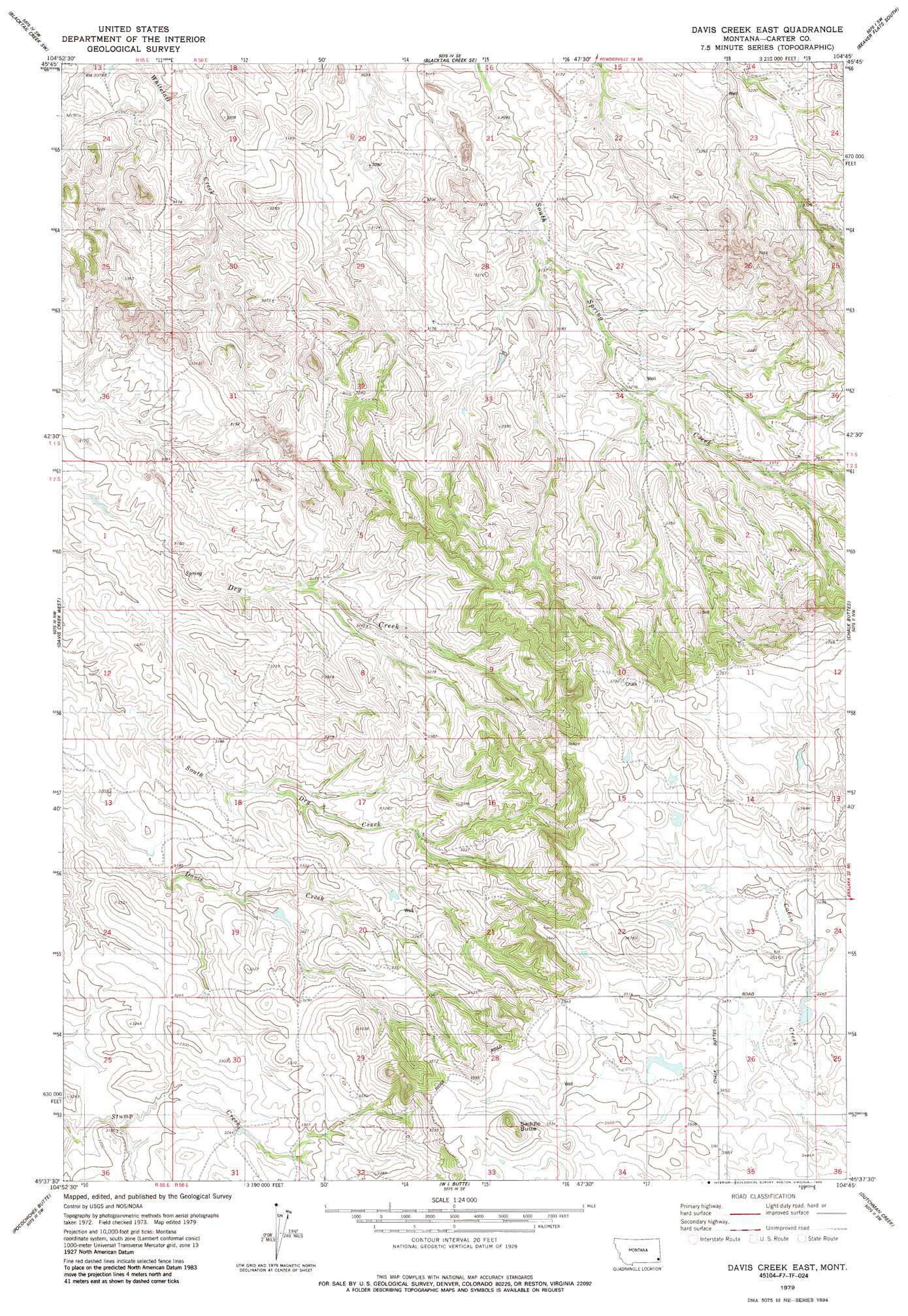
USGS Topo Quad 45104f7 - 1:24,000 scale
| Topo Map Name: | Davis Creek East |
| USGS Topo Quad ID: | 45104f7 |
| Print Size: | ca. 21 1/4" wide x 27" high |
| Southeast Coordinates: | 45.625° N latitude / 104.75° W longitude |
| Map Center Coordinates: | 45.6875° N latitude / 104.8125° W longitude |
| U.S. State: | MT |
| Filename: | o45104f7.jpg |
| Download Map JPG Image: | Davis Creek East topo map 1:24,000 scale |
| Map Type: | Topographic |
| Topo Series: | 7.5´ |
| Map Scale: | 1:24,000 |
| Source of Map Images: | United States Geological Survey (USGS) |
| Alternate Map Versions: |
Davis Creek East MT 1979, updated 1986 Download PDF Buy paper map Davis Creek East MT 2011 Download PDF Buy paper map Davis Creek East MT 2014 Download PDF Buy paper map |
1:24,000 Topo Quads surrounding Davis Creek East
Mills Creek East |
Blacktail Creek Nw |
Board Corral Creek |
Beaver Flats North |
Ekalaka |
Powderville |
Blacktail Creek Sw |
Blacktail Creek Se |
Beaver Flats South |
Stagville Draw |
Rattlesnake Ridge |
Davis Creek West |
Davis Creek East |
Chalk Buttes |
Dead Boy Divide |
Mckenzie Creek |
Pocochichee Butte |
W L Butte |
Dutchman Creek |
Ikey Creek |
Lightning Butte |
Pentecost Reservoir |
Knudson Draw Ne |
Whitetail Creek |
Ridgway |
> Back to 45104e1 at 1:100,000 scale
> Back to 45104a1 at 1:250,000 scale
> Back to U.S. Topo Maps home
Davis Creek East topo map: Gazetteer
Davis Creek East: Summits
Saddle Butte elevation 1134m 3720′Davis Creek East: Wells
01S56E30DDBA01 Well elevation 998m 3274′01S56E33DCC_01 Well elevation 1040m 3412′
01S56E36CBCB01 Well elevation 1046m 3431′
02S55E12C___01 Well elevation 982m 3221′
02S56E20ADD_01 Well elevation 1073m 3520′
02S56E28ABAA01 Well elevation 1102m 3615′
Davis Creek East digital topo map on disk
Buy this Davis Creek East topo map showing relief, roads, GPS coordinates and other geographical features, as a high-resolution digital map file on DVD:
Eastern Montana & Western North Dakota
Buy digital topo maps: Eastern Montana & Western North Dakota