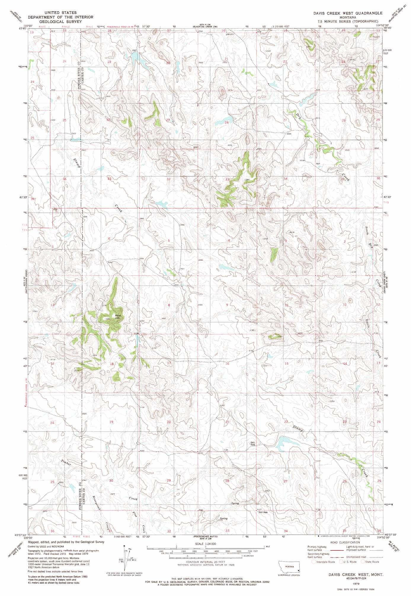
Davis Creek West Topo Map Montana
To zoom in, hover over the map of Davis Creek West
USGS Topo Quad 45104f8 - 1:24,000 scale
| Topo Map Name: | Davis Creek West |
| USGS Topo Quad ID: | 45104f8 |
| Print Size: | ca. 21 1/4" wide x 27" high |
| Southeast Coordinates: | 45.625° N latitude / 104.875° W longitude |
| Map Center Coordinates: | 45.6875° N latitude / 104.9375° W longitude |
| U.S. State: | MT |
| Filename: | o45104f8.jpg |
| Download Map JPG Image: | Davis Creek West topo map 1:24,000 scale |
| Map Type: | Topographic |
| Topo Series: | 7.5´ |
| Map Scale: | 1:24,000 |
| Source of Map Images: | United States Geological Survey (USGS) |
| Alternate Map Versions: |
Davis Creek West MT 1979, updated 1984 Download PDF Buy paper map Davis Creek West MT 2011 Download PDF Buy paper map Davis Creek West MT 2014 Download PDF Buy paper map |
1:24,000 Topo Quads surrounding Davis Creek West
Mills Creek West |
Mills Creek East |
Blacktail Creek Nw |
Board Corral Creek |
Beaver Flats North |
Snake Butte |
Powderville |
Blacktail Creek Sw |
Blacktail Creek Se |
Beaver Flats South |
Oliphant Butte |
Rattlesnake Ridge |
Davis Creek West |
Davis Creek East |
Chalk Buttes |
Deer Creek Buttes |
Mckenzie Creek |
Pocochichee Butte |
W L Butte |
Dutchman Creek |
Little Pilgrim Butte |
Lightning Butte |
Pentecost Reservoir |
Knudson Draw Ne |
Whitetail Creek |
> Back to 45104e1 at 1:100,000 scale
> Back to 45104a1 at 1:250,000 scale
> Back to U.S. Topo Maps home
Davis Creek West topo map: Gazetteer
Davis Creek West: Dams
Harkin Dam elevation 940m 3083′Davis Creek West: Streams
Davis Creek elevation 937m 3074′Flag Creek elevation 903m 2962′
Honeycomb Creek elevation 898m 2946′
South Dry Creek elevation 928m 3044′
Davis Creek West: Summits
Pine Hill elevation 1034m 3392′Davis Creek West: Wells
01S55E27CBA_01 Well elevation 886m 2906′01S55E29DBBA01 Well elevation 946m 3103′
02S54E01DC_001 Well elevation 920m 3018′
05S54E13BCBA01 Well elevation 916m 3005′
Davis Creek West digital topo map on disk
Buy this Davis Creek West topo map showing relief, roads, GPS coordinates and other geographical features, as a high-resolution digital map file on DVD:
Eastern Montana & Western North Dakota
Buy digital topo maps: Eastern Montana & Western North Dakota