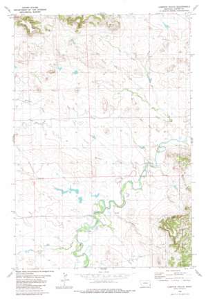
Lampkin Gulch Topo Map Montana
To zoom in, hover over the map of Lampkin Gulch
USGS Topo Quad 45104g3 - 1:24,000 scale
| Topo Map Name: | Lampkin Gulch |
| USGS Topo Quad ID: | 45104g3 |
| Print Size: | ca. 21 1/4" wide x 27" high |
| Southeast Coordinates: | 45.75° N latitude / 104.25° W longitude |
| Map Center Coordinates: | 45.8125° N latitude / 104.3125° W longitude |
| U.S. State: | MT |
| Filename: | o45104g3.jpg |
| Download Map JPG Image: | Lampkin Gulch topo map 1:24,000 scale |
| Map Type: | Topographic |
| Topo Series: | 7.5´ |
| Map Scale: | 1:24,000 |
| Source of Map Images: | United States Geological Survey (USGS) |
| Alternate Map Versions: |
Lampkin Gulch MT 1980, updated 1980 Download PDF Buy paper map Lampkin Gulch MT 1993, updated 1996 Download PDF Buy paper map Lampkin Gulch MT 2011 Download PDF Buy paper map Lampkin Gulch MT 2014 Download PDF Buy paper map |
| FStopo: | US Forest Service topo Lampkin Gulch is available: Download FStopo PDF Download FStopo TIF |
1:24,000 Topo Quads surrounding Lampkin Gulch
> Back to 45104e1 at 1:100,000 scale
> Back to 45104a1 at 1:250,000 scale
> Back to U.S. Topo Maps home
Lampkin Gulch topo map: Gazetteer
Lampkin Gulch: Dams
German Number 3 Dam elevation 963m 3159′German Number 9 Dam elevation 959m 3146′
Setine Dam elevation 982m 3221′
Lampkin Gulch: Post Offices
Staats Post Office (historical) elevation 1015m 3330′Lampkin Gulch: Springs
Last Chance Spring elevation 1041m 3415′Neece Spring elevation 1022m 3353′
Lampkin Gulch: Streams
Corral Creek elevation 936m 3070′Harmon Creek elevation 941m 3087′
Little Ramme Creek elevation 959m 3146′
Mud Creek elevation 939m 3080′
Lampkin Gulch: Valleys
Lampkin Gulch elevation 949m 3113′Lampkin Gulch: Wells
01N60E19DBDA01 Well elevation 996m 3267′01N60E22CAB_01 Well elevation 1078m 3536′
01S60E04CDDB01 Well elevation 952m 3123′
01S60E08ACBC01 Well elevation 970m 3182′
Lampkin Gulch digital topo map on disk
Buy this Lampkin Gulch topo map showing relief, roads, GPS coordinates and other geographical features, as a high-resolution digital map file on DVD:
Eastern Montana & Western North Dakota
Buy digital topo maps: Eastern Montana & Western North Dakota


